


<< Our Photo Pages >> Mynydd Garn Fawr - Ancient Trackway in Wales in Monmouthshire
Submitted by Annwfn_deCym23 on Thursday, 26 January 2023 Page Views: 3033
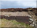
Date UncertainSite Name: Mynydd Garn Fawr Alternative Name: Mynydd Garn FawrCountry: Wales County: Monmouthshire Type: Ancient Trackway
Nearest Town: Blaenavon
Map Ref: SO2655609300
Latitude: 51.777528N Longitude: 3.06594W
Condition:
| 5 | Perfect |
| 4 | Almost Perfect |
| 3 | Reasonable but with some damage |
| 2 | Ruined but still recognisable as an ancient site |
| 1 | Pretty much destroyed, possibly visible as crop marks |
| 0 | No data. |
| -1 | Completely destroyed |
| 5 | Superb |
| 4 | Good |
| 3 | Ordinary |
| 2 | Not Good |
| 1 | Awful |
| 0 | No data. |
| 5 | Can be driven to, probably with disabled access |
| 4 | Short walk on a footpath |
| 3 | Requiring a bit more of a walk |
| 2 | A long walk |
| 1 | In the middle of nowhere, a nightmare to find |
| 0 | No data. |
| 5 | co-ordinates taken by GPS or official recorded co-ordinates |
| 4 | co-ordinates scaled from a detailed map |
| 3 | co-ordinates scaled from a bad map |
| 2 | co-ordinates of the nearest village |
| 1 | co-ordinates of the nearest town |
| 0 | no data |
Internal Links:
External Links:
I have visited· I would like to visit
Annwfn_deCym23 has visited here
")
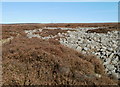
North east of Coedcae, Blaenavon, Torfaen.
You may be viewing yesterday's version of this page. To see the most up to date information please register for a free account.
")
")
")
")
Do not use the above information on other web sites or publications without permission of the contributor.
Nearby Images from Geograph Britain and Ireland:
©2010(licence)
©2007(licence)
©2010(licence)
©2012(licence)
©2012(licence)
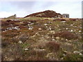
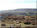
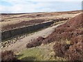
The above images may not be of the site on this page, they are loaded from Geograph.
Please Submit an Image of this site or go out and take one for us!
Click here to see more info for this site
Nearby sites
Key: Red: member's photo, Blue: 3rd party photo, Yellow: other image, Green: no photo - please go there and take one, Grey: site destroyed
Download sites to:
KML (Google Earth)
GPX (GPS waypoints)
CSV (Garmin/Navman)
CSV (Excel)
To unlock full downloads you need to sign up as a Contributory Member. Otherwise downloads are limited to 50 sites.
Turn off the page maps and other distractions
Nearby sites listing. In the following links * = Image available
826m NE 35° Carn y Defaid (S)* Cairn (SO27040997)
906m NE 34° Carn y Defaid (N)* Cairn (SO27081004)
1.3km ESE 109° Carn-y-Big Fach Cist (SO27790885)
1.7km SSE 164° Capel Newydd* Carving (SO27020763)
2.1km NNW 344° Blorenge West Flank - Y Blorens* Not Known (by us) (SO260113)
2.2km NW 306° Careg Croes-Ifor Round Cairn (SO248106)
2.5km SSE 150° Carn-y-Garnclochdy Ring Cairn (SO27780708)
2.6km N 9° Blorenge Cairn* Round Cairn (SO270119)
3.4km NW 306° Carreg Maen-Taro* Standing Stone (Menhir) (SO23831134)
4.0km NW 318° Gilwern Hill* Standing Stone (Menhir) (SO2395512301)
4.0km NW 323° Carreg Gywir* Stone Row / Alignment (SO242125)
4.5km NNW 334° Bedd y Gwr Hir* Standing Stone (Menhir) (SO246134)
4.6km S 177° Garnteg Barrows* Barrow Cemetery (SO267047)
4.6km S 176° Garnteg Menhir* Standing Stone (Menhir) (SO268047)
4.8km E 96° Ffynnon Gofer (Llanover)* Holy Well or Sacred Spring (SO313087)
4.9km NW 310° Twyn-y-Dinas Hillfort (SO228125)
5.0km NNE 25° Llanfoist Standing Stone* Standing Stone (Menhir) (SO28781379)
5.3km SE 142° Ffynnon Angaeron* Holy Well or Sacred Spring (SO298051)
5.4km W 280° Carreg Gywir Marker Stone (SO21191033)
5.7km NE 35° Abergavenny Museum* Museum (SO2995913943)
5.8km NW 312° Craig y Gaer* Hillfort (SO223133)
5.9km NE 38° Priory Well (Abergavenny)* Holy Well or Sacred Spring (SO30231387)
7.0km NW 311° Llanelly Round Barrow(s) (SO213140)
7.2km NW 325° Gaer Settlement Ancient Village or Settlement (SO225153)
7.6km NNE 23° Twyn yr Allt* Ancient Village or Settlement (SO296163)
View more nearby sites and additional images


 We would like to know more about this location. Please feel free to add a brief description and any relevant information in your own language.
 Wir möchten mehr über diese Stätte erfahren. Bitte zögern Sie nicht, eine kurze Beschreibung und relevante Informationen in Deutsch hinzuzufügen.
 Nous aimerions en savoir encore un peu sur les lieux. S'il vous plaît n'hesitez pas à ajouter une courte description et tous les renseignements pertinents dans votre propre langue.
 Quisieramos informarnos un poco más de las lugares. No dude en añadir una breve descripción y otros datos relevantes en su propio idioma.