<< Text Pages >> The Settlement Center - Museum in Iceland
Submitted by Anonymous on Friday, 19 January 2024 Page Views: 104
MuseumsSite Name: The Settlement CenterCountry: Iceland
NOTE: This site is 21.703 km away from the location you searched for.
Type: Museum
Nearest Town: Borganes
Latitude: 64.535649N Longitude: 21.923265W
Condition:
| 5 | Perfect |
| 4 | Almost Perfect |
| 3 | Reasonable but with some damage |
| 2 | Ruined but still recognisable as an ancient site |
| 1 | Pretty much destroyed, possibly visible as crop marks |
| 0 | No data. |
| -1 | Completely destroyed |
| 5 | Superb |
| 4 | Good |
| 3 | Ordinary |
| 2 | Not Good |
| 1 | Awful |
| 0 | No data. |
| 5 | Can be driven to, probably with disabled access |
| 4 | Short walk on a footpath |
| 3 | Requiring a bit more of a walk |
| 2 | A long walk |
| 1 | In the middle of nowhere, a nightmare to find |
| 0 | No data. |
| 5 | co-ordinates taken by GPS or official recorded co-ordinates |
| 4 | co-ordinates scaled from a detailed map |
| 3 | co-ordinates scaled from a bad map |
| 2 | co-ordinates of the nearest village |
| 1 | co-ordinates of the nearest town |
| 0 | no data |
Internal Links:
External Links:
Museum in Iceland
The Settlement Center is devoted to recreating Iceland’s earliest days and introduces visitors to one of the best known heroes of the Icelandic Sagas, Egil Skalla-Grimsson.
www.landnam.is/eng/
You may be viewing yesterday's version of this page. To see the most up to date information please register for a free account.
Do not use the above information on other web sites or publications without permission of the contributor.
Nearby Images from Flickr

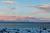

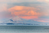
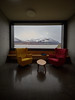
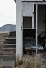
The above images may not be of the site on this page, but were taken nearby. They are loaded from Flickr so please click on them for image credits.
Click here to see more info for this site
Nearby sites
Click here to view sites on an interactive map of the areaKey: Red: member's photo, Blue: 3rd party photo, Yellow: other image, Green: no photo - please go there and take one, Grey: site destroyed
Download sites to:
KML (Google Earth)
GPX (GPS waypoints)
CSV (Garmin/Navman)
CSV (Excel)
To unlock full downloads you need to sign up as a Contributory Member. Otherwise downloads are limited to 50 sites.
Turn off the page maps and other distractions
Nearby sites listing. In the following links * = Image available
448m NNE 19° Skallagrimshaugur* Round Barrow(s)
43.2km S 181° Reykjavik Settlement Museum* Museum
49.1km SE 128° Althing* Natural Stone / Erratic / Other Natural Feature
68.1km NNW 326° Helgafell Natural Stone / Erratic / Other Natural Feature
68.8km SSW 205° Vikingaheimar* Museum
111.3km ESE 114° Þjóðveldisbærinn Ancient Village or Settlement
121.6km NNE 30° Borgarvirki* Promontory Fort / Cliff Castle
125.5km NNW 332° Flókatóftir Ancient Village or Settlement
160.6km SE 133° Rútshellir* Cave or Rock Shelter
198.8km SE 127° Hjörleifshaugur Cairn
204.9km ESE 112° Hildishaugur Cairn
222.2km NE 50° Eyjafjörður Fjord* Artificial Mound
261.7km ESE 103° Hofskirkja's carved stones* Sculptured Stone
336.1km E 92° Stokksnes Standing Stone* Standing Stone (Menhir)
347.9km NE 49° Arctic Henge Modern Stone Circle etc
350.8km NE 48° Þorgeirsdys Cairn
378.1km ENE 78° Völvuleiði Cairn
397.0km ENE 76° Fólkvangur Neskaupstaður* Rock Art
682.5km NNW 346° Danmark Ø Hut Foundations* Ancient Village or Settlement
786.3km ESE 103° Viking longhouse Kvívík, Faeröer Ancient Village or Settlement
798.6km ESE 102° Viking longhouse Leirvík, Faeröer Ancient Village or Settlement
995.5km N 352° Rendalen Hut Site* Ancient Village or Settlement
1029.0km SE 130° Boreray* Stone Circle (NA15060499)
1029.6km SE 130° Tobar nam Buadh (St Kilda) Holy Well or Sacred Spring (NA0864400247)
1029.8km SE 130° The Amazon's House (Hirta) Ancient Village or Settlement (NA08780010)
View more nearby sites and additional images


 We would like to know more about this location. Please feel free to add a brief description and any relevant information in your own language.
 Wir möchten mehr über diese Stätte erfahren. Bitte zögern Sie nicht, eine kurze Beschreibung und relevante Informationen in Deutsch hinzuzufügen.
 Nous aimerions en savoir encore un peu sur les lieux. S'il vous plaît n'hesitez pas à ajouter une courte description et tous les renseignements pertinents dans votre propre langue.
 Quisieramos informarnos un poco más de las lugares. No dude en añadir una breve descripción y otros datos relevantes en su propio idioma.