<< Our Photo Pages >> Motherby (Cumbria) - Holy Well or Sacred Spring in England in Cumbria
Submitted by Anne T on Thursday, 13 September 2018 Page Views: 2881
Springs and Holy WellsSite Name: Motherby (Cumbria)Country: England
NOTE: This site is 0.707 km away from the location you searched for.
County: Cumbria Type: Holy Well or Sacred Spring
Nearest Town: Penrith Nearest Village: Motherby
Map Ref: NY4293428212
Latitude: 54.645772N Longitude: 2.885824W
Condition:
| 5 | Perfect |
| 4 | Almost Perfect |
| 3 | Reasonable but with some damage |
| 2 | Ruined but still recognisable as an ancient site |
| 1 | Pretty much destroyed, possibly visible as crop marks |
| 0 | No data. |
| -1 | Completely destroyed |
| 5 | Superb |
| 4 | Good |
| 3 | Ordinary |
| 2 | Not Good |
| 1 | Awful |
| 0 | No data. |
| 5 | Can be driven to, probably with disabled access |
| 4 | Short walk on a footpath |
| 3 | Requiring a bit more of a walk |
| 2 | A long walk |
| 1 | In the middle of nowhere, a nightmare to find |
| 0 | No data. |
| 5 | co-ordinates taken by GPS or official recorded co-ordinates |
| 4 | co-ordinates scaled from a detailed map |
| 3 | co-ordinates scaled from a bad map |
| 2 | co-ordinates of the nearest village |
| 1 | co-ordinates of the nearest town |
| 0 | no data |
Internal Links:
External Links:
I have visited· I would like to visit
Anne T visited on 11th Sep 2018 - their rating: Cond: 3 Amb: 4 Access: 5 Well, Motherby, Cumbria: This is a very old village, with very picturesque cottages and farm houses. The well is not recorded on either Pastscape or Historic England.
The ‘wall’ is a strange structure. Following the line of stones up the hill, it ends in what seems to be a building platform and possibly an old quarry. The footpath at the village end of the footpath was closed due to building work, so we couldn’t investigate further.
I have emailed Mark Brennand at Cumbria County Council to see if he has any information. The line of stones follows an old footpath on the 1860 OS map, together with the letter 'T' (troughs?) where the troughs are currently located. No mention of the well.
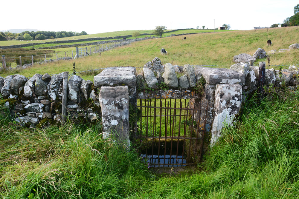
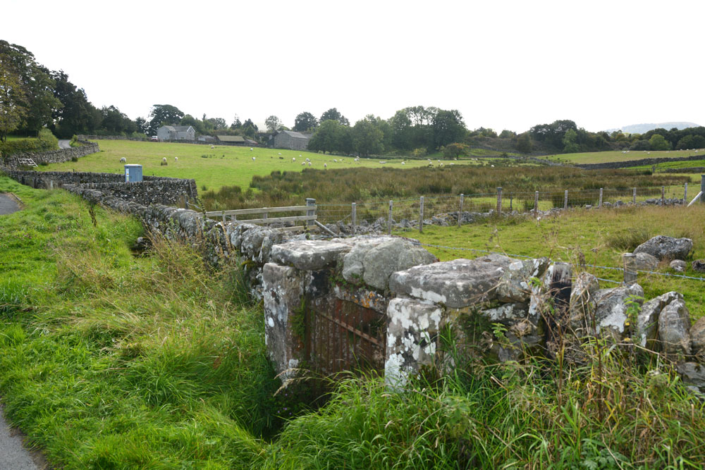
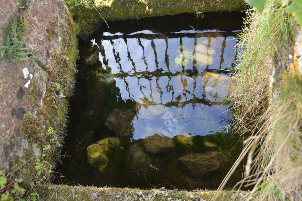
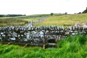
This well is not recorded on Pastscape or Historic England, nor mentioned on the modern OS map. The well sits underneath a dry stone wall, with a metal gate on either side of the wall giving access to the well chamber in the middle, and a series of drinking troughs some 10-20m to the south. The troughs bear a striking resemblance to those on the village green in nearby Newbeggin.
The River Petteril runs just to the south of the well, running south west to north east across the fields. The land to the west and south of the well is wet and spongy, and appears to be the source of a spring. The water within the well chamber itself is clear and fresh, with a fair flow at the time of our visit.
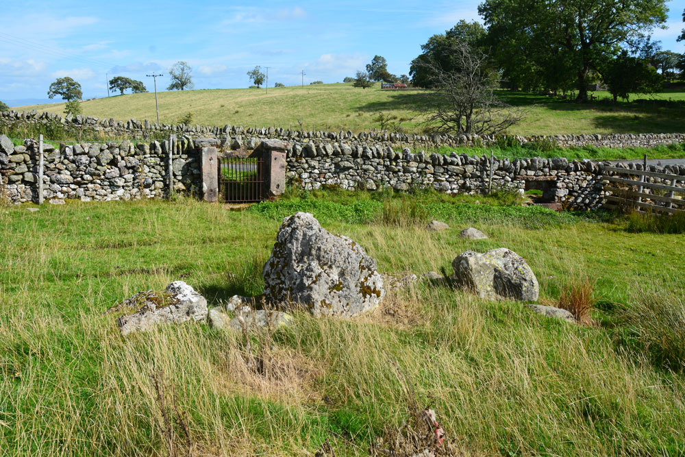
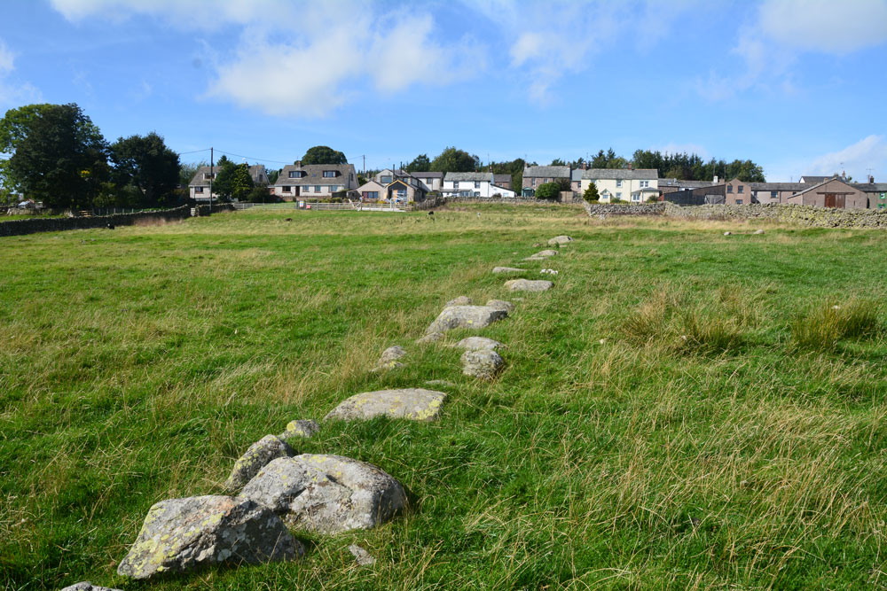
Just to the west of the well, running from NY 42929 28209 to NY 42870 28283 is a peculiar line of stones which looked as if they were all upright at some time in the past, and have now tumbled to form a wavy line along the ground. The northern most end appears to end in a building platform. The lower end of the stones curves round just beneath the well chamber, and looks as if the 'row' might be associated with controlling the flow of water.
The Lead Officer Historic Environment and Commons for Cumbria County Council tells me that a spring and trough are marked on early versions of the OS maps. He adds: "The linear feature is, I assume, a former field boundary, not depicted on the early mapping, although there is a footpath close to its course. One would have thought it was superseded by the wall that runs along the roadside, although its survival at all is intriguing, as one would have thought that the stone might be reclaimed."
Thanks to Dr. Alan Rich of Newbeggin for the information on the well and the stones.
You may be viewing yesterday's version of this page. To see the most up to date information please register for a free account.
Do not use the above information on other web sites or publications without permission of the contributor.
Click here to see more info for this site
Nearby sites
Key: Red: member's photo, Blue: 3rd party photo, Yellow: other image, Green: no photo - please go there and take one, Grey: site destroyed
Download sites to:
KML (Google Earth)
GPX (GPS waypoints)
CSV (Garmin/Navman)
CSV (Excel)
To unlock full downloads you need to sign up as a Contributory Member. Otherwise downloads are limited to 50 sites.
Turn off the page maps and other distractions
Nearby sites listing. In the following links * = Image available
1.0km W 269° Penruddock Stone Circle (NY419282)
1.0km W 269° Motherby Stone Circle (NY419282)
2.6km NNE 26° Eye Keld Well* Holy Well or Sacred Spring (NY441305)
2.9km NNE 21° Greystoke Village Cross* Ancient Cross (NY4401230870)
2.9km NNE 28° Sanctuary Stone (Greystoke)* Early Christian Sculptured Stone (NY4433530785)
3.4km NNW 336° Berrier Hill Earthworks Misc. Earthwork (NY416313)
3.4km ESE 116° Dacre Church* Ancient Cross (NY46002664)
4.0km E 79° Newbeggin Stone Row (Stone 5)* Standing Stone (Menhir) (NY4684928893)
4.0km ENE 79° Newbeggin Stone Row (Stone 4)* Standing Stone (Menhir) (NY4692428953)
4.2km ENE 75° Newbeggin Stone Row (Stone 2)* Standing Stone (Menhir) (NY4705629248)
4.2km ENE 74° Newbeggin Stone Row (Stone 3)* Standing Stone (Menhir) (NY4703929314)
4.3km ENE 78° Newbeggin Wells* Holy Well or Sacred Spring (NY47122902)
4.3km ENE 78° Newbeggin Stone Row (Blue Stone)* Natural Stone / Erratic / Other Natural Feature (NY4713029010)
4.3km ENE 75° Newbeggin Stone Row* Stone Row / Alignment (NY47122929)
4.3km SW 228° Great Mell Fell Tumulus* Round Cairn (NY3967825366)
4.3km ENE 75° Newbeggin Stone Row (Stone 1)* Standing Stone (Menhir) (NY4712629292)
4.4km NE 54° Kells Well (Newbeggin)* Holy Well or Sacred Spring (NY4654330728)
4.5km SSE 150° Maiden Castle (Cumbria) Hillfort (NY451243)
5.3km ENE 75° Newbeggin Stone Row (Possible)* Standing Stone (Menhir) (NY4805829531)
5.3km SE 132° Dunmallard* Hillfort (NY468246)
5.6km NE 53° Newton Reigny Stone Row / Alignment (NY475315)
5.8km ENE 67° Mossthorn Long Cairn 2* Cairn (NY4828930440)
5.8km ENE 65° Mossthorn Long Cairn 1* Cairn (NY4825830606)
6.0km E 97° Snuff Mill (Stainton)* Standing Stone (Menhir) (NY4890927405)
6.2km ENE 72° Sewborrans Stone* Standing Stone (Menhir) (NY48842999)
View more nearby sites and additional images


 We would like to know more about this location. Please feel free to add a brief description and any relevant information in your own language.
 Wir möchten mehr über diese Stätte erfahren. Bitte zögern Sie nicht, eine kurze Beschreibung und relevante Informationen in Deutsch hinzuzufügen.
 Nous aimerions en savoir encore un peu sur les lieux. S'il vous plaît n'hesitez pas à ajouter une courte description et tous les renseignements pertinents dans votre propre langue.
 Quisieramos informarnos un poco más de las lugares. No dude en añadir una breve descripción y otros datos relevantes en su propio idioma.