<< Text Pages >> Carden Park Barrow - Round Barrow(s) in England in Cheshire
Submitted by coldrum on Tuesday, 06 December 2011 Page Views: 2914
Neolithic and Bronze AgeSite Name: Carden Park BarrowCountry: England
NOTE: This site is 3.494 km away from the location you searched for.
County: Cheshire Type: Round Barrow(s)
Nearest Town: Tilston
Map Ref: SJ46365352
Latitude: 53.076201N Longitude: 2.802126W
Condition:
| 5 | Perfect |
| 4 | Almost Perfect |
| 3 | Reasonable but with some damage |
| 2 | Ruined but still recognisable as an ancient site |
| 1 | Pretty much destroyed, possibly visible as crop marks |
| 0 | No data. |
| -1 | Completely destroyed |
| 5 | Superb |
| 4 | Good |
| 3 | Ordinary |
| 2 | Not Good |
| 1 | Awful |
| 0 | No data. |
| 5 | Can be driven to, probably with disabled access |
| 4 | Short walk on a footpath |
| 3 | Requiring a bit more of a walk |
| 2 | A long walk |
| 1 | In the middle of nowhere, a nightmare to find |
| 0 | No data. |
| 5 | co-ordinates taken by GPS or official recorded co-ordinates |
| 4 | co-ordinates scaled from a detailed map |
| 3 | co-ordinates scaled from a bad map |
| 2 | co-ordinates of the nearest village |
| 1 | co-ordinates of the nearest town |
| 0 | no data |
Be the first person to rate this site - see the 'Contribute!' box in the right hand menu.
Internal Links:
External Links:
Round Barrow in Cheshire
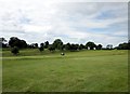
"Bowl barrow in Carden Park. Scheduled RSM No 23635. A bowl barrow located within a golf course in Carden Park on a saddle of higher ground to the south of The Birches wood. It has an oval sand and earthen mound up to 1.5m high with maximum dimensions of 32m by 25m. "
Source: Pastscape.
You may be viewing yesterday's version of this page. To see the most up to date information please register for a free account.
Do not use the above information on other web sites or publications without permission of the contributor.
Nearby Images from Geograph Britain and Ireland:
©2016(licence)
©2022(licence)
©2013(licence)
©2008(licence)
©2021(licence)
The above images may not be of the site on this page, they are loaded from Geograph.
Please Submit an Image of this site or go out and take one for us!
Click here to see more info for this site
Nearby sites
Key: Red: member's photo, Blue: 3rd party photo, Yellow: other image, Green: no photo - please go there and take one, Grey: site destroyed
Download sites to:
KML (Google Earth)
GPX (GPS waypoints)
CSV (Garmin/Navman)
CSV (Excel)
To unlock full downloads you need to sign up as a Contributory Member. Otherwise downloads are limited to 50 sites.
Turn off the page maps and other distractions
Nearby sites listing. In the following links * = Image available
190m NNW 341° Carden Park* Cave or Rock Shelter (SJ463537)
2.0km NNE 30° St Winefride's (Clutton)* Holy Well or Sacred Spring (SJ47395524)
3.5km E 100° Maiden Castle (Cheshire)* Hillfort (SJ49805286)
5.3km S 189° Meadows Farm Barrow* Round Barrow(s) (SJ45454834)
5.7km WNW 293° Churton* Long Barrow (SJ411558)
5.9km WNW 295° Knowl Plantation Barrow Cemetery (SJ410561)
7.8km NW 309° Poulton Timber Circle* Ancient Village or Settlement (SJ4033558472)
9.0km ENE 62° Peckforton Mere* Ancient Village or Settlement (SJ543577)
9.3km NE 52° Beeston Castle* Hillfort (SJ538592)
9.4km S 177° Oldcastle* Hillfort (SJ468441)
10.5km WNW 294° St Peter's Well (Denbighshire) Holy Well or Sacred Spring (SJ36735784)
10.5km W 263° Borras Quarry Neolithic Village Ancient Village or Settlement (SJ35855243)
10.9km NNE 17° Brookhouse Farm Ancient Village or Settlement (SJ497639)
11.7km NNW 332° Heronbridge Roman Strip Settlement Ancient Village or Settlement (SJ410639)
11.8km W 276° The Atropos Altar Stone* Sculptured Stone (SJ34645497)
12.0km SSE 162° Warren Tump (Wrexham)* Round Barrow(s) (SJ49974206)
12.0km W 262° Wrexham Gorsedd Circle Modern Stone Circle etc (SJ3436752064)
12.2km SW 230° Gerwyn Fechan Cursus (SJ36884584)
12.3km SSE 164° Whitewell 1* Round Barrow(s) (SJ49564160)
12.5km SSE 165° Whitewell (St Marys)* Holy Well or Sacred Spring (SJ49484137)
12.6km S 179° Bryn Rossett* Round Barrow(s) (SJ46454095)
12.8km ENE 59° Robin Hood's Tump* Round Barrow(s) (SJ575599)
13.1km NE 42° Salterswell* Holy Well or Sacred Spring (SJ552632)
13.2km W 270° Bryn Alyn* Hillfort (SJ33125370)
13.3km NNW 334° Chester Minerva shrine* Ancient Temple (SJ40676561)
View more nearby sites and additional images


 We would like to know more about this location. Please feel free to add a brief description and any relevant information in your own language.
 Wir möchten mehr über diese Stätte erfahren. Bitte zögern Sie nicht, eine kurze Beschreibung und relevante Informationen in Deutsch hinzuzufügen.
 Nous aimerions en savoir encore un peu sur les lieux. S'il vous plaît n'hesitez pas à ajouter une courte description et tous les renseignements pertinents dans votre propre langue.
 Quisieramos informarnos un poco más de las lugares. No dude en añadir una breve descripción y otros datos relevantes en su propio idioma.