<< Text Pages >> La Ermita - Cairn in Spain in Castilla y León
Submitted by MMG on Wednesday, 25 January 2006 Page Views: 2281
Neolithic and Bronze AgeSite Name: La Ermita Alternative Name: El RoyoCountry: Spain
NOTE: This site is 4.139 km away from the location you searched for.
Region: Castilla y León Type: Cairn
Latitude: 41.914196N Longitude: 2.670609W
Condition:
| 5 | Perfect |
| 4 | Almost Perfect |
| 3 | Reasonable but with some damage |
| 2 | Ruined but still recognisable as an ancient site |
| 1 | Pretty much destroyed, possibly visible as crop marks |
| 0 | No data. |
| -1 | Completely destroyed |
| 5 | Superb |
| 4 | Good |
| 3 | Ordinary |
| 2 | Not Good |
| 1 | Awful |
| 0 | No data. |
| 5 | Can be driven to, probably with disabled access |
| 4 | Short walk on a footpath |
| 3 | Requiring a bit more of a walk |
| 2 | A long walk |
| 1 | In the middle of nowhere, a nightmare to find |
| 0 | No data. |
| 5 | co-ordinates taken by GPS or official recorded co-ordinates |
| 4 | co-ordinates scaled from a detailed map |
| 3 | co-ordinates scaled from a bad map |
| 2 | co-ordinates of the nearest village |
| 1 | co-ordinates of the nearest town |
| 0 | no data |
Be the first person to rate this site - see the 'Contribute!' box in the right hand menu.
Internal Links:
External Links:
Cairn in Soria (Castilla y León)
For more details visit Megalitos.es.
You may be viewing yesterday's version of this page. To see the most up to date information please register for a free account.
Do not use the above information on other web sites or publications without permission of the contributor.
Nearby Images from Flickr
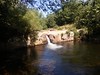
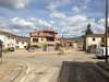
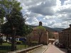
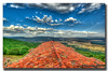
The above images may not be of the site on this page, but were taken nearby. They are loaded from Flickr so please click on them for image credits.
Click here to see more info for this site
Nearby sites
Click here to view sites on an interactive map of the areaKey: Red: member's photo, Blue: 3rd party photo, Yellow: other image, Green: no photo - please go there and take one, Grey: site destroyed
Download sites to:
KML (Google Earth)
GPX (GPS waypoints)
CSV (Garmin/Navman)
CSV (Excel)
To unlock full downloads you need to sign up as a Contributory Member. Otherwise downloads are limited to 50 sites.
Turn off the page maps and other distractions
Nearby sites listing. In the following links * = Image available
17.0km ENE 78° San Gregorio dolmen* Burial Chamber or Dolmen
23.9km SE 135° Proximadas de Soria Castro or Chafurdão
24.0km SE 134° Almaluez Castro or Chafurdão
24.6km S 184° Las Fraguas Cairn
26.9km SSW 207° Calatañazor* Cist
27.6km S 171° Villa Romana La Dehesa Ancient Village or Settlement
28.6km W 280° Necrópolis de Revenga* Barrow Cemetery
32.3km E 94° Carrascosa de la Sierra dolmen* Burial Chamber or Dolmen
32.6km WSW 247° Cañón del Rio Lobos Castro or Chafurdão
40.9km NNE 15° Portillo de los Ladrones Chambered Cairn
41.9km NNE 18° Collado Palomero Burial Chamber or Dolmen
42.9km NNE 19° Montalbo: Fuente Morena Burial Chamber or Dolmen
44.6km NNE 21° Barranco de la Cadena dolmen* Burial Chamber or Dolmen
47.6km NNE 23° Collado del Mallo Dolmen* Burial Chamber or Dolmen
48.3km NNE 21° Peña Guerra 3 Burial Chamber or Dolmen
48.3km NNE 21° Peña Guerra 2* Burial Chamber or Dolmen
48.5km NNE 21° Peña Guerra 1* Burial Chamber or Dolmen
51.6km SW 223° Uxama* Ancient Village or Settlement
52.0km SSE 162° Cerro Gordo Not Known (by us)
55.3km NNE 22° Unión (Clavijo) Burial Chamber or Dolmen
59.4km WNW 285° Morcales Round Barrow(s)
59.9km WSW 256° Colonia Clunia Sulpicia* Ancient Village or Settlement
62.1km WNW 288° Jaramillo Quemado Round Barrow(s)
62.3km WSW 255° Coruña del Conde* Not Known (by us)
64.6km NNE 20° Ruinas de Varea Ancient Village or Settlement
View more nearby sites and additional images


 We would like to know more about this location. Please feel free to add a brief description and any relevant information in your own language.
 Wir möchten mehr über diese Stätte erfahren. Bitte zögern Sie nicht, eine kurze Beschreibung und relevante Informationen in Deutsch hinzuzufügen.
 Nous aimerions en savoir encore un peu sur les lieux. S'il vous plaît n'hesitez pas à ajouter une courte description et tous les renseignements pertinents dans votre propre langue.
 Quisieramos informarnos un poco más de las lugares. No dude en añadir una breve descripción y otros datos relevantes en su propio idioma.