


<< Text Pages >> Prestonkirk Cursus - Cursus in Scotland in East Lothian
Submitted by EssexMan on Wednesday, 07 April 2010 Page Views: 3201
Neolithic and Bronze AgeSite Name: Prestonkirk CursusCountry: Scotland
NOTE: This site is 1.422 km away from the location you searched for.
County: East Lothian Type: Cursus
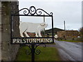
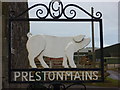
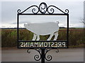
Nearest Town: Edinburgh Nearest Village: Prestonkirk
Map Ref: NT60007809 Landranger Map Number: 67
Latitude: 55.994091N Longitude: 2.642823W
Condition:
| 5 | Perfect |
| 4 | Almost Perfect |
| 3 | Reasonable but with some damage |
| 2 | Ruined but still recognisable as an ancient site |
| 1 | Pretty much destroyed, possibly visible as crop marks |
| 0 | No data. |
| -1 | Completely destroyed |
| 5 | Superb |
| 4 | Good |
| 3 | Ordinary |
| 2 | Not Good |
| 1 | Awful |
| 0 | No data. |
| 5 | Can be driven to, probably with disabled access |
| 4 | Short walk on a footpath |
| 3 | Requiring a bit more of a walk |
| 2 | A long walk |
| 1 | In the middle of nowhere, a nightmare to find |
| 0 | No data. |
| 5 | co-ordinates taken by GPS or official recorded co-ordinates |
| 4 | co-ordinates scaled from a detailed map |
| 3 | co-ordinates scaled from a bad map |
| 2 | co-ordinates of the nearest village |
| 1 | co-ordinates of the nearest town |
| 0 | no data |
Internal Links:
External Links:
Minor Cursus in East Lothian
Status: Possible
NMR No. NT57NE 29
Extent: 380mx85m
Terminal type: Rounded
May be a continuation of Drylawhill
Note: This location marks one terminal (end) of a cursus monument. The location of the other terminal can be found in the Nearby Site list below.
You may be viewing yesterday's version of this page. To see the most up to date information please register for a free account.
Do not use the above information on other web sites or publications without permission of the contributor.
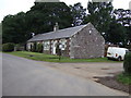
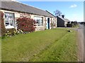
Nearby Images from Geograph Britain and Ireland:
©2013(licence)
©2016(licence)
©2011(licence)
©2011(licence)
©2011(licence)
The above images may not be of the site on this page, they are loaded from Geograph.
Please Submit an Image of this site or go out and take one for us!
Click here to see more info for this site
Nearby sites
Key: Red: member's photo, Blue: 3rd party photo, Yellow: other image, Green: no photo - please go there and take one, Grey: site destroyed
Download sites to:
KML (Google Earth)
GPX (GPS waypoints)
CSV (Garmin/Navman)
CSV (Excel)
To unlock full downloads you need to sign up as a Contributory Member. Otherwise downloads are limited to 50 sites.
Turn off the page maps and other distractions
Nearby sites listing. In the following links * = Image available
363m WSW 253° Prestonkirk Cursus Cursus (NT59657799)
746m WSW 247° St Baldred's Well* Holy Well or Sacred Spring (NT59317780)
756m W 261° Prestonkirk Cursus Cursus (NT59257798)
1.1km W 259° Prestonkirk Cursus Cursus (NT58927790)
1.7km ESE 106° Kirklandhill* Standing Stone (Menhir) (NT61687760)
2.3km SW 236° Pencraig Brae* Standing Stone (Menhir) (NT58087681)
3.5km N 356° Our Lady's Well (Whitekirk) Holy Well or Sacred Spring (NT598816)
3.7km SSW 206° Maiden Stone (East Lothian)* Standing Stone (Menhir) (NT5830774748)
3.9km SSW 209° Traprain Law* Hillfort (NT5805674696)
4.4km SSE 147° Rood Well* Holy Well or Sacred Spring (NT6237674417)
4.5km SSW 208° Loth Stone* Standing Stone (Menhir) (NT5782374146)
5.0km SSW 206° Standingstone (East Lothian)* Standing Stone (Menhir) (NT57737363)
6.5km N 352° St. Baldred's Well (Auldhame)* Holy Well or Sacred Spring (NT59168450)
7.3km NW 322° North Berwick Law* Ancient Village or Settlement (NT555839)
7.5km ESE 112° Witches' Stone (Spott)* Holy Well or Sacred Spring (NT66917520)
7.7km ESE 108° St John's Well (Spott)* Holy Well or Sacred Spring (NT67277561)
7.7km WNW 282° Boar Stone (Drem)* Ancient Cross (NT52427975)
8.1km E 100° Easter Broomhouse* Standing Stone (Menhir) (NT6800876615)
8.3km WSW 257° Kaeheughs Hillfort (NT51837627)
8.4km NNW 327° St. Andrew's Well Holy Well or Sacred Spring (NT55438520)
9.0km ESE 106° Doon Hill Dunbar* Ancient Village or Settlement (NT6868775539)
9.2km W 271° The Chesters* Hillfort (NT50767826)
9.3km WSW 243° Custom Stone (Haddington) Marker Stone (NT51697388)
9.6km S 171° White Castle Fort* Hillfort (NT61356860)
10.1km E 93° Broxmouth Hill Fort* Hillfort (NT7011177388)
View more nearby sites and additional images


 We would like to know more about this location. Please feel free to add a brief description and any relevant information in your own language.
 Wir möchten mehr über diese Stätte erfahren. Bitte zögern Sie nicht, eine kurze Beschreibung und relevante Informationen in Deutsch hinzuzufügen.
 Nous aimerions en savoir encore un peu sur les lieux. S'il vous plaît n'hesitez pas à ajouter une courte description et tous les renseignements pertinents dans votre propre langue.
 Quisieramos informarnos un poco más de las lugares. No dude en añadir una breve descripción y otros datos relevantes en su propio idioma.