<< Text Pages >> West Compton Bowl Barrow - Round Barrow(s) in England in Dorset
Submitted by SolarMegalith on Wednesday, 08 May 2013 Page Views: 1815
Neolithic and Bronze AgeSite Name: West Compton Bowl BarrowCountry: England County: Dorset Type: Round Barrow(s)
Nearest Town: Dorchester
Map Ref: SY56619347
Latitude: 50.739209N Longitude: 2.616268W
Condition:
| 5 | Perfect |
| 4 | Almost Perfect |
| 3 | Reasonable but with some damage |
| 2 | Ruined but still recognisable as an ancient site |
| 1 | Pretty much destroyed, possibly visible as crop marks |
| 0 | No data. |
| -1 | Completely destroyed |
| 5 | Superb |
| 4 | Good |
| 3 | Ordinary |
| 2 | Not Good |
| 1 | Awful |
| 0 | No data. |
| 5 | Can be driven to, probably with disabled access |
| 4 | Short walk on a footpath |
| 3 | Requiring a bit more of a walk |
| 2 | A long walk |
| 1 | In the middle of nowhere, a nightmare to find |
| 0 | No data. |
| 5 | co-ordinates taken by GPS or official recorded co-ordinates |
| 4 | co-ordinates scaled from a detailed map |
| 3 | co-ordinates scaled from a bad map |
| 2 | co-ordinates of the nearest village |
| 1 | co-ordinates of the nearest town |
| 0 | no data |
Internal Links:
External Links:
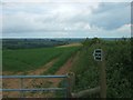
Round Barrow in Dorset
A ditchless bowl barrow, currently 0.6m high.
Read More at Pastscape.
You may be viewing yesterday's version of this page. To see the most up to date information please register for a free account.
Do not use the above information on other web sites or publications without permission of the contributor.
Nearby Images from Geograph Britain and Ireland:
©2020(licence)
©2009(licence)
©2010(licence)
©2009(licence)
©2010(licence)
The above images may not be of the site on this page, they are loaded from Geograph.
Please Submit an Image of this site or go out and take one for us!
Click here to see more info for this site
Nearby sites
Key: Red: member's photo, Blue: 3rd party photo, Yellow: other image, Green: no photo - please go there and take one, Grey: site destroyed
Download sites to:
KML (Google Earth)
GPX (GPS waypoints)
CSV (Garmin/Navman)
CSV (Excel)
To unlock full downloads you need to sign up as a Contributory Member. Otherwise downloads are limited to 50 sites.
Turn off the page maps and other distractions
Nearby sites listing. In the following links * = Image available
788m E 87° West Compton Fort Hillfort (SY574935)
1.2km WNW 284° Two Gates (Dorset)* Burial Chamber or Dolmen (SY5548593770)
2.0km SSW 209° Litton Cheney* Timber Circle (SY5562591741)
2.1km SSE 162° Kingston Russell Standing Stone* Standing Stone (Menhir) (SY57259149)
2.2km S 172° Martin's Down Round Barrows* Round Barrow(s) (SY569913)
2.2km WNW 300° Eggardon earthwork* Henge (SY54689460)
2.4km SSE 160° Long Bredy A Cursus* Cursus (SY57419124)
2.4km SSE 160° Martin's Down Bell Barrows* Round Barrow(s) (SY57419124)
2.4km SSE 166° Long Bredy Bank Barrow* Long Barrow (SY57179115)
2.4km SSE 164° Long Bredy Barrow Cemetery* Barrow Cemetery (SY5726491115)
2.5km SSE 149° Kingston Russell Stone 1 Standing Stone (Menhir) (SY579913)
2.6km SSE 150° Long Bredy B Cursus Cursus (SY579912)
2.7km SSE 165° Long Bredy 2* Long Barrow (SY573909)
2.8km WNW 296° Eggardon Hill* Hillfort (SY54129472)
3.0km SE 143° Hangman's Rocks Stone Circle (SY58389109)
3.3km SSE 155° Kingston Russell 1* Long Barrow (SY580905)
3.3km SSE 155° Kingston Russell Stone 3* Standing Stone (Menhir) (SY580905)
3.4km SSE 155° Kingston Russell 2* Long Barrow (SY580904)
3.6km SE 140° Poor Lot Barrows* Barrow Cemetery (SY589907)
3.9km SSE 147° Pitcombe Down* Barrow Cemetery (SY587902)
3.9km WSW 247° Chilcombe Hill* Hillfort (SY530920)
4.2km SE 136° Broad Stone (Dorset)* Stone Circle (SY59539040)
4.2km WSW 243° Chilcombe Hill Barrows* Round Barrow(s) (SY528916)
4.5km N 353° Toller Porcorum* Standing Stones (SY561979)
4.5km ENE 72° Notton Down Barrow Round Barrow(s) (SY60949486)
View more nearby sites and additional images


 We would like to know more about this location. Please feel free to add a brief description and any relevant information in your own language.
 Wir möchten mehr über diese Stätte erfahren. Bitte zögern Sie nicht, eine kurze Beschreibung und relevante Informationen in Deutsch hinzuzufügen.
 Nous aimerions en savoir encore un peu sur les lieux. S'il vous plaît n'hesitez pas à ajouter une courte description et tous les renseignements pertinents dans votre propre langue.
 Quisieramos informarnos un poco más de las lugares. No dude en añadir una breve descripción y otros datos relevantes en su propio idioma.