<< Our Photo Pages >> Small Down Barrows - Barrow Cemetery in England in Somerset
Submitted by SolarMegalith on Tuesday, 10 December 2002 Page Views: 5074
Neolithic and Bronze AgeSite Name: Small Down BarrowsCountry: England County: Somerset Type: Barrow Cemetery
Map Ref: ST666406 Landranger Map Number: 183
Latitude: 51.163665N Longitude: 2.479039W
Condition:
| 5 | Perfect |
| 4 | Almost Perfect |
| 3 | Reasonable but with some damage |
| 2 | Ruined but still recognisable as an ancient site |
| 1 | Pretty much destroyed, possibly visible as crop marks |
| 0 | No data. |
| -1 | Completely destroyed |
| 5 | Superb |
| 4 | Good |
| 3 | Ordinary |
| 2 | Not Good |
| 1 | Awful |
| 0 | No data. |
| 5 | Can be driven to, probably with disabled access |
| 4 | Short walk on a footpath |
| 3 | Requiring a bit more of a walk |
| 2 | A long walk |
| 1 | In the middle of nowhere, a nightmare to find |
| 0 | No data. |
| 5 | co-ordinates taken by GPS or official recorded co-ordinates |
| 4 | co-ordinates scaled from a detailed map |
| 3 | co-ordinates scaled from a bad map |
| 2 | co-ordinates of the nearest village |
| 1 | co-ordinates of the nearest town |
| 0 | no data |
Internal Links:
External Links:
I have visited· I would like to visit
SolarMegalith visited on 28th Apr 2012 - their rating: Cond: 3 Amb: 4 Access: 4
")
The barrow cemetery inside Small Down hillfort consists of 14 tightly clustered Bronze Age bowl barrows. Sherds of the Iron Age pottery were discovered in the quarry ditches, which is probably connected with construction of the hillfort. The best preserved barrows reach up to 1.5 m in height.
Access to the barrows is relatively easy, they are very obvious in western part of the hillfort's interior.
Note: An urn from one of the barrows can be found in Taunton Museum.
You may be viewing yesterday's version of this page. To see the most up to date information please register for a free account.
")
")
")
Do not use the above information on other web sites or publications without permission of the contributor.
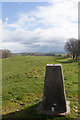
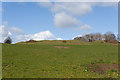
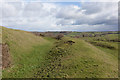
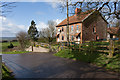
Nearby Images from Geograph Britain and Ireland:

©2014(licence)
©2014(licence)
©2014(licence)
©2014(licence)
©2014(licence)
The above images may not be of the site on this page, they are loaded from Geograph.
Please Submit an Image of this site or go out and take one for us!
Click here to see more info for this site
Nearby sites
Key: Red: member's photo, Blue: 3rd party photo, Yellow: other image, Green: no photo - please go there and take one, Grey: site destroyed
Download sites to:
KML (Google Earth)
GPX (GPS waypoints)
CSV (Garmin/Navman)
CSV (Excel)
To unlock full downloads you need to sign up as a Contributory Member. Otherwise downloads are limited to 50 sites.
Turn off the page maps and other distractions
Nearby sites listing. In the following links * = Image available
100m N 359° Small Down Camp* Hillfort (ST666407)
490m E 86° Evercreech 14-15 Bowl Barrows* Round Barrow(s) (ST67094063)
2.3km NNW 340° West Cranmore Round Barrows* Barrow Cemetery (ST65844274)
3.2km NW 324° St Aldhelm's Well* Holy Well or Sacred Spring (ST647432)
3.4km NNW 328° Doulting Quarries barrow* Modern Stone Circle etc (ST64824353)
6.0km SSE 162° Patwell* Holy Well or Sacred Spring (ST6843434863)
6.4km NNW 330° Beacon Hill (Oakhill) Barrows* Barrow Cemetery (ST63484616)
7.2km N 352° Fairy Cave Cave or Rock Shelter (ST65654775)
7.5km E 82° Witham Friary I Round Barrow(s) (ST74014156)
7.7km WSW 254° Glastonbury Stone Circle* Modern Stone Circle etc (ST59143858)
7.9km NE 50° Nunney Artificial Mound (ST72734564)
8.5km NW 305° Crapnell Stone Circle (ST596455)
8.6km NW 319° Maesbury Castle* Hillfort (ST610472)
8.7km E 81° Witham Friary 2 Round Barrow(s) (ST75264194)
8.8km N 358° Stratton on the Fosse Artificial Mound (ST66314938)
9.9km NNW 342° Blackers Hill Promontory Fort* Hillfort (ST6364850045)
10.7km N 6° Giants Grave, Southmead* Long Barrow (ST678512)
10.8km ENE 74° Conquest Field Round Barrow(s) (ST77004347)
10.8km N 6° Charmborough Hill Chambered Tomb (ST678513)
10.8km NNW 342° Three Tuns Tumuli* Barrow Cemetery (ST6324250870)
10.8km ESE 118° St. Peter's Pump* Holy Well or Sacred Spring (ST761354)
10.9km NW 321° Whitnell Corner Barrows* Barrow Cemetery (ST5982849096)
10.9km N 351° Fry's Well* Holy Well or Sacred Spring (ST649514)
11.0km WNW 297° King's Castle (Wells) Ancient Village or Settlement (ST568456)
11.4km ESE 121° Park Hill Camp* Hillfort (ST76383471)
View more nearby sites and additional images


 We would like to know more about this location. Please feel free to add a brief description and any relevant information in your own language.
 Wir möchten mehr über diese Stätte erfahren. Bitte zögern Sie nicht, eine kurze Beschreibung und relevante Informationen in Deutsch hinzuzufügen.
 Nous aimerions en savoir encore un peu sur les lieux. S'il vous plaît n'hesitez pas à ajouter une courte description et tous les renseignements pertinents dans votre propre langue.
 Quisieramos informarnos un poco más de las lugares. No dude en añadir una breve descripción y otros datos relevantes en su propio idioma.