<< Text Pages >> Annot Cross (Brierfield) - Ancient Cross in England in Lancashire
Submitted by Anne T on Sunday, 14 January 2018 Page Views: 1057
Early Medieval (Dark Age)Site Name: Annot Cross (Brierfield)Country: England County: Lancashire Type: Ancient Cross
Nearest Town: Nelson Nearest Village: Lane Bottom
Map Ref: SD881353
Latitude: 53.813845N Longitude: 2.182213W
Condition:
| 5 | Perfect |
| 4 | Almost Perfect |
| 3 | Reasonable but with some damage |
| 2 | Ruined but still recognisable as an ancient site |
| 1 | Pretty much destroyed, possibly visible as crop marks |
| 0 | No data. |
| -1 | Completely destroyed |
| 5 | Superb |
| 4 | Good |
| 3 | Ordinary |
| 2 | Not Good |
| 1 | Awful |
| 0 | No data. |
| 5 | Can be driven to, probably with disabled access |
| 4 | Short walk on a footpath |
| 3 | Requiring a bit more of a walk |
| 2 | A long walk |
| 1 | In the middle of nowhere, a nightmare to find |
| 0 | No data. |
| 5 | co-ordinates taken by GPS or official recorded co-ordinates |
| 4 | co-ordinates scaled from a detailed map |
| 3 | co-ordinates scaled from a bad map |
| 2 | co-ordinates of the nearest village |
| 1 | co-ordinates of the nearest town |
| 0 | no data |
Be the first person to rate this site - see the 'Contribute!' box in the right hand menu.
Internal Links:
External Links:
Ancient Cross in Lancashire
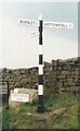
The Northern Antiquarian (TNA) features a page for the lost site of this long lost cross - see their entry for Annot Cross, Brierfield, Lancashire.
TNA tells us: "(the cross) was erected in a region full of pre-christian remains and (at the time) living remnants of heathen folklore and practices between Worsthorne and Nelson. Mr Byrne (1974) described his search for the place, saying: 'This cross is of ancient origin and no part of it now remains as far as can be ascertained by investigation, although the memory of it certainly remains, for an elderly gentleman living in the cottages of Holt Hill, Briercliffe, said instantly on being asked about he cross that he had often heard it referred to by older people when he was a boy, although he could not say exactly where in the hamlet the monolith had stood. We are told that the cross is mentioned in a document in the year 1313 when Robert Briercliffe granted away the Sene intacks in the Holt Hill as it lay by Annot Cross on the south side. This implies that it stood on the south side of the road (between) Thursden and Haggate, which is an old road from Burnley to Halifax…'"
Note: Do you know anything about this now lost cross? Do you have any information, illustrations or drawings to contribute?
You may be viewing yesterday's version of this page. To see the most up to date information please register for a free account.
Do not use the above information on other web sites or publications without permission of the contributor.
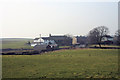
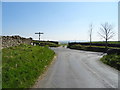
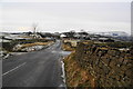
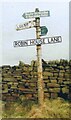
Nearby Images from Geograph Britain and Ireland:
©2008(licence)
©2019(licence)
©2010(licence)
©2021(licence)
©2021(licence)
The above images may not be of the site on this page, they are loaded from Geograph.
Please Submit an Image of this site or go out and take one for us!
Click here to see more info for this site
Nearby sites
Key: Red: member's photo, Blue: 3rd party photo, Yellow: other image, Green: no photo - please go there and take one, Grey: site destroyed
Download sites to:
KML (Google Earth)
GPX (GPS waypoints)
CSV (Garmin/Navman)
CSV (Excel)
To unlock full downloads you need to sign up as a Contributory Member. Otherwise downloads are limited to 50 sites.
Turn off the page maps and other distractions
Nearby sites listing. In the following links * = Image available
695m SSW 193° Calf Hey Well (Briercliffe) Holy Well or Sacred Spring (SD8794334622)
858m NE 54° Burwain's Farm Stone Circle (SD888358)
1.2km SSE 169° Nogworth Cross (Briercliffe) Ancient Cross (SD8833934086)
1.5km WNW 290° Finn's Well (Haggate) Holy Well or Sacred Spring (SD86713582)
1.5km SE 142° Beadle Hill (Extwistle) Misc. Earthwork (SD8901834112)
1.5km SSE 151° Beth Cross (Holden Clough) Ancient Cross (SD88863395)
1.6km SE 140° Bonfire Hill III* Round Barrow(s) (SD891341)
1.6km SE 137° Bonfire Hill II* Round Barrow(s) (SD892341)
1.6km SE 127° Bonfire Hill 1* Cairn (SD894343)
1.8km SSE 151° Twist Hill Barrow* Round Barrow(s) (SD88983370)
1.9km N 2° Catlow Well/Spring* Holy Well or Sacred Spring (SD8818137169)
1.9km E 87° Burwain's Camp* Misc. Earthwork (SD900354)
2.0km NE 35° Ring Stones Hill Stone Circle (SD89263693)
2.1km E 92° Broadbank* Ancient Village or Settlement (SD9023935227)
2.3km NE 42° Knave Hill (Nelson)* Cairn (SD8963636991)
2.3km ESE 120° Hellclough Ring Cairn* Cairn (SD9012534145)
2.4km SSE 166° Ring Stones (Worsthorne) Stone Circle (SD8864933006)
2.4km ESE 119° Hellclough Saucer Barrow* Ring Cairn (SD9020034124)
2.4km NNE 33° Walton Spire Cross* Standing Stone (Menhir) (SD8941637328)
2.5km SE 129° Delf Hill* Stone Circle (SD9006433732)
2.5km NNE 30° Walton Spire Stone* Standing Stone (Menhir) (SD8939137498)
2.6km S 172° Worsthorne Moor* Stone Circle (SD8845932764)
2.9km SSE 159° Hameldon Pasture (I)* Round Barrow(s) (SD8914232622)
2.9km SSE 159° Hameldon Pasture (II)* Cairn (SD8911832597)
2.9km N 10° The Gib Clough Head Stone* Marker Stone (SD886382)
View more nearby sites and additional images


 We would like to know more about this location. Please feel free to add a brief description and any relevant information in your own language.
 Wir möchten mehr über diese Stätte erfahren. Bitte zögern Sie nicht, eine kurze Beschreibung und relevante Informationen in Deutsch hinzuzufügen.
 Nous aimerions en savoir encore un peu sur les lieux. S'il vous plaît n'hesitez pas à ajouter une courte description et tous les renseignements pertinents dans votre propre langue.
 Quisieramos informarnos un poco más de las lugares. No dude en añadir una breve descripción y otros datos relevantes en su propio idioma.