<< Text Pages >> Habchester - Hillfort in Scotland in Scottish Borders
Submitted by Andy B on Wednesday, 01 March 2023 Page Views: 2376
Iron Age and Later PrehistorySite Name: HabchesterCountry: Scotland
NOTE: This site is 3.045 km away from the location you searched for.
County: Scottish Borders Type: Hillfort
Map Ref: NT94425881
Latitude: 55.822507N Longitude: 2.090629W
Condition:
| 5 | Perfect |
| 4 | Almost Perfect |
| 3 | Reasonable but with some damage |
| 2 | Ruined but still recognisable as an ancient site |
| 1 | Pretty much destroyed, possibly visible as crop marks |
| 0 | No data. |
| -1 | Completely destroyed |
| 5 | Superb |
| 4 | Good |
| 3 | Ordinary |
| 2 | Not Good |
| 1 | Awful |
| 0 | No data. |
| 5 | Can be driven to, probably with disabled access |
| 4 | Short walk on a footpath |
| 3 | Requiring a bit more of a walk |
| 2 | A long walk |
| 1 | In the middle of nowhere, a nightmare to find |
| 0 | No data. |
| 5 | co-ordinates taken by GPS or official recorded co-ordinates |
| 4 | co-ordinates scaled from a detailed map |
| 3 | co-ordinates scaled from a bad map |
| 2 | co-ordinates of the nearest village |
| 1 | co-ordinates of the nearest town |
| 0 | no data |
Be the first person to rate this site - see the 'Contribute!' box in the right hand menu.
Internal Links:
External Links:
Hillfort in Scottish Borders
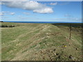
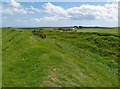
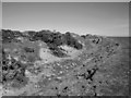
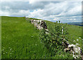
This oval fort measures 380ft by 270ft within two bold ramparts with external ditches. The NW sector has been ploughed away, but at the surviving entrance in the NE, the ramparts join round the head of the inner ditch. The NW sector of the defences is represented by the crest of a natural steep scarp, and it is probable that, in its original state, the fort would have been bounded on this side by only the inner rampart. Another feature is a quarry ditch at the inner foot of the remaining part of the inner rampart.
Source: Canmore
You may be viewing yesterday's version of this page. To see the most up to date information please register for a free account.
Do not use the above information on other web sites or publications without permission of the contributor.
Nearby Images from Geograph Britain and Ireland:
©2013(licence)
©2014(licence)
©2006(licence)
©2014(licence)
©2015(licence)
The above images may not be of the site on this page, they are loaded from Geograph.
Please Submit an Image of this site or go out and take one for us!
Click here to see more info for this site
Nearby sites
Key: Red: member's photo, Blue: 3rd party photo, Yellow: other image, Green: no photo - please go there and take one, Grey: site destroyed
Download sites to:
KML (Google Earth)
GPX (GPS waypoints)
CSV (Garmin/Navman)
CSV (Excel)
To unlock full downloads you need to sign up as a Contributory Member. Otherwise downloads are limited to 50 sites.
Turn off the page maps and other distractions
Nearby sites listing. In the following links * = Image available
1.6km NNE 31° Chester Hill (Greystonelees)* Promontory Fort / Cliff Castle (NT95266018)
4.4km S 171° High Cocklaw Cists* Cist (NT95105449)
5.7km N 358° Wellbraes* Holy Well or Sacred Spring (NT9424664542)
8.5km NNW 336° The Creel Path* Ancient Trackway (NT910666)
8.7km SSE 166° Ord A, B & C Rock Art (NT9645050350)
9.0km S 181° Milfield Cursus Cursus (NT942498)
9.7km W 267° The Pech Stane* Standing Stone (Menhir) (NT84685831)
10.0km NNW 340° Mire Loch South* Ancient Village or Settlement (NT91066824)
10.3km NNW 332° Westloch House East* Ancient Village or Settlement (NT89556792)
10.4km NNW 340° Mire Loch North* Ancient Village or Settlement (NT90846863)
10.8km NNW 340° Pettico Wick* Promontory Fort / Cliff Castle (NT90676900)
10.9km NNW 335° Coldingham Loch Fort* Hillfort (NT89886868)
10.9km NNW 336° Coldingham Loch Long Barrow* Long Barrow (NT89966873)
10.9km NNW 331° Westloch House West* Ancient Village or Settlement (NT8912168407)
11.2km NNW 332° Westerside* Ancient Village or Settlement (NT89136866)
11.5km NNW 333° Earn's Heugh* Promontory Fort / Cliff Castle (NT8921069130)
12.0km WSW 255° Edrom Sculptured Stone (NT828558)
12.3km SSW 201° Norham Cross* Ancient Cross (NT8992447329)
12.3km SSW 202° St Cuthbert's Church (Norham)* Ancient Cross (NT8968447411)
13.4km SSW 205° Nun's Well (Upsettlington)* Holy Well or Sacred Spring (NT8870446652)
13.5km SSW 205° St Mary's Well (Upsettlington)* Holy Well or Sacred Spring (NT8865846592)
13.7km WSW 256° Manderston cist* Cist (NT81125555)
13.7km SSW 206° Monk's Well (Upsettlington)* Holy Well or Sacred Spring (NT8849646471)
13.8km W 277° Drakemire hillforts* Hillfort (NT80726051)
13.9km W 260° Broomhouse Souterrain* Souterrain (Fogou, Earth House) (NT80675629)
View more nearby sites and additional images


 We would like to know more about this location. Please feel free to add a brief description and any relevant information in your own language.
 Wir möchten mehr über diese Stätte erfahren. Bitte zögern Sie nicht, eine kurze Beschreibung und relevante Informationen in Deutsch hinzuzufügen.
 Nous aimerions en savoir encore un peu sur les lieux. S'il vous plaît n'hesitez pas à ajouter une courte description et tous les renseignements pertinents dans votre propre langue.
 Quisieramos informarnos un poco más de las lugares. No dude en añadir una breve descripción y otros datos relevantes en su propio idioma.