

<< Text Pages >> Alticoana - Castro or Chafurdão in Spain in Navarra
Submitted by TheCaptain on Wednesday, 08 September 2010 Page Views: 1480
Iron Age and Later PrehistorySite Name: AlticoanaCountry: Spain
NOTE: This site is 3.776 km away from the location you searched for.
Region: Navarra Type: Castro or Chafurdão
Nearest Town: Pamplona Nearest Village: Estella
Latitude: 42.670000N Longitude: 2.031W
Condition:
| 5 | Perfect |
| 4 | Almost Perfect |
| 3 | Reasonable but with some damage |
| 2 | Ruined but still recognisable as an ancient site |
| 1 | Pretty much destroyed, possibly visible as crop marks |
| 0 | No data. |
| -1 | Completely destroyed |
| 5 | Superb |
| 4 | Good |
| 3 | Ordinary |
| 2 | Not Good |
| 1 | Awful |
| 0 | No data. |
| 5 | Can be driven to, probably with disabled access |
| 4 | Short walk on a footpath |
| 3 | Requiring a bit more of a walk |
| 2 | A long walk |
| 1 | In the middle of nowhere, a nightmare to find |
| 0 | No data. |
| 5 | co-ordinates taken by GPS or official recorded co-ordinates |
| 4 | co-ordinates scaled from a detailed map |
| 3 | co-ordinates scaled from a bad map |
| 2 | co-ordinates of the nearest village |
| 1 | co-ordinates of the nearest town |
| 0 | no data |
Be the first person to rate this site - see the 'Contribute!' box in the right hand menu.
Internal Links:
External Links:
Castro in Navarra
Alticoana is a Castro in the community of Estella, Province of Navarra, region of Navarra
You may be viewing yesterday's version of this page. To see the most up to date information please register for a free account.
Do not use the above information on other web sites or publications without permission of the contributor.
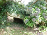
Nearby Images from Flickr
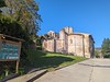
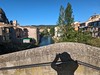
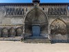
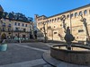
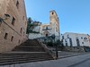
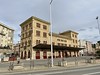
The above images may not be of the site on this page, but were taken nearby. They are loaded from Flickr so please click on them for image credits.
Click here to see more info for this site
Nearby sites
Click here to view sites on an interactive map of the areaKey: Red: member's photo, Blue: 3rd party photo, Yellow: other image, Green: no photo - please go there and take one, Grey: site destroyed
Download sites to:
KML (Google Earth)
GPX (GPS waypoints)
CSV (Garmin/Navman)
CSV (Excel)
To unlock full downloads you need to sign up as a Contributory Member. Otherwise downloads are limited to 50 sites.
Turn off the page maps and other distractions
Nearby sites listing. In the following links * = Image available
9.3km E 95° Txarrakadia Alcalá Dolmen* Burial Chamber or Dolmen
9.3km ESE 103° Eskintza Menhir Standing Stone (Menhir)
9.5km NNW 340° Regalbar Túmulo 2 Round Barrow(s)
9.5km NNW 340° Regalbar Túmulo 1 Round Barrow(s)
9.5km NNW 340° Regalbar Fondo Cabaña 1 Ancient Village or Settlement
9.6km NNW 341° Regalbar Fondo Cabaña 2 Ancient Village or Settlement
9.6km NNW 340° Regalbar Túmulo 3 Round Barrow(s)
9.8km E 100° Corral De Sanchez Menhir Standing Stone (Menhir)
10.0km NNW 340° Sangris Tumulo De Anillo Ring Cairn
10.2km E 79° Aitzibita Dolmen* Burial Chamber or Dolmen
10.3km NNW 339° Iturza Tumulo De Anillo Ring Cairn
10.6km NNW 341° Iturza Menhir Standing Stone (Menhir)
10.7km NNW 341° Iturza Túmulo Round Barrow(s)
11.0km SE 137° Lauzola Menhir Standing Stone (Menhir)
11.1km E 86° Cirauqui* Ancient Trackway
11.8km N 6° La Planilla Menhir Standing Stone (Menhir)
12.1km SSE 155° El Cascajillo Petroglifo Rock Art
12.2km NNE 19° Mendizelaia Túmulo de Anillo Ring Cairn
12.8km SE 136° Labóriz Petroglifo Rock Art
13.0km N 351° Ekaiza Menhir Standing Stone (Menhir)
13.2km N 357° La Txila Menhir Standing Stone (Menhir)
13.2km SE 137° Kortabairrieta Túmulo Round Barrow(s)
13.3km WNW 299° Ulibarri Túmulo Round Barrow(s)
13.3km NNW 338° Aizkorri Túmulo Round Barrow(s)
13.4km E 81° Markalagain Menhir Standing Stone (Menhir)
View more nearby sites and additional images


 We would like to know more about this location. Please feel free to add a brief description and any relevant information in your own language.
 Wir möchten mehr über diese Stätte erfahren. Bitte zögern Sie nicht, eine kurze Beschreibung und relevante Informationen in Deutsch hinzuzufügen.
 Nous aimerions en savoir encore un peu sur les lieux. S'il vous plaît n'hesitez pas à ajouter une courte description et tous les renseignements pertinents dans votre propre langue.
 Quisieramos informarnos un poco más de las lugares. No dude en añadir una breve descripción y otros datos relevantes en su propio idioma.