<< Our Photo Pages >> Inishkea Cross Slab - Ancient Cross in Ireland (Republic of) in Co. Mayo
Submitted by damian120 on Monday, 17 September 2018 Page Views: 2062
Early Medieval (Dark Age)Site Name: Inishkea Cross SlabCountry: Ireland (Republic of)
NOTE: This site is 522.617 km away from the location you searched for.
County: Co. Mayo Type: Ancient Cross
Nearest Town: Belmullet
Latitude: 54.133300N Longitude: 10.2W
Condition:
| 5 | Perfect |
| 4 | Almost Perfect |
| 3 | Reasonable but with some damage |
| 2 | Ruined but still recognisable as an ancient site |
| 1 | Pretty much destroyed, possibly visible as crop marks |
| 0 | No data. |
| -1 | Completely destroyed |
| 5 | Superb |
| 4 | Good |
| 3 | Ordinary |
| 2 | Not Good |
| 1 | Awful |
| 0 | No data. |
| 5 | Can be driven to, probably with disabled access |
| 4 | Short walk on a footpath |
| 3 | Requiring a bit more of a walk |
| 2 | A long walk |
| 1 | In the middle of nowhere, a nightmare to find |
| 0 | No data. |
| 5 | co-ordinates taken by GPS or official recorded co-ordinates |
| 4 | co-ordinates scaled from a detailed map |
| 3 | co-ordinates scaled from a bad map |
| 2 | co-ordinates of the nearest village |
| 1 | co-ordinates of the nearest town |
| 0 | no data |
Internal Links:
External Links:
")
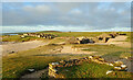
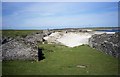
The Vikings are said to have landed in the 10th century and the Pirate Queen, Grace O' Malley, ruled the western seaboard with an iron fist during the 1500s. Perhaps with such a tumultuous history it wasn't until the island was resettled in the 17th century and hosted a small but thriving community until the island was finally deserted in the 1930s.
The island is slowly being reclaimed by the sands of time yet still hosts an array of wildlife from the Corcrake to the multitudes of offshore seals and dolphins.
Many thanks to Castlebar-based tour guide Barry Murphy of Tourism Pure Walking Holidays for yesterday organising an amazing visit to the deserted island paradise that is Inishkea North Island.
You may be viewing yesterday's version of this page. To see the most up to date information please register for a free account.
")
")
")
Do not use the above information on other web sites or publications without permission of the contributor.
Nearby Images from Geograph Britain and Ireland:
©2021(licence)
©2006(licence)
The above images may not be of the site on this page, they are loaded from Geograph.
Please Submit an Image of this site or go out and take one for us!
Click here to see more info for this site
Nearby sites
Click here to view sites on an interactive map of the areaKey: Red: member's photo, Blue: 3rd party photo, Yellow: other image, Green: no photo - please go there and take one, Grey: site destroyed
Download sites to:
KML (Google Earth)
GPX (GPS waypoints)
CSV (Garmin/Navman)
CSV (Excel)
To unlock full downloads you need to sign up as a Contributory Member. Otherwise downloads are limited to 50 sites.
Turn off the page maps and other distractions
Nearby sites listing. In the following links * = Image available
8.5km ESE 120° Tobar Dherbhile (Fallmore) Early Christian Sculptured Stone (F635182)
8.7km ESE 120° Derible's Twist* Modern Stone Circle etc
17.2km SSE 149° Stone Structures on Slievemore Mountain Ancient Village or Settlement
17.3km SSE 153° Slievermore well Holy Well or Sacred Spring
17.4km SSE 149° Cromlech Tumulus* Ancient Village or Settlement (F64840756)
17.4km SSE 148° Keel East court tomb* Court Tomb (F64980758)
17.7km SSE 157° Keel East standing stone* Standing Stone (Menhir) (F62640616)
17.7km SSE 157° Achill-henge* Modern Stone Circle etc
17.7km SSE 157° Keel East hill summit* Not Known (by us) (F62650613)
20.6km SE 146° Loughannascaddy crannog* Crannog (F67330534)
28.5km SE 142° Kildavnet Churchyard Crosses Ancient Cross (L731997)
29.2km ENE 56° Dooncarton circle* Stone Circle
30.6km ENE 58° Rosdoagh Stone Circle (F827383)
46.8km E 93° Dooleeg More* Stone Row / Alignment (G031188)
47.2km SSE 167° Tobar Muire Holy Well or Sacred Spring
47.4km S 172° Inishturk Stone II Standing Stone (Menhir)
47.8km SSE 166° Teampaill Phádraig Early Christian Sculptured Stone
47.8km S 173° Inishturk Stone Standing Stone (Menhir)
47.8km SSE 166° Caher stones Standing Stones
47.9km SSE 166° Caher forts Promontory Fort / Cliff Castle
48.5km E 93° Eskeragh* Stone Row / Alignment (G048189)
49.0km S 173° Dun Baile Greagaigh Promontory Fort / Cliff Castle
49.1km S 173° Dun Baile Thiar Promontory Fort / Cliff Castle
49.1km S 173° Inishturk Fort Promontory Fort / Cliff Castle
50.0km SSE 152° Formoyle Tomb Burial Chamber or Dolmen
View more nearby sites and additional images


 We would like to know more about this location. Please feel free to add a brief description and any relevant information in your own language.
 Wir möchten mehr über diese Stätte erfahren. Bitte zögern Sie nicht, eine kurze Beschreibung und relevante Informationen in Deutsch hinzuzufügen.
 Nous aimerions en savoir encore un peu sur les lieux. S'il vous plaît n'hesitez pas à ajouter une courte description et tous les renseignements pertinents dans votre propre langue.
 Quisieramos informarnos un poco más de las lugares. No dude en añadir una breve descripción y otros datos relevantes en su propio idioma.