


<< Our Photo Pages >> Cuevas de Bandama - Cave or Rock Shelter in Spain in Canary Isles
Submitted by Themistokles on Friday, 12 September 2008 Page Views: 4559
Natural PlacesSite Name: Cuevas de BandamaCountry: Spain
NOTE: This site is 9.248 km away from the location you searched for.
Region: Canary Isles Type: Cave or Rock Shelter
Nearest Town: Santa Brigida Nearest Village: La Atalaya
Latitude: 28.035180N Longitude: 15.45718W
Condition:
| 5 | Perfect |
| 4 | Almost Perfect |
| 3 | Reasonable but with some damage |
| 2 | Ruined but still recognisable as an ancient site |
| 1 | Pretty much destroyed, possibly visible as crop marks |
| 0 | No data. |
| -1 | Completely destroyed |
| 5 | Superb |
| 4 | Good |
| 3 | Ordinary |
| 2 | Not Good |
| 1 | Awful |
| 0 | No data. |
| 5 | Can be driven to, probably with disabled access |
| 4 | Short walk on a footpath |
| 3 | Requiring a bit more of a walk |
| 2 | A long walk |
| 1 | In the middle of nowhere, a nightmare to find |
| 0 | No data. |
| 5 | co-ordinates taken by GPS or official recorded co-ordinates |
| 4 | co-ordinates scaled from a detailed map |
| 3 | co-ordinates scaled from a bad map |
| 2 | co-ordinates of the nearest village |
| 1 | co-ordinates of the nearest town |
| 0 | no data |
Internal Links:
External Links:
")
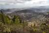
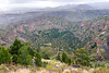
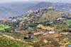
The Cuevas de Bandama are situated inside the vulcanic crater of Bandama and thus one of the most exciting ancient sites on Gran Canaria. It is possible to visit this site by a short walk on a footpath. You can find here former rooms and granaries and with some luck petroglyphs.
You may be viewing yesterday's version of this page. To see the most up to date information please register for a free account.
")
")
Do not use the above information on other web sites or publications without permission of the contributor.
Nearby Images from Flickr
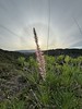
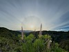
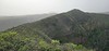
The above images may not be of the site on this page, but were taken nearby. They are loaded from Flickr so please click on them for image credits.
Click here to see more info for this site
Nearby sites
Click here to view sites on an interactive map of the areaKey: Red: member's photo, Blue: 3rd party photo, Yellow: other image, Green: no photo - please go there and take one, Grey: site destroyed
Download sites to:
KML (Google Earth)
GPX (GPS waypoints)
CSV (Garmin/Navman)
CSV (Excel)
To unlock full downloads you need to sign up as a Contributory Member. Otherwise downloads are limited to 50 sites.
Turn off the page maps and other distractions
Nearby sites listing. In the following links * = Image available
6.8km E 97° La Restinga* Ancient Village or Settlement
8.3km NNE 30° Museo Canario* Museum
9.3km SSE 156° Cuatro Puertas* Ancient Temple
11.0km SE 136° Pablo de Tufia* Ancient Village or Settlement
11.3km SSW 197° Guayadeque Valley* Cave or Rock Shelter
11.7km SSW 192° Cueva Bermeja* Cave or Rock Shelter
12.4km S 182° Museo de Guayadeque* Museum
14.0km SW 225° Humiaga* Ancient Temple
14.6km S 175° Agüimes* Modern Stone Circle etc
14.8km SSW 196° Audiencia* Cave or Rock Shelter
15.4km SSE 153° Burrero* Cave or Rock Shelter
16.0km SW 220° Poblado de Tunte* Cave or Rock Shelter
16.9km WSW 245° Roque Nublo* Natural Stone / Erratic / Other Natural Feature
18.1km SSW 204° Centro de Interpretación La Fortaleza* Museum
18.3km SSW 202° Fortalezas (2)* Ancient Village or Settlement
18.4km SSW 202° Fortalezas (1)* Cave or Rock Shelter
18.5km NW 309° Cenobio de Valeron* Cave or Rock Shelter
18.5km WSW 254° Centro de Interpretación del Roque Bentayga* Museum
18.5km WSW 254° Roque Bentaiga* Cave or Rock Shelter
18.8km W 265° Centro de Interpretación del Paisaje Cultural de Risco Caído y Montañas Sagradas* Museum
19.0km WSW 243° Chimirique* Cave or Rock Shelter
19.9km WSW 257° Cuevas del Rey* Cave or Rock Shelter
20.1km W 273° Risco Caído Cave or Rock Shelter
22.2km W 262° Mesa de Acusa* Cave or Rock Shelter
22.8km WNW 302° Cueva Pintada* Ancient Village or Settlement
View more nearby sites and additional images


 We would like to know more about this location. Please feel free to add a brief description and any relevant information in your own language.
 Wir möchten mehr über diese Stätte erfahren. Bitte zögern Sie nicht, eine kurze Beschreibung und relevante Informationen in Deutsch hinzuzufügen.
 Nous aimerions en savoir encore un peu sur les lieux. S'il vous plaît n'hesitez pas à ajouter une courte description et tous les renseignements pertinents dans votre propre langue.
 Quisieramos informarnos un poco más de las lugares. No dude en añadir una breve descripción y otros datos relevantes en su propio idioma.