<< Other Photo Pages >> Tangle Lakes Archaeological District - Ancient Village or Settlement in United States in Alaska
Submitted by AKFisher on Monday, 21 August 2023 Page Views: 420
Pre-ColumbianSite Name: Tangle Lakes Archaeological District Alternative Name: Tangle Lakes Site, TLADCountry: United States
NOTE: This site is 206.003 km away from the location you searched for.
Region: Alaska Type: Ancient Village or Settlement
Nearest Town: Delta Junction, AK
Latitude: 63.045910N Longitude: 146.03165W
Condition:
| 5 | Perfect |
| 4 | Almost Perfect |
| 3 | Reasonable but with some damage |
| 2 | Ruined but still recognisable as an ancient site |
| 1 | Pretty much destroyed, possibly visible as crop marks |
| 0 | No data. |
| -1 | Completely destroyed |
| 5 | Superb |
| 4 | Good |
| 3 | Ordinary |
| 2 | Not Good |
| 1 | Awful |
| 0 | No data. |
| 5 | Can be driven to, probably with disabled access |
| 4 | Short walk on a footpath |
| 3 | Requiring a bit more of a walk |
| 2 | A long walk |
| 1 | In the middle of nowhere, a nightmare to find |
| 0 | No data. |
| 5 | co-ordinates taken by GPS or official recorded co-ordinates |
| 4 | co-ordinates scaled from a detailed map |
| 3 | co-ordinates scaled from a bad map |
| 2 | co-ordinates of the nearest village |
| 1 | co-ordinates of the nearest town |
| 0 | no data |
Internal Links:
External Links:
")
The Tangle Lakes Archaeological District Special Use Area (TLAD SUA) contains one of the largest concentrations of archaeological sites found along the Highway corridor. Each year the DNR Office of History and Archaeology assists the DNR Division of Mining, Land and Water in managing the area for maximum public access consistent with conservation of the district's cultural heritage.
Prehistoric Camps
Prehistoric camp sites are common in the area. Most are found along lake margins or in close proximity to hunting overlooks. Buried camp sites usually feature one or more hearths used for heating and cooking, along with a scattering of chipped stone artifacts. The camp sites often contain a greater variety of tools than hunting overlooks. These may include several kinds of scrapers used to prepare hides for use in clothing, along with tools called burins and gravers used to work antler, bone or wood. Faint oval outlines interpreted as temporary house floors have been found at a few sites. These probably represent tents made of hides stretched over a wooden frame. Several camp sites, hearths and house floors in the District have been dated using the radiocarbon method. These dates prove that prehistoric people established camps in the District at 11,600, 10,300, 5,100, 3,030 and 1,100 years ago. Many others remain undated.
Denali Highway Archaeologists
Archaeologists from the University of Alaska Fairbanks discovered prehistoric sites in the Tangle Lakes area in 1957. Since then archaeologists affiliated with UAF, the Bureau of Land Management, Alaska Pacific University, Harvard's Peabody Museum, the Bureau of Indian Affairs, the State of Alaska, and Texas A&M University have all carried out research or management studies in lands bordering the Denali Highway. Studies in adjacent areas like the Richardson Highway and the proposed Susitna-Watana dam impoundment have also contributed to our understanding. Recently, archeologists have discovered prehistoric sites in the alpine tundra of the Clearwater Mountains, including a quarry. Tantalizing leads at a few sites that may indicate human occupation older than 13,000 years ago are currently being explored.
Further reading and information:
Alaska DNR
Bureau of Land Management
Directions: From Delta Junction via Richardson Hwy S, 102 mi.
You may be viewing yesterday's version of this page. To see the most up to date information please register for a free account.
")
Do not use the above information on other web sites or publications without permission of the contributor.
Nearby Images from Flickr
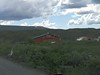
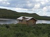
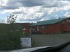

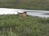

The above images may not be of the site on this page, but were taken nearby. They are loaded from Flickr so please click on them for image credits.
Click here to see more info for this site
Nearby sites
Click here to view sites on an interactive map of the areaKey: Red: member's photo, Blue: 3rd party photo, Yellow: other image, Green: no photo - please go there and take one, Grey: site destroyed
Download sites to:
KML (Google Earth)
GPX (GPS waypoints)
CSV (Garmin/Navman)
CSV (Excel)
To unlock full downloads you need to sign up as a Contributory Member. Otherwise downloads are limited to 50 sites.
Turn off the page maps and other distractions
Nearby sites listing. In the following links * = Image available
125.1km N 4° Swan Point Archaeological Site* Ancient Village or Settlement
131.5km N 7° Upward Sun River* Ancient Village or Settlement
516.0km NNE 26° Bluefish Caves* Cave or Rock Shelter
629.0km ESE 109° Yukon Beringia Interpretive Centre* Museum
726.5km NW 314° Onion Portage Archaeological District* Ancient Village or Settlement
806.9km NW 321° Feniak Lake* Rock Art
902.1km SE 132° Hidden Falls Ancient Village or Settlement
917.7km WSW 254° Nunalleq* Ancient Village or Settlement
962.9km WNW 288° Snake River Sandspit Pithouses Ancient Village or Settlement
1018.6km SE 131° On-Your-Knees Cave* Cave or Rock Shelter
1026.7km NNW 339° Birnirk National Historic Landmark* Artificial Mound
1052.3km SE 128° Petroglyph Beach* Rock Art
1312.4km SE 131° Lucy Islands Ancient Village or Settlement
1350.7km ESE 121° 'Ksan Historical Village and Museum* Museum
1435.4km WNW 291° Un'en'en Ancient Village or Settlement
1458.0km SE 137° Gwaii Haanas Caves Cave or Rock Shelter
1557.5km WSW 239° Amaknak Bridge Ancient Village or Settlement
1640.8km SE 127° Nuxalk Petroglyphs Rock Art
1668.9km ESE 117° Beaverly Workshop Ancient Mine, Quarry or other Industry
1867.9km NW 310° Petroglyphs of Pegtymel River* Rock Art
1889.5km SE 129° Ancient clam gardens on Quadra Island* Ancient Mine, Quarry or other Industry
1955.2km SE 130° Comox Estuary* Ancient Village or Settlement
1956.2km SE 130° Comox Harbor Ancient Fish Trap* Ancient Mine, Quarry or other Industry
1957.0km SE 129° Pictographs near Powell River ferry terminal Rock Art
1986.1km E 93° Quarry of the Ancestors Ancient Mine, Quarry or other Industry
View more nearby sites and additional images


 We would like to know more about this location. Please feel free to add a brief description and any relevant information in your own language.
 Wir möchten mehr über diese Stätte erfahren. Bitte zögern Sie nicht, eine kurze Beschreibung und relevante Informationen in Deutsch hinzuzufügen.
 Nous aimerions en savoir encore un peu sur les lieux. S'il vous plaît n'hesitez pas à ajouter une courte description et tous les renseignements pertinents dans votre propre langue.
 Quisieramos informarnos un poco más de las lugares. No dude en añadir una breve descripción y otros datos relevantes en su propio idioma.