<< Text Pages >> Lucy Islands - Ancient Village or Settlement in Canada
Submitted by Andy B on Wednesday, 05 October 2016 Page Views: 2016
Multi-periodSite Name: Lucy Islands Alternative Name: Prince Rupert Visitor CentreCountry: Canada Type: Ancient Village or Settlement
Latitude: 54.300278N Longitude: 130.618889W
Condition:
| 5 | Perfect |
| 4 | Almost Perfect |
| 3 | Reasonable but with some damage |
| 2 | Ruined but still recognisable as an ancient site |
| 1 | Pretty much destroyed, possibly visible as crop marks |
| 0 | No data. |
| -1 | Completely destroyed |
| 5 | Superb |
| 4 | Good |
| 3 | Ordinary |
| 2 | Not Good |
| 1 | Awful |
| 0 | No data. |
| 5 | Can be driven to, probably with disabled access |
| 4 | Short walk on a footpath |
| 3 | Requiring a bit more of a walk |
| 2 | A long walk |
| 1 | In the middle of nowhere, a nightmare to find |
| 0 | No data. |
| 5 | co-ordinates taken by GPS or official recorded co-ordinates |
| 4 | co-ordinates scaled from a detailed map |
| 3 | co-ordinates scaled from a bad map |
| 2 | co-ordinates of the nearest village |
| 1 | co-ordinates of the nearest town |
| 0 | no data |
Internal Links:
External Links:
Off the coast of northern British Columbia, the Lucy Islands have some of the oldest archaeological sites on the western coast, human occupation has been traced back to 5,000 years ago at the site.
Among the finds are houses, burial remains and ancient landfills (called middens). More recent inhabitants of the island became fishermen and lighthouse keepers, but the islands today are effectively uninhabited. You'll also be able to take a peek at the old lighthouse on the islands, though.
Further Information
Official web site
Wikipedia
You may be viewing yesterday's version of this page. To see the most up to date information please register for a free account.
Do not use the above information on other web sites or publications without permission of the contributor.
Nearby Images from Flickr
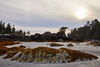
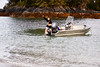


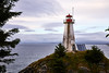
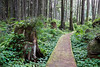
The above images may not be of the site on this page, but were taken nearby. They are loaded from Flickr so please click on them for image credits.
Click here to see more info for this site
Nearby sites
Click here to view sites on an interactive map of the areaKey: Red: member's photo, Blue: 3rd party photo, Yellow: other image, Green: no photo - please go there and take one, Grey: site destroyed
Download sites to:
KML (Google Earth)
GPX (GPS waypoints)
CSV (Garmin/Navman)
CSV (Excel)
To unlock full downloads you need to sign up as a Contributory Member. Otherwise downloads are limited to 50 sites.
Turn off the page maps and other distractions
Nearby sites listing. In the following links * = Image available
212.9km SSW 194° Gwaii Haanas Caves Cave or Rock Shelter
216.3km ENE 60° 'Ksan Historical Village and Museum* Museum
267.4km NNW 336° Petroglyph Beach* Rock Art
294.1km NW 321° On-Your-Knees Cave* Cave or Rock Shelter
338.5km SE 128° Nuxalk Petroglyphs Rock Art
411.5km NW 320° Hidden Falls Ancient Village or Settlement
500.2km E 92° Beaverly Workshop Ancient Mine, Quarry or other Industry
578.9km SE 139° Ancient clam gardens on Quadra Island* Ancient Mine, Quarry or other Industry
643.6km SE 141° Comox Estuary* Ancient Village or Settlement
644.4km SE 141° Comox Harbor Ancient Fish Trap* Ancient Mine, Quarry or other Industry
647.4km SE 138° Pictographs near Powell River ferry terminal Rock Art
680.7km SE 143° Sproat Lake Petroglyphs* Rock Art
700.2km SE 135° Salmon Inlet Barrow Cemetery
713.7km SE 136° shíshálh Nation tems swiya Museum Museum
735.4km SE 139° Petroglyph Provincial Park (British Columbia)* Rock Art
735.4km SE 138° Lock Bay Site* Rock Art
742.0km SE 138° Cedar by the Sea Petroglyphs* Rock Art
744.6km SE 138° Degnen Bay Site* Rock Art
753.7km SE 135° Museum of Anthropology - University of British Columbia* Museum
755.1km SE 134° Coast Salish Stone Fish Weir* Stone Row / Alignment
755.1km SE 134° Skalsh Rock* Rock Outcrop
756.8km SE 134° Xwayzway Village* Ancient Village or Settlement
760.5km NNW 341° Yukon Beringia Interpretive Centre* Museum
777.9km SE 134° Glenrose Cannery* Ancient Village or Settlement
778.0km SE 134° Sewqueqsen Settlement at St.Mungo Cannery* Ancient Village or Settlement
View more nearby sites and additional images


 We would like to know more about this location. Please feel free to add a brief description and any relevant information in your own language.
 Wir möchten mehr über diese Stätte erfahren. Bitte zögern Sie nicht, eine kurze Beschreibung und relevante Informationen in Deutsch hinzuzufügen.
 Nous aimerions en savoir encore un peu sur les lieux. S'il vous plaît n'hesitez pas à ajouter une courte description et tous les renseignements pertinents dans votre propre langue.
 Quisieramos informarnos un poco más de las lugares. No dude en añadir una breve descripción y otros datos relevantes en su propio idioma.