<< Our Photo Pages >> Los Osos Back Bay - Ancient Village or Settlement in United States in The West
Submitted by C_Michael_Hogan on Wednesday, 06 February 2008 Page Views: 30563
Multi-periodSite Name: Los Osos Back BayCountry: United States
NOTE: This site is 31.017 km away from the location you searched for.
Region: The West Type: Ancient Village or Settlement
Nearest Town: Morro Bay Nearest Village: Los Osos
Latitude: 35.324903N Longitude: 120.819447W
Condition:
| 5 | Perfect |
| 4 | Almost Perfect |
| 3 | Reasonable but with some damage |
| 2 | Ruined but still recognisable as an ancient site |
| 1 | Pretty much destroyed, possibly visible as crop marks |
| 0 | No data. |
| -1 | Completely destroyed |
| 5 | Superb |
| 4 | Good |
| 3 | Ordinary |
| 2 | Not Good |
| 1 | Awful |
| 0 | No data. |
| 5 | Can be driven to, probably with disabled access |
| 4 | Short walk on a footpath |
| 3 | Requiring a bit more of a walk |
| 2 | A long walk |
| 1 | In the middle of nowhere, a nightmare to find |
| 0 | No data. |
| 5 | co-ordinates taken by GPS or official recorded co-ordinates |
| 4 | co-ordinates scaled from a detailed map |
| 3 | co-ordinates scaled from a bad map |
| 2 | co-ordinates of the nearest village |
| 1 | co-ordinates of the nearest town |
| 0 | no data |
Internal Links:
External Links:
I have visited· I would like to visit
C_Michael_Hogan has visited here
")
Los Osos Back Bay is the largest extant Native American midden in San Luis Obispo County, California. This somewhat rectangular Chumash site is situated on a low lying sand dune near Morro Bay, comprising roughly 23,000 square meters in extent. Three distinct settlement eras have been deduced from excavations generally about one meter in depth, with remnants of a sweat-lodge, residential structures and numerous fire pits.
The site has yielded large quantities of shell material as well as beads, stone tools, animal bones, charcoal and thermal fractured rock. The research herein is based upon my on site visit of January, 2007 as well as archival review of literature and artifacts.
OCCUPATION Excavation reveals the site was occupied as early as the period 800 to 1200 AD. There are three distinct periods of occupation, with the middle period manifesting the largest number of inhabitants. (Hoover, 1977) The Chumash peoples who lived here clearly exploited marine resources from the nearby back bay of Morro Bay (photo). This late Holocene occupation is consistent with regional analysis of fishing strategies of native peoples of the California Central Coast, in which smaller sized taxa are prevalent into the Late Prehistoric Period. I concur with other authors (Rick, 2000) that such a trend in marine species size is evidence of over-harvesting of near shore marine fauna. This factor may partially explain the decreased population of the latest occupation period of the Los Osos Back Bay site.
Occurrence of the Medieval Climatic Anomaly in this region between about 900 to 1300 AD (Boxt, 2000) may argue for the first era of occupation at around 800 AD, since the aridity of the dune coupled with low flow of Los Osos Creek would have made this site particularly inhospitable during the four century drought; this would also explain the rather clear layering between oldest and middle occupation periods. The site choice is also consistent with known higher sea levels of a millennium earlier, since that would have positioned the bay shoreline slightly closer without inducing salinity to Los Osos Creek.
In the early period level remains of a sweat-lodge or ‘'temescal'‘ were uncovered with a hut diameter of as great as six meters. In both the early and middle occupation periods, there is evidence of dwellings situated on an elaborate terraced system leading toward Los Osos Creek. In some cases the density of shell middens were actually used structurally to support terrace edges in the nature of a retaining wall for the otherwise sandy strata. A thick charcoal layer along with thermal fractured rock was present at one of the residential hearths. Numerous dense ash, shell and charcoal lenses are found throughout the site, but principally at the early and mid-occupation periods, suggesting that the later occupation was more sporadic and with far less population. A cemetery area lies at the east of the Los Osos Back Bay site.
ENVIRONMENT The site is positioned on a low lying silty stabilized sand dune above the northwest edge of Morro Bay, whose waters today lie about 700 meters to the northwest. Situated primarily on the southern flank of the large dune, the site receives shelter from prevailing northwest winds. The arid sandy soils are not hospitable to agriculture, but are covered with low lying sage scrub, as they likely would have held millennia past. Los Osos Creek is a proximate source of fresh water, lying at the eastern downslope edge of the site as it flows into Morro Bay. Therefore the location of this settlement was cleverly optimized to achieve proximity to the shellfish resources of Morro Bay, but also an even closer presence to the freshwater source; furthermore, the gradient of Los Osos Creek channel is steep enough to block tidal saline intrusion to the water supply. Note this situation is not common, since many Central Coast creeks manifest low channel gradients, leading to deep inland estuarine penetration.
STONE TOOLS Most of the stone tools were recovered from the earliest settlement era. Chert and sandstone implements are quite common, reflecting the abundance of these rock types in the local coastal hills. (Fitzgerald, 2000) With less than one percent of the total site having been excavated, the quantity of tools found classify Los Osos Back Bay as a highly intensive lithic manufacturing site. This finding is particularly remarkable in that no stone material occurs naturally in the native soil. Tools fall into the following groups: projectile point, chopper, drill, scraper, hammer-stone, pitted stone (or "acorn cracker"), rubbing stone and preform.
25 chert projectile points have been recovered, all of which are consistent with the Late Prehistoric Chumash. Some of these points are classified as the "Canilino" type similar to some found in the Santa Barbara Channel area; this type has also been found in the Burton Mound.. (Harrington, 1928) Two choppers were found, one of chert and the other of shale. Six chert drills were recovered, with five being designed for very fine drilling; re-enforcing the concept that this site was a major bead manufacturing locus. Further five basalt hammer-stones, four chert scrapers, one pitted stone and a large number of preforms and cores were retrieved. .
BEADS, ANIMAL BONES AND HOUSEHOLD ITEMS An enormous volume of beads (including a small number of steatite) were recovered along with a spectrum of mano, metate, pestle, basket and rubbing-stone items. Beads include shell derived specimens such as "Olivella diplicata", "Mytilis Californianus" disks and fishhook, "Dentalium neohexagonum" tubes, and "Tivela stulturum" disks, "Macoma nasuta" disks, "Haliotis rufescens" disk and "Haliotis cracherodii" disk. Other shell species found were "Acanthina spirata" and "Protothaca staminea". A specimen of drilled sea lion tooth was also recovered from the excavations. Hoover suggests that the site may have been a "major staging point" for obsidian trading with the Owens Valley and for plant and animal products from the San Joaquin Valley Yokuts.
Manos were made of either sandstone or basalt, and all save one had a unifacial working surface. Fragmentary baskets bore evidence of sealing with local asphaltum to achieve waterproofing. Bone awls were also recovered, which items would have been needed for manufacture of baskets. Six chunks of red ochre were found, which would typically have been used as body paint for religious ceremonies.
REFERENCES
* Robert L. Hoover and W.B.Sawyer (1977) ‘'Los Osos Junior High School Site 4-SLO-214'', addendum to Applegate's ‘'Chumash Place Names'‘, Occ paper #9, by Kathryn A.Klar, San Luis Obispo County Archaeological Society
* Torben C.Rick and Jon M.Erlandson (2000) ‘'Early Holocene Fishing Strategies on the California Coast: Evidence from CA-SBA-2057'', J. Arch. Sci. 27, 621-633
* Matthew A. Boxt, L.Mark Raab, Owen K.Davis and Kevin O.Pope (2000) ‘'Extreme Late Holocene Climate Change in Coastal Southern California'‘, University of California Long Beach
* Richard T.Fitzgerald (2000) ‘'Cross Creek: An Early Holocene/Millingstone Site'‘, Calif. State Water Project, Coastal Branch Series, Paper #12, San Luis Obispo County Archaeological Society
* John Peabody Harrington (1928) ‘'Exploration of the Burton Mound in Santa Barbara County'‘, Bureau of American Ethnology Annual Report 56:25 168, Washington D.C.
(The above is original work of C.Michael Hogan prepared for the Megalithic Portal. I am grateful to the San Luis Obispo County Archaeological Society, which provided valuable insights as well as access to elements of the Society's Chumash artifact collection.)
You may be viewing yesterday's version of this page. To see the most up to date information please register for a free account.
")
")
")
Do not use the above information on other web sites or publications without permission of the contributor.
Nearby Images from Flickr


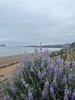
The above images may not be of the site on this page, but were taken nearby. They are loaded from Flickr so please click on them for image credits.
Click here to see more info for this site
Nearby sites
Click here to view sites on an interactive map of the areaKey: Red: member's photo, Blue: 3rd party photo, Yellow: other image, Green: no photo - please go there and take one, Grey: site destroyed
Download sites to:
KML (Google Earth)
GPX (GPS waypoints)
CSV (Garmin/Navman)
CSV (Excel)
To unlock full downloads you need to sign up as a Contributory Member. Otherwise downloads are limited to 50 sites.
Turn off the page maps and other distractions
Nearby sites listing. In the following links * = Image available
6.8km NNW 332° Morro Creek* Ancient Village or Settlement
89.4km ESE 103° Painted Rock, Carrizo Plain* Rock Art
131.1km SE 134° Chumash Painted Cave* Cave or Rock Shelter
144.6km SE 134° Burton Mound* Artificial Mound
146.4km SSE 165° California Channel Islands* Ancient Village or Settlement
153.1km ESE 103° Wind Wolves Preserve* Rock Art
172.4km NW 326° Monterey Indian Stone* Rock Art
186.3km NNW 333° Moss Landing Shellmound* Artificial Mound
204.8km NNW 339° Chitactac-Adams Heritage County Park* Ancient Village or Settlement
205.7km ENE 67° Painted Rock at Tule River Rock Art
219.7km NNW 327° Sand Hill Bluff Shellmound* Artificial Mound
219.9km NNW 331° Scotts Valley City Hall Artifact Display* Museum
226.5km E 94° Tomo Kahni* Rock Art
246.8km ESE 112° Tataviam Pictograph Site* Rock Art
265.0km ESE 121° Levitated Mass* Modern Stone Circle etc
272.8km NNW 336° Coyote Hills Shellmound ALA 329* Artificial Mound
298.6km ENE 61° Swansea petroglyph site* Rock Art
299.3km ENE 75° Coso Petroglyphs* Rock Art
302.0km NW 323° East Bay Walls* Stone Row / Alignment
308.7km NNW 335° Emeryville Shellmound* Artificial Mound
311.2km SE 124° Bolsa Chica Mesa* Ancient Village or Settlement
312.2km NNW 335° West Berkeley Shell Mound* Artificial Mound
312.9km NE 43° Bishop Eastern Sierra Petroglyphs* Rock Art
323.9km NNW 333° Ring Mountain Carving
329.5km E 91° Inscription Canyon* Rock Art
View more nearby sites and additional images


 We would like to know more about this location. Please feel free to add a brief description and any relevant information in your own language.
 Wir möchten mehr über diese Stätte erfahren. Bitte zögern Sie nicht, eine kurze Beschreibung und relevante Informationen in Deutsch hinzuzufügen.
 Nous aimerions en savoir encore un peu sur les lieux. S'il vous plaît n'hesitez pas à ajouter une courte description et tous les renseignements pertinents dans votre propre langue.
 Quisieramos informarnos un poco más de las lugares. No dude en añadir una breve descripción y otros datos relevantes en su propio idioma.