

<< Other Photo Pages >> San Diego Archaeological Centre - Museum in United States in The West
Submitted by Andy B on Friday, 15 August 2014 Page Views: 7370
MuseumsSite Name: San Diego Archaeological CentreCountry: United States
NOTE: This site is 65.526 km away from the location you searched for.
Region: The West Type: Museum
Nearest Town: San Diego, CA Nearest Village: Escondido, CA
Latitude: 33.089340N Longitude: 116.98092W
Condition:
| 5 | Perfect |
| 4 | Almost Perfect |
| 3 | Reasonable but with some damage |
| 2 | Ruined but still recognisable as an ancient site |
| 1 | Pretty much destroyed, possibly visible as crop marks |
| 0 | No data. |
| -1 | Completely destroyed |
| 5 | Superb |
| 4 | Good |
| 3 | Ordinary |
| 2 | Not Good |
| 1 | Awful |
| 0 | No data. |
| 5 | Can be driven to, probably with disabled access |
| 4 | Short walk on a footpath |
| 3 | Requiring a bit more of a walk |
| 2 | A long walk |
| 1 | In the middle of nowhere, a nightmare to find |
| 0 | No data. |
| 5 | co-ordinates taken by GPS or official recorded co-ordinates |
| 4 | co-ordinates scaled from a detailed map |
| 3 | co-ordinates scaled from a bad map |
| 2 | co-ordinates of the nearest village |
| 1 | co-ordinates of the nearest town |
| 0 | no data |
Internal Links:
External Links:
")
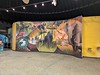
The Center Museum has changing exhibits and hands-on activities that explore 10,000 years of history of the San Diego region through the archaeological record. Learn about the life-ways of early Native American hunter-gatherers who lived in our region and the many groups and immigrants who have contributed to our region's archaeological record.
There are activities for children including an artifact matching game, archaeological related crafts and equipment and games and exploration materials for budding archaeologists to expand their knowledge. You can visit our Virtual Museum to view our past and present exhibit panels.
Suggested donation of $2 per person or $5 per family.
Opening Hours:
Monday - Friday 9:00 a.m. to 4:00 p.m.
Saturday 10:00 a.m. to 2:00 p.m.
CLOSED SUNDAY
Address
San Diego Archaeological Center
16666 San Pasqual Valley Road
Escondido, California 92027-7001
Phone (760) 291-0370
The Center is located on Rte. 78, 1.5 miles East of the San Diego Zoo Safari Park.
Official Web Site
You may be viewing yesterday's version of this page. To see the most up to date information please register for a free account.
Do not use the above information on other web sites or publications without permission of the contributor.
davidmorgan has found this location on Google Street View:
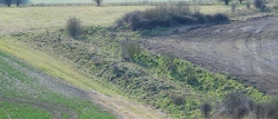
Nearby Images from Flickr

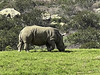
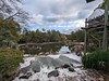
The above images may not be of the site on this page, but were taken nearby. They are loaded from Flickr so please click on them for image credits.
Click here to see more info for this site
Nearby sites
Click here to view sites on an interactive map of the areaKey: Red: member's photo, Blue: 3rd party photo, Yellow: other image, Green: no photo - please go there and take one, Grey: site destroyed
Download sites to:
KML (Google Earth)
GPX (GPS waypoints)
CSV (Garmin/Navman)
CSV (Excel)
To unlock full downloads you need to sign up as a Contributory Member. Otherwise downloads are limited to 50 sites.
Turn off the page maps and other distractions
Nearby sites listing. In the following links * = Image available
59.2km NNE 29° Anza Fertility Site* Natural Stone / Erratic / Other Natural Feature
77.4km N 355° Hemet Maze Stone* Rock Art
120.5km NW 305° Bolsa Chica Mesa* Ancient Village or Settlement
129.1km NE 36° Brunette Lady* Rock Art
129.8km NE 36° Barker Dam Trail* Rock Art
130.1km NE 37° Red lady* Rock Art
149.2km NE 35° Archaeology and Paleontology Curation Center Museum
164.9km ENE 68° Corn Springs* Rock Art
167.6km NW 311° Levitated Mass* Modern Stone Circle etc
197.9km NW 322° Tataviam Pictograph Site* Rock Art
235.3km N 355° Inscription Canyon* Rock Art
240.6km ENE 70° Blythe Intaglios* Hill Figure or Geoglyph
256.5km NNE 23° 17 Mile Point* Rock Art
260.7km NNW 332° Tomo Kahni* Rock Art
261.7km NNE 33° Hole-in-the-Wall* Rock Art
264.5km NE 34° Tortoise Shell Mountain* Rock Art
280.3km E 98° Antelope Hill Ancient Mine, Quarry or other Industry
290.6km WNW 301° Burton Mound* Artificial Mound
291.9km NE 51° Topock Maze* Misc. Earthwork
293.4km NW 317° Wind Wolves Preserve* Rock Art
303.3km WNW 302° Chumash Painted Cave* Cave or Rock Shelter
317.9km NE 41° Grapevine Canyon* Rock Art
328.2km N 350° Coso Petroglyphs* Rock Art
336.0km WNW 289° California Channel Islands* Ancient Village or Settlement
337.7km E 92° Sears Point* Rock Art
View more nearby sites and additional images


 We would like to know more about this location. Please feel free to add a brief description and any relevant information in your own language.
 Wir möchten mehr über diese Stätte erfahren. Bitte zögern Sie nicht, eine kurze Beschreibung und relevante Informationen in Deutsch hinzuzufügen.
 Nous aimerions en savoir encore un peu sur les lieux. S'il vous plaît n'hesitez pas à ajouter une courte description et tous les renseignements pertinents dans votre propre langue.
 Quisieramos informarnos un poco más de las lugares. No dude en añadir una breve descripción y otros datos relevantes en su propio idioma.