<< Text Pages >> Indian Painted Rocks (Spokane) - Rock Art in United States in The Northwest Mountains
Submitted by Bugtussle on Sunday, 10 February 2019 Page Views: 3044
Rock ArtSite Name: Indian Painted Rocks (Spokane)Country: United States
NOTE: This site is 66.115 km away from the location you searched for.
Region: The Northwest Mountains Type: Rock Art
Nearest Town: Spokane, ID Nearest Village: Spokane, ID
Latitude: 47.782810N Longitude: 117.49644W
Condition:
| 5 | Perfect |
| 4 | Almost Perfect |
| 3 | Reasonable but with some damage |
| 2 | Ruined but still recognisable as an ancient site |
| 1 | Pretty much destroyed, possibly visible as crop marks |
| 0 | No data. |
| -1 | Completely destroyed |
| 5 | Superb |
| 4 | Good |
| 3 | Ordinary |
| 2 | Not Good |
| 1 | Awful |
| 0 | No data. |
| 5 | Can be driven to, probably with disabled access |
| 4 | Short walk on a footpath |
| 3 | Requiring a bit more of a walk |
| 2 | A long walk |
| 1 | In the middle of nowhere, a nightmare to find |
| 0 | No data. |
| 5 | co-ordinates taken by GPS or official recorded co-ordinates |
| 4 | co-ordinates scaled from a detailed map |
| 3 | co-ordinates scaled from a bad map |
| 2 | co-ordinates of the nearest village |
| 1 | co-ordinates of the nearest town |
| 0 | no data |
Internal Links:
External Links:
Rock Art in Spokane County, Washington.
"Protected from the elements, these Native American rock paintings have survived approximately 250 years." For more, see Atlas Obscura, Indian Painted Rocks.
You may be viewing yesterday's version of this page. To see the most up to date information please register for a free account.
Do not use the above information on other web sites or publications without permission of the contributor.
Nearby Images from Flickr
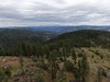
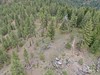
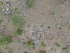
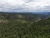
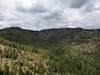
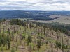
The above images may not be of the site on this page, but were taken nearby. They are loaded from Flickr so please click on them for image credits.
Click here to see more info for this site
Nearby sites
Click here to view sites on an interactive map of the areaKey: Red: member's photo, Blue: 3rd party photo, Yellow: other image, Green: no photo - please go there and take one, Grey: site destroyed
Download sites to:
KML (Google Earth)
GPX (GPS waypoints)
CSV (Garmin/Navman)
CSV (Excel)
To unlock full downloads you need to sign up as a Contributory Member. Otherwise downloads are limited to 50 sites.
Turn off the page maps and other distractions
Nearby sites listing. In the following links * = Image available
99.1km NNE 28° Priest Lake Pictographs Rock Art
148.0km WNW 291° Balance Rock Omak* Natural Stone / Erratic / Other Natural Feature
164.1km SSE 168° Red Elk Rock Shelter* Rock Art
210.3km WSW 245° Vantage Petroglyphs* Rock Art
214.5km SW 217° Columbia Park* Ancient Village or Settlement
221.5km SW 236° Whale Island Petroglyphs Rock Art
222.9km ENE 59° Crystal Lakes Golf Course Stonehenge* Modern Stone Circle etc
224.9km SSE 158° Cooper's Ferry Archaeological Site* Ancient Village or Settlement
250.4km SW 215° Matalam Ancient Village or Settlement
279.2km SSE 166° Snake River Archaeological Site* Rock Art
315.8km S 171° Hells Canyon Archeological District* Rock Art
342.8km SW 229° Maryhill Stonehenge* Modern Stone Circle etc
353.7km NE 51° Head-Smashed-In Buffalo Jump* Ancient Mine, Quarry or other Industry
359.9km W 261° Skystone* Natural Stone / Erratic / Other Natural Feature
360.2km W 270° Burke Museum of Natural History and Culture* Museum
363.8km SW 230° Columbia Hills State Park* Rock Art
373.1km SW 233° Lower Memaloose Island* Barrow Cemetery
373.5km WNW 294° Sumas Lightning Rock* Natural Stone / Erratic / Other Natural Feature
377.4km W 271° Haleets* Rock Art
382.1km WNW 295° Xaytem Ancient Native Settlement* Ancient Village or Settlement
408.9km NE 36° Big Rock (Alberta) Rock Art
411.8km W 263° Qwu?gwes Ancient Village or Settlement
415.0km WNW 291° P'Quals White Rock* Natural Stone / Erratic / Other Natural Feature
429.2km WNW 293° Glenrose Cannery* Ancient Village or Settlement
429.4km WNW 293° Sewqueqsen Settlement at St.Mungo Cannery* Ancient Village or Settlement
View more nearby sites and additional images


 We would like to know more about this location. Please feel free to add a brief description and any relevant information in your own language.
 Wir möchten mehr über diese Stätte erfahren. Bitte zögern Sie nicht, eine kurze Beschreibung und relevante Informationen in Deutsch hinzuzufügen.
 Nous aimerions en savoir encore un peu sur les lieux. S'il vous plaît n'hesitez pas à ajouter une courte description et tous les renseignements pertinents dans votre propre langue.
 Quisieramos informarnos un poco más de las lugares. No dude en añadir una breve descripción y otros datos relevantes en su propio idioma.