<< Text Pages >> Hand Palm Paintings - Rock Art in United States in The Southwest
Submitted by KaiHofmann on Wednesday, 21 September 2022 Page Views: 466
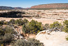
Rock ArtSite Name: Hand Palm PaintingsCountry: United States
NOTE: This site is 4.133 km away from the location you searched for.
Region: The Southwest Type: Rock Art
Nearest Town: Blanding
Latitude: 37.614404N Longitude: 110.017738W
Condition:
| 5 | Perfect |
| 4 | Almost Perfect |
| 3 | Reasonable but with some damage |
| 2 | Ruined but still recognisable as an ancient site |
| 1 | Pretty much destroyed, possibly visible as crop marks |
| 0 | No data. |
| -1 | Completely destroyed |
| 5 | Superb |
| 4 | Good |
| 3 | Ordinary |
| 2 | Not Good |
| 1 | Awful |
| 0 | No data. |
| 5 | Can be driven to, probably with disabled access |
| 4 | Short walk on a footpath |
| 3 | Requiring a bit more of a walk |
| 2 | A long walk |
| 1 | In the middle of nowhere, a nightmare to find |
| 0 | No data. |
| 5 | co-ordinates taken by GPS or official recorded co-ordinates |
| 4 | co-ordinates scaled from a detailed map |
| 3 | co-ordinates scaled from a bad map |
| 2 | co-ordinates of the nearest village |
| 1 | co-ordinates of the nearest town |
| 0 | no data |
Internal Links:
External Links:
Rock Art in The Southwest
Many ancient negative and positive hand shape paintings on a rock wall.
You may be viewing yesterday's version of this page. To see the most up to date information please register for a free account.
Do not use the above information on other web sites or publications without permission of the contributor.
Nearby Images from Flickr


The above images may not be of the site on this page, but were taken nearby. They are loaded from Flickr so please click on them for image credits.
Click here to see more info for this site
Nearby sites
Click here to view sites on an interactive map of the areaKey: Red: member's photo, Blue: 3rd party photo, Yellow: other image, Green: no photo - please go there and take one, Grey: site destroyed
Download sites to:
KML (Google Earth)
GPX (GPS waypoints)
CSV (Garmin/Navman)
CSV (Excel)
To unlock full downloads you need to sign up as a Contributory Member. Otherwise downloads are limited to 50 sites.
Turn off the page maps and other distractions
Nearby sites listing. In the following links * = Image available
612m ENE 70° Natural Bridges National Monument Natural Stone / Erratic / Other Natural Feature
14.7km SE 133° Grand Gulch Primitive Area* Ancient Village or Settlement
34.8km ESE 106° Butler Wash* Ancient Village or Settlement
36.5km SSE 157° Valley of the Gods* Natural Stone / Erratic / Other Natural Feature
46.5km E 87° Edge of the Cedars State Park and Museum* Ancient Village or Settlement
50.0km SE 139° Wolfman Panel Petroglyphs Rock Art
51.2km SSE 163° Mexican Hat* Natural Stone / Erratic / Other Natural Feature
52.3km SE 144° Kachina Petroglyph Panel Rock Art
52.4km SE 146° Comb Wash Ruins Ancient Village or Settlement
52.7km SE 138° Sand Island petroglyph Panel* Rock Art
54.6km SE 132° Bluff Great House* Ancient Village or Settlement
56.3km NNE 26° Thirteen Faces Pictographs Rock Art
60.4km NE 46° Newspaper Rock State Park* Rock Art
65.9km ENE 64° Manti-La Sal National Forest* Ancient Village or Settlement
69.3km SSW 191° Monument Valley - Ear of the Wind Handprint Pictographs* Rock Art
69.3km SSW 191° Monument Valley - Sun's Eye Arch Petroglyphs* Rock Art
69.3km SSW 191° Monument Valley - Water Birth Cliff Petroglyphs* Rock Art
69.3km SSW 191° Monument Valley* Ancient Village or Settlement
81.5km ESE 115° Hovenweep - Cajon House* Ancient Village or Settlement
83.7km E 95° Mule Canyon* Ancient Village or Settlement
86.5km ESE 107° Hovenweep - Square Tower* Ancient Village or Settlement
86.9km ESE 107° Hovenweep - Twin Towers* Ancient Village or Settlement
87.0km ESE 107° Hovenweep - Stronghold House* Ancient Village or Settlement
87.1km N 9° Mesa Arch* Natural Stone / Erratic / Other Natural Feature
87.2km ESE 107° Hovenweep* Ancient Village or Settlement
View more nearby sites and additional images


 We would like to know more about this location. Please feel free to add a brief description and any relevant information in your own language.
 Wir möchten mehr über diese Stätte erfahren. Bitte zögern Sie nicht, eine kurze Beschreibung und relevante Informationen in Deutsch hinzuzufügen.
 Nous aimerions en savoir encore un peu sur les lieux. S'il vous plaît n'hesitez pas à ajouter une courte description et tous les renseignements pertinents dans votre propre langue.
 Quisieramos informarnos un poco más de las lugares. No dude en añadir una breve descripción y otros datos relevantes en su propio idioma.