<< Other Photo Pages >> Hueco Tanks State Park & Historic Site - Rock Art in United States in The Southwest
Submitted by coldrum on Wednesday, 17 June 2009 Page Views: 6077
Rock ArtSite Name: Hueco Tanks State Park & Historic SiteCountry: United States
NOTE: This site is 165.472 km away from the location you searched for.
Region: The Southwest Type: Rock Art
Nearest Town: El Paso Nearest Village: El Paso
Latitude: 31.919248N Longitude: 106.038035W
Condition:
| 5 | Perfect |
| 4 | Almost Perfect |
| 3 | Reasonable but with some damage |
| 2 | Ruined but still recognisable as an ancient site |
| 1 | Pretty much destroyed, possibly visible as crop marks |
| 0 | No data. |
| -1 | Completely destroyed |
| 5 | Superb |
| 4 | Good |
| 3 | Ordinary |
| 2 | Not Good |
| 1 | Awful |
| 0 | No data. |
| 5 | Can be driven to, probably with disabled access |
| 4 | Short walk on a footpath |
| 3 | Requiring a bit more of a walk |
| 2 | A long walk |
| 1 | In the middle of nowhere, a nightmare to find |
| 0 | No data. |
| 5 | co-ordinates taken by GPS or official recorded co-ordinates |
| 4 | co-ordinates scaled from a detailed map |
| 3 | co-ordinates scaled from a bad map |
| 2 | co-ordinates of the nearest village |
| 1 | co-ordinates of the nearest town |
| 0 | no data |
Internal Links:
External Links:
")
Rock art site.
http://www.tpwd.state.tx.us/spdest/findadest/parks/hueco_tanks/
You may be viewing yesterday's version of this page. To see the most up to date information please register for a free account.
")
Do not use the above information on other web sites or publications without permission of the contributor.
Nearby Images from Flickr
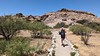

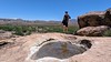
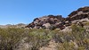
The above images may not be of the site on this page, but were taken nearby. They are loaded from Flickr so please click on them for image credits.
Click here to see more info for this site
Nearby sites
Click here to view sites on an interactive map of the areaKey: Red: member's photo, Blue: 3rd party photo, Yellow: other image, Green: no photo - please go there and take one, Grey: site destroyed
Download sites to:
KML (Google Earth)
GPX (GPS waypoints)
CSV (Garmin/Navman)
CSV (Excel)
To unlock full downloads you need to sign up as a Contributory Member. Otherwise downloads are limited to 50 sites.
Turn off the page maps and other distractions
Nearby sites listing. In the following links * = Image available
59.3km WSW 241° Caballo Blanco de Juárez Hill Figure or Geoglyph
98.8km NW 312° Summerford Mountain Archaeology District Rock Art
101.8km NNW 345° Fossilized Footprints - White Sands National Park* Ancient Trackway
158.5km N 1° Three Rivers Petroglyphs* Rock Art
250.6km SW 227° Paquime Ancient Village or Settlement
254.5km NW 306° Gila Cliff Dwellings* Ancient Village or Settlement
317.0km WSW 240° Arroyo el Concho* Cave or Rock Shelter
321.5km NW 313° Tularosa cave* Cave or Rock Shelter
323.2km NW 307° Cordova Cave* Cave or Rock Shelter
331.0km NNW 345° Los Lunas Decalogue Stone* Marker Stone
332.8km SW 218° Valley of the Caves, Chihuahua* Cave or Rock Shelter
332.8km SW 218° Madera Caves Cave or Rock Shelter
350.4km E 90° UTPB Stonehenge Replica* Modern Stone Circle etc
354.5km SE 133° Bee Cave Canyon* Cave or Rock Shelter
356.3km N 351° Maxwell Museum of Anthropology* Museum
360.7km NNW 337° Acoma Pueblo Ancient Village or Settlement
363.9km N 350° Petroglyph National Monument Rock Art
363.9km N 350° Petroglyph Nat. Mon.* Rock Art
364.3km NE 43° Blackwater Draw* Museum
366.0km N 350° Boca Negra Canyon* Rock Art
392.3km NW 310° Casa Malpais* Ancient Village or Settlement
393.7km W 265° Murray Springs* Ancient Village or Settlement
407.9km NNW 329° Atsinna Pueblo* Ancient Village or Settlement
422.1km NW 314° Table Rock Pueblo* Ancient Village or Settlement
429.7km N 357° Bandelier National Monument* Ancient Village or Settlement
View more nearby sites and additional images


 We would like to know more about this location. Please feel free to add a brief description and any relevant information in your own language.
 Wir möchten mehr über diese Stätte erfahren. Bitte zögern Sie nicht, eine kurze Beschreibung und relevante Informationen in Deutsch hinzuzufügen.
 Nous aimerions en savoir encore un peu sur les lieux. S'il vous plaît n'hesitez pas à ajouter une courte description et tous les renseignements pertinents dans votre propre langue.
 Quisieramos informarnos un poco más de las lugares. No dude en añadir una breve descripción y otros datos relevantes en su propio idioma.