<< Our Photo Pages >> Ballycarbery west wedge tomb - Wedge Tomb in Ireland (Republic of) in Co. Kerry
Submitted by ladrin on Friday, 25 September 2015 Page Views: 1678
Neolithic and Bronze AgeSite Name: Ballycarbery west wedge tombCountry: Ireland (Republic of)
NOTE: This site is 1.794 km away from the location you searched for.
County: Co. Kerry Type: Wedge Tomb
Nearest Town: Cahersiveen
Latitude: 51.945730N Longitude: 10.280589W
Condition:
| 5 | Perfect |
| 4 | Almost Perfect |
| 3 | Reasonable but with some damage |
| 2 | Ruined but still recognisable as an ancient site |
| 1 | Pretty much destroyed, possibly visible as crop marks |
| 0 | No data. |
| -1 | Completely destroyed |
| 5 | Superb |
| 4 | Good |
| 3 | Ordinary |
| 2 | Not Good |
| 1 | Awful |
| 0 | No data. |
| 5 | Can be driven to, probably with disabled access |
| 4 | Short walk on a footpath |
| 3 | Requiring a bit more of a walk |
| 2 | A long walk |
| 1 | In the middle of nowhere, a nightmare to find |
| 0 | No data. |
| 5 | co-ordinates taken by GPS or official recorded co-ordinates |
| 4 | co-ordinates scaled from a detailed map |
| 3 | co-ordinates scaled from a bad map |
| 2 | co-ordinates of the nearest village |
| 1 | co-ordinates of the nearest town |
| 0 | no data |
Internal Links:
External Links:
")
Remains of a small wedge tomb, 1m in lenght. Open to the west, only two side stones visible today.
You may be viewing yesterday's version of this page. To see the most up to date information please register for a free account.
")
Do not use the above information on other web sites or publications without permission of the contributor.
Nearby Images from Geograph Britain and Ireland:
©2007(licence)
©2007(licence)

©2019(licence)
©2007(licence)
©2007(licence)
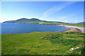
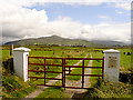
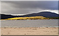
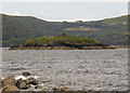
The above images may not be of the site on this page, they are loaded from Geograph.
Please Submit an Image of this site or go out and take one for us!
Click here to see more info for this site
Nearby sites
Click here to view sites on an interactive map of the areaKey: Red: member's photo, Blue: 3rd party photo, Yellow: other image, Green: no photo - please go there and take one, Grey: site destroyed
Download sites to:
KML (Google Earth)
GPX (GPS waypoints)
CSV (Garmin/Navman)
CSV (Excel)
To unlock full downloads you need to sign up as a Contributory Member. Otherwise downloads are limited to 50 sites.
Turn off the page maps and other distractions
Nearby sites listing. In the following links * = Image available
1.2km NNW 338° Doulus Head Hut Sites* Ancient Village or Settlement
1.9km NE 54° Cahergal* Stone Fort or Dun (V4484180557)
2.1km NE 39° Leacanabuaile* Stone Fort or Dun (V4463781059)
2.2km NE 51° Kimego Standing Stones (V450808)
3.2km WSW 242° Glanleam standing stone* Standing Stone (Menhir)
3.5km E 96° Cahersiveen standing stones* Standing Stones (V4674478981)
5.8km WSW 243° Tinnies Upper Stone Circle (V380770)
6.7km SW 235° Cool East wedge tomb* Wedge Tomb
7.0km SW 234° Cool East ogham stone* Standing Stone (Menhir)
7.4km SSE 162° Fermoyle Stone Row / Alignment (V453724)
7.5km ESE 105° Canburrin Standing Stones
9.0km WSW 244° St Brendan's Well* Holy Well or Sacred Spring
9.4km E 86° Srugreana Standing Stone (Menhir)
10.1km ENE 73° Ballynahow Beg* Rock Art (V5305682093)
10.5km SSW 196° St Buonia's Cross (Killabuonia) Early Christian Sculptured Stone (V4002269422)
10.7km S 190° Leabaleaha Stone Circle (V410690)
12.0km ENE 63° Kells Modern Stone Circle* Modern Stone Circle etc (V5413584497)
12.0km ENE 69° Garrydine Standing Stones
13.7km SSE 153° Spuncane Stone Circle (V490670)
13.8km S 189° Coom Wedge Tomb* Wedge Tomb
14.1km SE 125° Doory row Stone Row / Alignment
14.1km ENE 77° Teeromoyle* Standing Stones (V571823)
14.1km ENE 71° Gortnagulla Stone Row / Alignment (V568836)
14.2km SE 125° Doory standing stone Standing Stone (Menhir)
15.0km SE 125° Dromod Stone Row* Stone Row / Alignment
View more nearby sites and additional images


 We would like to know more about this location. Please feel free to add a brief description and any relevant information in your own language.
 Wir möchten mehr über diese Stätte erfahren. Bitte zögern Sie nicht, eine kurze Beschreibung und relevante Informationen in Deutsch hinzuzufügen.
 Nous aimerions en savoir encore un peu sur les lieux. S'il vous plaît n'hesitez pas à ajouter une courte description et tous les renseignements pertinents dans votre propre langue.
 Quisieramos informarnos un poco más de las lugares. No dude en añadir una breve descripción y otros datos relevantes en su propio idioma.