<< Our Photo Pages >> Gres de Saint-Meen dolmen - Standing Stone (Menhir) in France in Bretagne:Ille-et-Vilaine (35)
Submitted by TheCaptain on Sunday, 19 December 2004 Page Views: 3232
Neolithic and Bronze AgeSite Name: Gres de Saint-Meen dolmenCountry: France
NOTE: This site is 5.289 km away from the location you searched for.
Département: Bretagne:Ille-et-Vilaine (35) Type: Standing Stone (Menhir)
Nearest Town: Rennes Nearest Village: Talensac
Latitude: 48.111500N Longitude: 1.9461W
Condition:
| 5 | Perfect |
| 4 | Almost Perfect |
| 3 | Reasonable but with some damage |
| 2 | Ruined but still recognisable as an ancient site |
| 1 | Pretty much destroyed, possibly visible as crop marks |
| 0 | No data. |
| -1 | Completely destroyed |
| 5 | Superb |
| 4 | Good |
| 3 | Ordinary |
| 2 | Not Good |
| 1 | Awful |
| 0 | No data. |
| 5 | Can be driven to, probably with disabled access |
| 4 | Short walk on a footpath |
| 3 | Requiring a bit more of a walk |
| 2 | A long walk |
| 1 | In the middle of nowhere, a nightmare to find |
| 0 | No data. |
| 5 | co-ordinates taken by GPS or official recorded co-ordinates |
| 4 | co-ordinates scaled from a detailed map |
| 3 | co-ordinates scaled from a bad map |
| 2 | co-ordinates of the nearest village |
| 1 | co-ordinates of the nearest town |
| 0 | no data |
Be the first person to rate this site - see the 'Contribute!' box in the right hand menu.
Internal Links:
External Links:
I have visited· I would like to visit
MenhirHunters visited on 2nd Sep 2014 - their rating: Cond: 2 Amb: 4 Access: 4
")
You may be viewing yesterday's version of this page. To see the most up to date information please register for a free account.
")
")
Do not use the above information on other web sites or publications without permission of the contributor.
Nearby Images from Flickr
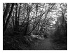
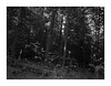
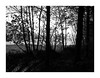
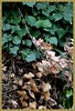
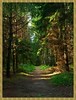
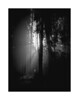
The above images may not be of the site on this page, but were taken nearby. They are loaded from Flickr so please click on them for image credits.
Click here to see more info for this site
Nearby sites
Click here to view sites on an interactive map of the areaKey: Red: member's photo, Blue: 3rd party photo, Yellow: other image, Green: no photo - please go there and take one, Grey: site destroyed
Download sites to:
KML (Google Earth)
GPX (GPS waypoints)
CSV (Garmin/Navman)
CSV (Excel)
To unlock full downloads you need to sign up as a Contributory Member. Otherwise downloads are limited to 50 sites.
Turn off the page maps and other distractions
Nearby sites listing. In the following links * = Image available
2.5km NW 321° La Roche (Coulon)* Standing Stone (Menhir)
3.0km NW 309° Coffre de Ty Bot* Cist
5.7km W 275° Pierre Longue (Iffendic)* Standing Stone (Menhir)
8.7km WSW 244° Menhir de la Haute Roche (Boutavent)* Standing Stone (Menhir)
8.8km SW 236° Dolmens de Boutavent Burial Chamber or Dolmen
9.0km WSW 238° Menhirs de Boutavent* Standing Stones
13.1km WSW 254° Fontaine de Jouvence* Holy Well or Sacred Spring
13.2km NE 40° Menhir des Basses Mardelles Standing Stone (Menhir)
13.3km WSW 254° Tombeau de Merlin* Passage Grave
13.3km NE 40° Roche des Basses Mordelles* Modern Stone Circle etc
13.4km WSW 248° Tombeau de la Duchesse d'Angoulème Burial Chamber or Dolmen
13.5km W 259° Ville Guichais menhir* Standing Stone (Menhir)
14.3km WSW 257° Tombeau des Anglais (Paimpont)* Passage Grave
14.5km W 259° Menhir de Coisbois* Standing Stone (Menhir)
15.3km W 264° Menhirs de la Lande de Saint-Jean Standing Stone (Menhir)
18.9km N 4° Les Pierres du Diable* Standing Stones
19.0km SE 131° Pierre de Cahot* Standing Stone (Menhir)
20.0km E 91° Musée du Bretagne* Museum
20.3km SSW 206° Menhir du Carrefour de la Pierre Droite* Standing Stone (Menhir)
20.4km SE 130° Pierre Qui Chôme Standing Stone (Menhir)
21.1km W 260° Allée Couverte dite Le Rocher Passage Grave
21.2km NNE 18° Montmuran menhirs Standing Stones
21.7km NNW 337° La Roche Carrée* Standing Stone (Menhir)
22.0km NNW 336° Bergeons* Stone Row / Alignment
22.1km NNW 337° Les Longs Points* Stone Row / Alignment
View more nearby sites and additional images


 We would like to know more about this location. Please feel free to add a brief description and any relevant information in your own language.
 Wir möchten mehr über diese Stätte erfahren. Bitte zögern Sie nicht, eine kurze Beschreibung und relevante Informationen in Deutsch hinzuzufügen.
 Nous aimerions en savoir encore un peu sur les lieux. S'il vous plaît n'hesitez pas à ajouter une courte description et tous les renseignements pertinents dans votre propre langue.
 Quisieramos informarnos un poco más de las lugares. No dude en añadir una breve descripción y otros datos relevantes en su propio idioma.