<< Our Photo Pages >> Bunbury Hillfort (Alton Towers) - Hillfort in England in Staffordshire
Submitted by TimPrevett on Saturday, 31 January 2009 Page Views: 10646
Iron Age and Later PrehistorySite Name: Bunbury Hillfort (Alton Towers)Country: England County: Staffordshire Type: Hillfort
Nearest Town: Cheadle Nearest Village: Alton
Map Ref: SK07164318
Latitude: 52.985912N Longitude: 1.894796W
Condition:
| 5 | Perfect |
| 4 | Almost Perfect |
| 3 | Reasonable but with some damage |
| 2 | Ruined but still recognisable as an ancient site |
| 1 | Pretty much destroyed, possibly visible as crop marks |
| 0 | No data. |
| -1 | Completely destroyed |
| 5 | Superb |
| 4 | Good |
| 3 | Ordinary |
| 2 | Not Good |
| 1 | Awful |
| 0 | No data. |
| 5 | Can be driven to, probably with disabled access |
| 4 | Short walk on a footpath |
| 3 | Requiring a bit more of a walk |
| 2 | A long walk |
| 1 | In the middle of nowhere, a nightmare to find |
| 0 | No data. |
| 5 | co-ordinates taken by GPS or official recorded co-ordinates |
| 4 | co-ordinates scaled from a detailed map |
| 3 | co-ordinates scaled from a bad map |
| 2 | co-ordinates of the nearest village |
| 1 | co-ordinates of the nearest town |
| 0 | no data |
Internal Links:
External Links:
I have visited· I would like to visit
TimPrevett has visited here
 (PID:31768)")
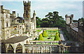
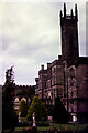
Remains of a univallate hillfort within the grounds of Alton Towers theme park.
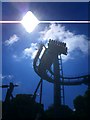
Note: Hill fort may delay rollercoaster see comment.
You may be viewing yesterday's version of this page. To see the most up to date information please register for a free account.
 (PID:229480)")
Do not use the above information on other web sites or publications without permission of the contributor.
Nearby Images from Geograph Britain and Ireland:
©2006(licence)
©2008(licence)
©2015(licence)
©2020(licence)
©2021(licence)
The above images may not be of the site on this page, they are loaded from Geograph.
Please Submit an Image of this site or go out and take one for us!
Click here to see more info for this site
Nearby sites
Key: Red: member's photo, Blue: 3rd party photo, Yellow: other image, Green: no photo - please go there and take one, Grey: site destroyed
Download sites to:
KML (Google Earth)
GPX (GPS waypoints)
CSV (Garmin/Navman)
CSV (Excel)
To unlock full downloads you need to sign up as a Contributory Member. Otherwise downloads are limited to 50 sites.
Turn off the page maps and other distractions
Nearby sites listing. In the following links * = Image available
4.3km NE 45° Weaver Hills* Barrow Cemetery (SK102462)
4.5km N 6° Cauldon Lowe Barrow Cemetery (SK076477)
4.9km N 1° Hoften's Cross* Early Christian Sculptured Stone (SK072481)
5.4km SSW 195° Toot Hill Barrow (1) Round Barrow(s) (SK05773797)
5.5km E 98° The Norbury Cross* Ancient Cross (SK126424)
5.5km SE 134° Rocester Church Cross (Rocester)* Ancient Cross (SK1117039394)
5.7km NE 45° Thorswood* Barrow Cemetery (SK112472)
6.2km NNW 346° Windywaycross* Early Christian Sculptured Stone (SK056492)
6.7km NE 35° Caltonmoor* Round Barrow(s) (SK11084868)
6.9km SW 220° St Mary and All Saints (Checkley)* Ancient Cross (SK02783787)
7.4km N 10° Stonesteads* Round Barrow(s) (SK08405052)
7.5km NNW 332° Hopestone ; Ipstones/Foxt ; Staffordshire Natural Stone / Erratic / Other Natural Feature (SK0361049834)
7.6km NE 34° Calton Round Barrow* Round Barrow(s) (SK114495)
7.8km NE 37° Dun Low* Round Barrow(s) (SK119494)
7.8km NNE 12° Lamber Low* Round Barrow(s) (SK08735085)
8.2km NE 44° Top Low 1 Round Barrow(s) (SK129491)
8.3km NNE 33° Musden Low Cemetery* Barrow Cemetery (SK117501)
8.5km NE 39° Hazleton Clump Cairn (SK125498)
8.5km NE 46° Top Low 2 Round Barrow(s) (SK133491)
8.8km NW 323° Ipstones tympanum* Early Christian Sculptured Stone (SK01785022)
9.2km SSE 167° Pennycroft Well Holy Well or Sacred Spring (SK09293422)
9.2km N 9° Waterfall Low* Round Barrow(s) (SK08615231)
9.3km NE 46° Lady Low Round Barrow(s) (SK138497)
9.3km NE 46° Barrow near Lady Low Round Barrow(s) (SK138497)
9.3km NE 38° The Battle Stone (Ilam)* Ancient Cross (SK1286950579)
View more nearby sites and additional images


 We would like to know more about this location. Please feel free to add a brief description and any relevant information in your own language.
 Wir möchten mehr über diese Stätte erfahren. Bitte zögern Sie nicht, eine kurze Beschreibung und relevante Informationen in Deutsch hinzuzufügen.
 Nous aimerions en savoir encore un peu sur les lieux. S'il vous plaît n'hesitez pas à ajouter une courte description et tous les renseignements pertinents dans votre propre langue.
 Quisieramos informarnos un poco más de las lugares. No dude en añadir una breve descripción y otros datos relevantes en su propio idioma.