<< Text Pages >> Wart Stone (Bradford) - Standing Stone (Menhir) in England in Yorkshire (West)
Submitted by Anne T on Wednesday, 03 January 2018 Page Views: 1254
Neolithic and Bronze AgeSite Name: Wart Stone (Bradford) Alternative Name: Ash Stone (Bradford); Pin Stone (Bradford)Country: England
NOTE: This site is 0.986 km away from the location you searched for.
County: Yorkshire (West) Type: Standing Stone (Menhir)
Nearest Town: Bradford
Map Ref: SE15783412
Latitude: 53.803143N Longitude: 1.761883W
Condition:
| 5 | Perfect |
| 4 | Almost Perfect |
| 3 | Reasonable but with some damage |
| 2 | Ruined but still recognisable as an ancient site |
| 1 | Pretty much destroyed, possibly visible as crop marks |
| 0 | No data. |
| -1 | Completely destroyed |
| 5 | Superb |
| 4 | Good |
| 3 | Ordinary |
| 2 | Not Good |
| 1 | Awful |
| 0 | No data. |
| 5 | Can be driven to, probably with disabled access |
| 4 | Short walk on a footpath |
| 3 | Requiring a bit more of a walk |
| 2 | A long walk |
| 1 | In the middle of nowhere, a nightmare to find |
| 0 | No data. |
| 5 | co-ordinates taken by GPS or official recorded co-ordinates |
| 4 | co-ordinates scaled from a detailed map |
| 3 | co-ordinates scaled from a bad map |
| 2 | co-ordinates of the nearest village |
| 1 | co-ordinates of the nearest town |
| 0 | no data |
Internal Links:
External Links:
Standing Stone (Menhir) in Yorkshire (West)
The Northern Antiquarian (TNA) features a page for this now destroyed standing stone - see their entry for Wart Stone, Bradford, West Yorkshire. TNA tell us that this stone used to stand adjacent to the Holy Ash Well (now under Bradford City's Football Ground), but "for some reason it was uprooted and moved further up the hill around the end of the 19th century and was resurrected beside the old Belle Vue Hotel on Manningham Lane. From thereon however, I’ve not been able to trace what happened to it, and presume it’s been destroyed. It was known by local people to have had a ritual relationship with the adjacent healing well, to which people were said to visit from far and wide."
TNA adds: "It seems to have been described first by Abraham Holroyd (1873), who told us that: 'In Manningham Lane there is a fine well, in old deeds called Hellywell, i.e., holy well, in a field now called Halliwell Ash, now a stone quarry… Near this is the ancient Pin Stone.' The Bradford historian William Preston also made mention of the stone in one of his early surveys, where he told how local people also knew the stone as the Ash Stone, due to its proximity and ritual relationship to a great old tree."
This stone was also known as the Wart Stone, as it was said to cure people of warts and other skin afflictions.
Note: Do you know if this standing stone still exists or can you confirm if it has been destroyed? Do you have any historical information or images to contribute?
You may be viewing yesterday's version of this page. To see the most up to date information please register for a free account.
Do not use the above information on other web sites or publications without permission of the contributor.
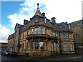
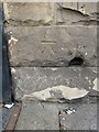
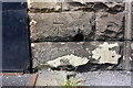
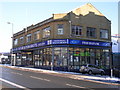
Nearby Images from Geograph Britain and Ireland:
©2023(licence)
©2014(licence)
©2020(licence)
©2010(licence)
©2018(licence)
The above images may not be of the site on this page, they are loaded from Geograph.
Please Submit an Image of this site or go out and take one for us!
Click here to see more info for this site
Nearby sites
Key: Red: member's photo, Blue: 3rd party photo, Yellow: other image, Green: no photo - please go there and take one, Grey: site destroyed
Download sites to:
KML (Google Earth)
GPX (GPS waypoints)
CSV (Garmin/Navman)
CSV (Excel)
To unlock full downloads you need to sign up as a Contributory Member. Otherwise downloads are limited to 50 sites.
Turn off the page maps and other distractions
Nearby sites listing. In the following links * = Image available
237m ENE 68° Holy Ash Well (Bradford) Holy Well or Sacred Spring (SE16003421)
743m ENE 68° Boar Well Holy Well or Sacred Spring (SE16473440)
748m E 92° Spink Well (Bradford) Holy Well or Sacred Spring (SE16533410)
2.4km NNE 19° Sweet Willy Well (Wrose) Holy Well or Sacred Spring (SE1656136440)
3.3km NW 320° Northcliffe Woods (Shipley) Rock Art (SE1364236608)
3.6km NNW 339° Bowling Green Rock Rock Art (SE1448437520)
3.7km NE 55° Holy Well (Eccleshill) Holy Well or Sacred Spring (SE18783622)
4.7km NNW 347° Baildon Green 01* Rock Art (SE1469038690)
4.7km NNW 347° Crutch Well (Baildon) Holy Well or Sacred Spring (SE1467838688)
4.7km NNW 347° Baildon Green 02* Rock Art (SE1469038702)
4.7km NW 323° Hirst Woods (Saltaire) Rock Art (SE129379)
4.9km NE 50° West Woods 2 (Calverley) Rock Art (SE195373)
5.0km NE 51° West Woods 1 (Calverley) Rock Art (SE19703731)
5.1km NW 322° Hirst Wood Rock Art (SE1260038100)
5.1km NNE 15° Buck Woods 7 Rock Art (SE1711039037)
5.1km NE 56° Calverley Woods Stone Circle (Leeds) Stone Circle (SE200370)
5.1km N 7° Hoyle Court 01* Rock Art (SE1639839185)
5.1km NW 323° Hirst Wood Ancient Village or Settlement (SE127382)
5.2km NNW 335° Prod Lane 01 Rock Art (SE1357038790)
5.2km N 354° Lane End 01 Rock Art (SE1520039300)
5.2km NNE 16° Buck Woods 8 Rock Art (SE1718839154)
5.2km NNE 19° Buck Woods 9* Rock Art (SE1744239101)
5.3km NNE 18° Buck Woods 4* Rock Art (SE1741839163)
5.3km NNE 19° Buck Woods 1* Rock Art (SE1745639155)
5.3km NNE 19° Buck Woods 3* Rock Art (SE1745639162)
View more nearby sites and additional images


 We would like to know more about this location. Please feel free to add a brief description and any relevant information in your own language.
 Wir möchten mehr über diese Stätte erfahren. Bitte zögern Sie nicht, eine kurze Beschreibung und relevante Informationen in Deutsch hinzuzufügen.
 Nous aimerions en savoir encore un peu sur les lieux. S'il vous plaît n'hesitez pas à ajouter une courte description et tous les renseignements pertinents dans votre propre langue.
 Quisieramos informarnos un poco más de las lugares. No dude en añadir una breve descripción y otros datos relevantes en su propio idioma.