<< Text Pages >> Snowden Crags Necropolis - Barrow Cemetery in England in Yorkshire (North)
Submitted by Anne T on Sunday, 07 January 2018 Page Views: 1047
Neolithic and Bronze AgeSite Name: Snowden Crags NecropolisCountry: England
NOTE: This site is 1.511 km away from the location you searched for.
County: Yorkshire (North) Type: Barrow Cemetery
Nearest Town: Otley Nearest Village: Askwith
Map Ref: SE176514
Latitude: 53.958393N Longitude: 1.733264W
Condition:
| 5 | Perfect |
| 4 | Almost Perfect |
| 3 | Reasonable but with some damage |
| 2 | Ruined but still recognisable as an ancient site |
| 1 | Pretty much destroyed, possibly visible as crop marks |
| 0 | No data. |
| -1 | Completely destroyed |
| 5 | Superb |
| 4 | Good |
| 3 | Ordinary |
| 2 | Not Good |
| 1 | Awful |
| 0 | No data. |
| 5 | Can be driven to, probably with disabled access |
| 4 | Short walk on a footpath |
| 3 | Requiring a bit more of a walk |
| 2 | A long walk |
| 1 | In the middle of nowhere, a nightmare to find |
| 0 | No data. |
| 5 | co-ordinates taken by GPS or official recorded co-ordinates |
| 4 | co-ordinates scaled from a detailed map |
| 3 | co-ordinates scaled from a bad map |
| 2 | co-ordinates of the nearest village |
| 1 | co-ordinates of the nearest town |
| 0 | no data |
Be the first person to rate this site - see the 'Contribute!' box in the right hand menu.
Internal Links:
External Links:
Barrow Cemetery in Yorkshire (North)
The Northern Antiquarian (TNA) features a page for this cairnfield - see their entry for Snowden Crags Necropolis, Askwith Moor, North Yorkshire, which gives directions for finding this site, photographs and descriptions. TNA warn "if the heather’s grown, you probably won’t see a thing."
TNA adds: "First described in Eric Cowling Rombald’s Way (1946), where he mentions around 30 cairns on the moorland plain immediately west of the Snowden Moor settlement. These were plainly visible when Richard Stroud and I visited here in 2005, thanks mainly to the fact that the heather had been burnt away. Once it’s grown back, virtually all of these tombs will be hard to find."
At the grid reference given by TNA, Pastscape Monument No. 50438 records: "SE 176514. On the level above Snowden Crags. Artifacts 40, core 1, scraper 1, graver 1. Mesolithic."
The scheduling information on Historic England List ID 1014304 covers "Cairnfield, enclosures, boulder walling, hollow way and carved rocks towards edge of Snowden Carr centred at 370m south east of Crag House", adding: "The monument includes a cairnfield and associated concentration of prehistoric features. Included in the area are a large sub-rectangular enclosure, two smaller enclosures, at least 17 cairns of various sizes, several lengths of boulder walling, a hollow way, and at least 17 carved rocks."
Note: Have you visited this site? Do you have any photographs or information to add?
You may be viewing yesterday's version of this page. To see the most up to date information please register for a free account.
Do not use the above information on other web sites or publications without permission of the contributor.
Nearby Images from Geograph Britain and Ireland:

©2012(licence)
©2015(licence)
©2023(licence)
©2005(licence)
©2023(licence)
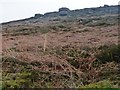
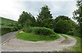
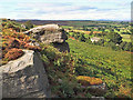
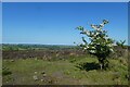
The above images may not be of the site on this page, they are loaded from Geograph.
Please Submit an Image of this site or go out and take one for us!
Click here to see more info for this site
Nearby sites
Key: Red: member's photo, Blue: 3rd party photo, Yellow: other image, Green: no photo - please go there and take one, Grey: site destroyed
Download sites to:
KML (Google Earth)
GPX (GPS waypoints)
CSV (Garmin/Navman)
CSV (Excel)
To unlock full downloads you need to sign up as a Contributory Member. Otherwise downloads are limited to 50 sites.
Turn off the page maps and other distractions
Nearby sites listing. In the following links * = Image available
107m ESE 112° Snowden Crags Cairn Circle* Cairn (SE17705136)
141m SE 135° Snowden Moor* Ancient Village or Settlement (SE177513)
196m ESE 123° Snowden Carr (570) Rock Art (SE1776651295)
206m ESE 122° Snowden Carr (571) Rock Art (SE1777651293)
226m SSE 158° Snowden Carr 01 Rock Art (SE1768651191)
251m SE 126° Snowdon Half Moon Stone* Rock Art (SE1780551254)
255m SE 131° Death's Head Carving (Askwith Moor)* Rock Art (SE1779551235)
330m ESE 114° Snowden Carr (594)* Rock Art (SE1790351266)
420m SSE 161° Askwith Moor (567) Rock Art (SE1773851003)
437m SE 124° Snowden Carr (597) Rock Art (SE1796551158)
437m SSE 153° Snowden Carr (582) Rock Art (SE1780351012)
440m SSE 154° Snowden Carr (579) & (580) Rock Art (SE1779851007)
442m SSE 154° Snowden Carr (581) Rock Art (SE1779951005)
445m ESE 122° Tree of Life Stone* Rock Art (SE1797851163)
453m ESE 122° Snowden Carr (600) Rock Art (SE1798751162)
459m SW 214° Askwith Moor (528) Rock Art (SE1734551018)
462m SW 215° Askwith Moor (527) Rock Art (SE1733651020)
472m SW 222° Askwith Moor (526)* Rock Art (SE1728551048)
482m SW 222° Askwith Moor (525)* Rock Art (SE1727851040)
486m SE 127° Snowden Carr (603) Rock Art (SE1799351112)
488m ESE 108° Snowden Carr (605) Rock Art (SE1806651251)
555m ESE 111° Snowden Carr (612) Rock Art (SE1812051201)
567m ESE 106° Snowden Carr (613) Rock Art (SE1814651242)
643m WSW 240° Shooting House Hill (Askwith Moor) Ancient Village or Settlement (SE17045108)
662m SSW 196° Askwith Moor (533)* Rock Art (SE1742150762)
View more nearby sites and additional images


 We would like to know more about this location. Please feel free to add a brief description and any relevant information in your own language.
 Wir möchten mehr über diese Stätte erfahren. Bitte zögern Sie nicht, eine kurze Beschreibung und relevante Informationen in Deutsch hinzuzufügen.
 Nous aimerions en savoir encore un peu sur les lieux. S'il vous plaît n'hesitez pas à ajouter une courte description et tous les renseignements pertinents dans votre propre langue.
 Quisieramos informarnos un poco más de las lugares. No dude en añadir una breve descripción y otros datos relevantes en su propio idioma.