<< Text Pages >> Richard Wood South (Thornton Steward) - Rock Art in England in Yorkshire (North)
Submitted by Anne T on Thursday, 04 January 2018 Page Views: 920
Rock ArtSite Name: Richard Wood South (Thornton Steward)Country: England
NOTE: This site is 2.707 km away from the location you searched for.
County: Yorkshire (North) Type: Rock Art
Nearest Town: Middleham Nearest Village: Thornton Steward
Map Ref: SE1694087301
Latitude: 54.281070N Longitude: 1.741323W
Condition:
| 5 | Perfect |
| 4 | Almost Perfect |
| 3 | Reasonable but with some damage |
| 2 | Ruined but still recognisable as an ancient site |
| 1 | Pretty much destroyed, possibly visible as crop marks |
| 0 | No data. |
| -1 | Completely destroyed |
| 5 | Superb |
| 4 | Good |
| 3 | Ordinary |
| 2 | Not Good |
| 1 | Awful |
| 0 | No data. |
| 5 | Can be driven to, probably with disabled access |
| 4 | Short walk on a footpath |
| 3 | Requiring a bit more of a walk |
| 2 | A long walk |
| 1 | In the middle of nowhere, a nightmare to find |
| 0 | No data. |
| 5 | co-ordinates taken by GPS or official recorded co-ordinates |
| 4 | co-ordinates scaled from a detailed map |
| 3 | co-ordinates scaled from a bad map |
| 2 | co-ordinates of the nearest village |
| 1 | co-ordinates of the nearest town |
| 0 | no data |
Be the first person to rate this site - see the 'Contribute!' box in the right hand menu.
Internal Links:
External Links:
Rock Art in Yorkshire (North)
This assumed lost cup marked stone is featured on The Northern Antiquarian, who are appealing for information to relocate it - see their entry for Richard Wood South, Thornton Steward, North Yorkshire.
TNA tell us this is: "A prehistoric carving that is missing and possibly destroyed since being rediscovered in 2001 by Barbara Brown (2008) and subsequently described in her book on North Yorkshire petroglyphs. She told it to be in 'Thornton Steward field hedge bottom' and was a simple glyph, being a 'rectangular slab (with) single cup-mark located in hedge bottom part of old walling.' When she revisited the site with her husband in 2006, the old hedge and wall had been removed, with 'new hedging in place.”' The carved stone may be buried within a pile of clearance stones adjacent to the hedgerow, but it has yet to be relocated. If anyone finds it, please let us know! It was one of several cup-marked stones that exist in the wider neighbourhood."
Note: Do you know where this stone might be, or do you have any information that will help to relocate this cup marked stone? If so, please post a comment below.
You may be viewing yesterday's version of this page. To see the most up to date information please register for a free account.
Do not use the above information on other web sites or publications without permission of the contributor.
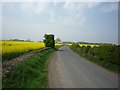
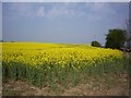
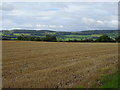
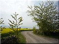
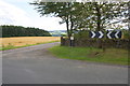
Nearby Images from Geograph Britain and Ireland:
©2011(licence)
©2011(licence)
©2020(licence)
©2011(licence)
©2017(licence)
The above images may not be of the site on this page, they are loaded from Geograph.
Please Submit an Image of this site or go out and take one for us!
Click here to see more info for this site
Nearby sites
Key: Red: member's photo, Blue: 3rd party photo, Yellow: other image, Green: no photo - please go there and take one, Grey: site destroyed
Download sites to:
KML (Google Earth)
GPX (GPS waypoints)
CSV (Garmin/Navman)
CSV (Excel)
To unlock full downloads you need to sign up as a Contributory Member. Otherwise downloads are limited to 50 sites.
Turn off the page maps and other distractions
Nearby sites listing. In the following links * = Image available
4.3km W 278° St Mary and St Alkelda* Ancient Cross (SE1262887878)
4.6km W 278° St Alkelda's Holy Well* Holy Well or Sacred Spring (SE124879)
5.1km WNW 298° Fairy Well (Harmby)* Holy Well or Sacred Spring (SE12448969)
5.9km SW 215° Agra Moor Standing Stone* Standing Stone (Menhir) (SE1349982440)
6.0km SSW 200° Gollinglith Foot (West Agra) Standing Stone (Menhir) (SE149817)
6.2km SSW 206° West Agra* Rock Art (SE14248175)
6.2km SSW 206° West Agra 3a and 3b* Rock Art (SE1423681675)
6.3km SSW 207° West Agra Carving 2b Rock Art (SE1412681669)
6.3km S 180° Healey Stone Circles (Masham) Stone Circle (SE170810)
6.4km SSW 207° West Agra Carving 1 Rock Art (SE1406981627)
6.4km N 359° St Oswald (East Hauxwell)* Ancient Cross (SE168937)
6.6km ESE 108° St Mary (Thornton Watlass)* Ancient Cross (SE2324585265)
6.7km SSE 155° Fearby Cross (Masham) Ancient Cross (SE1984081273)
7.7km SSE 166° Fearby, Masham* Stone Circle (SE188798)
8.0km WNW 286° Holy Trinity (Wensley)* Ancient Cross (SE09228954)
8.6km S 177° Swinton Druid's Temple* Modern Stone Circle etc (SE1746478713)
8.8km SE 140° St Mary (Masham)* Ancient Cross (SE2266080651)
8.9km SSE 150° Berry Well* Holy Well or Sacred Spring (SE2140479628)
9.4km S 169° Skew Skell Well* Holy Well or Sacred Spring (SE1876078084)
9.7km E 83° St Gregory's Church (Bedale)* Early Christian Sculptured Stone (SE266885)
10.8km SSE 156° Himalayan Gardens & Sculpture Park* Modern Stone Circle etc (SE2139577417)
10.9km ESE 121° St Michael's Well (Well)* Holy Well or Sacred Spring (SE26338175)
11.2km ESE 118° St Michael's Church (Well)* Ancient Cross (SE2682982053)
11.6km SSE 154° Lime Tree Modern Stone Circle* Modern Stone Circle etc (SE2212876922)
11.7km SSE 154° Lime Tree Roundhouse* Modern Stone Circle etc (SE2216776849)
View more nearby sites and additional images


 We would like to know more about this location. Please feel free to add a brief description and any relevant information in your own language.
 Wir möchten mehr über diese Stätte erfahren. Bitte zögern Sie nicht, eine kurze Beschreibung und relevante Informationen in Deutsch hinzuzufügen.
 Nous aimerions en savoir encore un peu sur les lieux. S'il vous plaît n'hesitez pas à ajouter une courte description et tous les renseignements pertinents dans votre propre langue.
 Quisieramos informarnos un poco más de las lugares. No dude en añadir una breve descripción y otros datos relevantes en su propio idioma.