<< Other Photo Pages >> Beggars Well - Holy Well or Sacred Spring in England in Warwickshire
Submitted by Anonymous on Friday, 16 November 2012 Page Views: 6355
Springs and Holy WellsSite Name: Beggars WellCountry: England
NOTE: This site is 0.427 km away from the location you searched for.
County: Warwickshire Type: Holy Well or Sacred Spring
Nearest Town: Coleshill
Map Ref: SP1962989822
Latitude: 52.505945N Longitude: 1.71224W
Condition:
| 5 | Perfect |
| 4 | Almost Perfect |
| 3 | Reasonable but with some damage |
| 2 | Ruined but still recognisable as an ancient site |
| 1 | Pretty much destroyed, possibly visible as crop marks |
| 0 | No data. |
| -1 | Completely destroyed |
| 5 | Superb |
| 4 | Good |
| 3 | Ordinary |
| 2 | Not Good |
| 1 | Awful |
| 0 | No data. |
| 5 | Can be driven to, probably with disabled access |
| 4 | Short walk on a footpath |
| 3 | Requiring a bit more of a walk |
| 2 | A long walk |
| 1 | In the middle of nowhere, a nightmare to find |
| 0 | No data. |
| 5 | co-ordinates taken by GPS or official recorded co-ordinates |
| 4 | co-ordinates scaled from a detailed map |
| 3 | co-ordinates scaled from a bad map |
| 2 | co-ordinates of the nearest village |
| 1 | co-ordinates of the nearest town |
| 0 | no data |
Internal Links:
External Links:
I have visited· I would like to visit
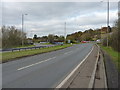
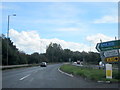
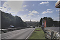
Hodur visited on 3rd Jun 2018 - their rating: Cond: 3 Amb: 1 Access: 5 Terrible ambience as it's right next to a busy A road. The well itself is in decent condition although I'm sure this isn't its original state.
Access is easy, you can park literally metres from the Well.
")
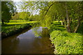
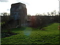
An old well/spring now sadly dry and overgrown for most of the year. It is not too far from where remains where found of a Romano-British temple on Grimstock Hill.
I found the well from a photo on an old postcard.
You may be viewing yesterday's version of this page. To see the most up to date information please register for a free account.
Do not use the above information on other web sites or publications without permission of the contributor.
Nearby Images from Geograph Britain and Ireland:
©2016(licence)
©2016(licence)
©2009(licence)
©2006(licence)
©2021(licence)
The above images may not be of the site on this page, they are loaded from Geograph.
Please Submit an Image of this site or go out and take one for us!
Click here to see more info for this site
Nearby sites
Key: Red: member's photo, Blue: 3rd party photo, Yellow: other image, Green: no photo - please go there and take one, Grey: site destroyed
Download sites to:
KML (Google Earth)
GPX (GPS waypoints)
CSV (Garmin/Navman)
CSV (Excel)
To unlock full downloads you need to sign up as a Contributory Member. Otherwise downloads are limited to 50 sites.
Turn off the page maps and other distractions
Nearby sites listing. In the following links * = Image available
10.5km SW 223° Burnt mound in Fox Hollies Park Artificial Mound (SP1247182177)
11.4km NW 307° Keeper's Well* Holy Well or Sacred Spring (SP1049296613)
11.6km ENE 72° Ansley Common Round Barrow(s) (SP307935)
11.7km SSE 156° Berkswell* Holy Well or Sacred Spring (SP244791)
11.7km NNW 337° St Modwen's Well (Canwell) Holy Well or Sacred Spring (SK14890058)
11.8km ESE 114° Burrow Hill Camp (Warwickshire)* Hillfort (SP304850)
12.3km WNW 303° Rowton Well* Holy Well or Sacred Spring (SP0927496487)
12.5km NW 311° Druid's Well (Sutton Park) Holy Well or Sacred Spring (SP1016297991)
12.7km ENE 68° Oldbury Camp (Warwickshire) Hillfort (SP314947)
12.9km SW 233° Moseley Bog Burnt Mound* Artificial Mound (SP0934382043)
13.0km WNW 297° The King's Standing* Round Barrow(s) (SP080956)
13.3km WSW 258° Birmingham Museum & Art Gallery Museum (SP066869)
14.0km W 261° War Stone* Natural Stone / Erratic / Other Natural Feature (SP058877)
14.0km N 5° St Ruffin's Well (Tamworth)* Holy Well or Sacred Spring (SK207038)
15.7km SW 220° Berry Mound* Hillfort (SP095778)
16.2km WSW 247° Lapworth Museum Museum (SP047834)
16.3km SE 129° St. Catherine's Well (Coventry) Holy Well or Sacred Spring (SP323796)
17.2km W 275° St Augustine's Well (Sandwell)* Holy Well or Sacred Spring (SP0248391296)
17.6km ENE 65° Fenny Drayton Barrow* Round Barrow(s) (SP356973)
18.1km SSE 165° St. John's Well (Warwickshire)* Holy Well or Sacred Spring (SP24487234)
19.5km NNW 330° Wall Roman sites (Letocetum)* Ancient Village or Settlement (SK0977506660)
20.2km SSE 166° Beausale Fort* Hillfort (SP246702)
21.8km NNW 340° St Chad's Well (Lichfield)* Holy Well or Sacred Spring (SK122103)
22.4km N 5° Stone in Croxall Churchyard* Marker Stone (SK2140512127)
22.9km ENE 64° King Richard's Well* Holy Well or Sacred Spring (SK402000)
View more nearby sites and additional images


 We would like to know more about this location. Please feel free to add a brief description and any relevant information in your own language.
 Wir möchten mehr über diese Stätte erfahren. Bitte zögern Sie nicht, eine kurze Beschreibung und relevante Informationen in Deutsch hinzuzufügen.
 Nous aimerions en savoir encore un peu sur les lieux. S'il vous plaît n'hesitez pas à ajouter une courte description et tous les renseignements pertinents dans votre propre langue.
 Quisieramos informarnos un poco más de las lugares. No dude en añadir una breve descripción y otros datos relevantes en su propio idioma.