<< Text Pages >> Moor Lane Well (Gomersal) - Holy Well or Sacred Spring in England in Yorkshire (West)
Submitted by Anne T on Tuesday, 05 December 2017 Page Views: 1549
Springs and Holy WellsSite Name: Moor Lane Well (Gomersal)Country: England
NOTE: This site is 1.465 km away from the location you searched for.
County: Yorkshire (West) Type: Holy Well or Sacred Spring
Nearest Town: Gomersal
Map Ref: SE20712677
Latitude: 53.736910N Longitude: 1.68752W
Condition:
| 5 | Perfect |
| 4 | Almost Perfect |
| 3 | Reasonable but with some damage |
| 2 | Ruined but still recognisable as an ancient site |
| 1 | Pretty much destroyed, possibly visible as crop marks |
| 0 | No data. |
| -1 | Completely destroyed |
| 5 | Superb |
| 4 | Good |
| 3 | Ordinary |
| 2 | Not Good |
| 1 | Awful |
| 0 | No data. |
| 5 | Can be driven to, probably with disabled access |
| 4 | Short walk on a footpath |
| 3 | Requiring a bit more of a walk |
| 2 | A long walk |
| 1 | In the middle of nowhere, a nightmare to find |
| 0 | No data. |
| 5 | co-ordinates taken by GPS or official recorded co-ordinates |
| 4 | co-ordinates scaled from a detailed map |
| 3 | co-ordinates scaled from a bad map |
| 2 | co-ordinates of the nearest village |
| 1 | co-ordinates of the nearest town |
| 0 | no data |
Be the first person to rate this site - see the 'Contribute!' box in the right hand menu.
Internal Links:
External Links:
Holy Well or Sacred Spring in Yorkshire (West)
The Northern Antiquarian (TNA) features a page for this healing well - see their entry for Moor Lane Well, Gomersal, West Yorkshire, which shows the location of the well on the 1847 OS map.
TNA include some interesting 'archaeology & history', including details of a local custom called 'Riding the Strang'. TNA add: "The Moor Lane Well was one of the main water supplies for the old villagers in bygone times, but seems to have disappeared under the modern houses. There is, however, a small narrow band of trees where the old waters once ran, amidst which it might still be found—if luck is on our side…"
Does anyone know if this well still exists?
Note: Does anyone know if this well still exists? If so, please add some information and images/photographs to this page. Thanks!
You may be viewing yesterday's version of this page. To see the most up to date information please register for a free account.
Do not use the above information on other web sites or publications without permission of the contributor.
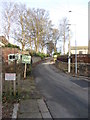
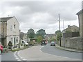
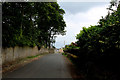
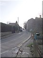
Nearby Images from Geograph Britain and Ireland:
©2011(licence)
©2010(licence)
©2018(licence)
©2011(licence)
©2020(licence)
The above images may not be of the site on this page, they are loaded from Geograph.
Please Submit an Image of this site or go out and take one for us!
Click here to see more info for this site
Nearby sites
Key: Red: member's photo, Blue: 3rd party photo, Yellow: other image, Green: no photo - please go there and take one, Grey: site destroyed
Download sites to:
KML (Google Earth)
GPX (GPS waypoints)
CSV (Garmin/Navman)
CSV (Excel)
To unlock full downloads you need to sign up as a Contributory Member. Otherwise downloads are limited to 50 sites.
Turn off the page maps and other distractions
Nearby sites listing. In the following links * = Image available
1.2km ESE 112° Pickel Well (Birstall) Holy Well or Sacred Spring (SE21802633)
1.7km SSE 168° Mannerly Well (Gomersal) Holy Well or Sacred Spring (SE21072515)
1.8km S 171° Doidy Poidy Well (Gomersal) Holy Well or Sacred Spring (SE210250)
3.8km SSW 194° Fairy Well (Roberttown)* Holy Well or Sacred Spring (SE19812308)
4.3km SW 226° The Walton Cross* Ancient Cross (SE1761423792)
4.3km SW 221° Lady Well (Hartshead) Holy Well or Sacred Spring (SE1788423487)
6.5km SE 145° Dewsbury Minster Ancient Cross (SE245215)
7.5km W 267° Priestly Green Holy Well Holy Well or Sacred Spring (SE13202632)
8.4km NNW 331° Spink Well (Bradford) Holy Well or Sacred Spring (SE16533410)
8.6km SW 233° St Matthew (Rastrick)* Ancient Cross (SE1383121596)
8.7km NNW 331° Boar Well Holy Well or Sacred Spring (SE16473440)
8.8km NNW 328° Holy Ash Well (Bradford) Holy Well or Sacred Spring (SE16003421)
8.8km NNW 326° Wart Stone (Bradford) Standing Stone (Menhir) (SE15783412)
9.2km SSE 150° St Michael and All Angels (Thornhill)* Ancient Cross (SE25341885)
9.6km NNW 349° Holy Well (Eccleshill) Holy Well or Sacred Spring (SE18783622)
10.2km N 356° Calverley Woods Stone Circle (Leeds) Stone Circle (SE200370)
10.4km N 1° St Wilfrid (Calverley) Sculptured Stone (SE208372)
10.5km NNW 337° Sweet Willy Well (Wrose) Holy Well or Sacred Spring (SE1656136440)
10.6km N 355° West Woods 1 (Calverley) Rock Art (SE19703731)
10.6km N 354° West Woods 2 (Calverley) Rock Art (SE195373)
10.7km NE 55° St Helen's Well (Holbeck) Holy Well or Sacred Spring (SE295329)
10.9km NE 47° Gray Stone (Burley) Natural Stone / Erratic / Other Natural Feature (SE2865934229)
11.0km NNE 14° Horsforth Milestone* Rock Art (SE23323748)
11.2km N 357° Calverley Woods 1 (Leeds) Rock Art (SE20083791)
11.2km N 359° Calverley Woods 3 (Leeds)* Rock Art (SE2036937923)
View more nearby sites and additional images


 We would like to know more about this location. Please feel free to add a brief description and any relevant information in your own language.
 Wir möchten mehr über diese Stätte erfahren. Bitte zögern Sie nicht, eine kurze Beschreibung und relevante Informationen in Deutsch hinzuzufügen.
 Nous aimerions en savoir encore un peu sur les lieux. S'il vous plaît n'hesitez pas à ajouter une courte description et tous les renseignements pertinents dans votre propre langue.
 Quisieramos informarnos un poco más de las lugares. No dude en añadir una breve descripción y otros datos relevantes en su propio idioma.