Featured: Current Archaeology Book of the Year 2019!

Current Archaeology Book of the Year 2019!

Random Image


Pentridge 3

Avebury Archaeology Map

Avebury Archaeology Map

Who's Online

There are currently, 444 guests and 2 members online.

You are a guest. To join in, please register for free by clicking here

Sponsors

<< Our Photo Pages >> Buckland Rings - Ancient Village or Settlement in England in Hampshire

Submitted by JimChampion on Wednesday, 31 July 2019  Page Views: 22767

Multi-periodSite Name: Buckland Rings
Country: England
NOTE: This site is 1.553 km away from the location you searched for.

County: Hampshire Type: Ancient Village or Settlement
Nearest Town: Lymington  Nearest Village: Buckland
Map Ref: SZ315968  Landranger Map Number: 196
Latitude: 50.769935N  Longitude: 1.554671W
Condition:
5Perfect
4Almost Perfect
3Reasonable but with some damage
2Ruined but still recognisable as an ancient site
1Pretty much destroyed, possibly visible as crop marks
0No data.
-1Completely destroyed
3 Ambience:
5Superb
4Good
3Ordinary
2Not Good
1Awful
0No data.
3 Access:
5Can be driven to, probably with disabled access
4Short walk on a footpath
3Requiring a bit more of a walk
2A long walk
1In the middle of nowhere, a nightmare to find
0No data.
3 Accuracy:
5co-ordinates taken by GPS or official recorded co-ordinates
4co-ordinates scaled from a detailed map
3co-ordinates scaled from a bad map
2co-ordinates of the nearest village
1co-ordinates of the nearest town
0no data
4

Internal Links:
External Links:

I have visited· I would like to visit

dubnicos visited on 1st Jan 2010 - their rating: Cond: 3 Amb: 2 Access: 4 I have been here more times than I care to mind, as Buckland Rings is less than half a mile from my parents' front door in Lymington. The grassy interior and the wooded ramparts are nice, of course, and a welcome habitat for wild rabbits and foxes which are often highly visible. However the ambience is ruined by a number of factors - chief among them proximity to the main road and a rather musically inclined power station. It is a fairly popular spot for strolling or walking the dog for many local people - which would be nice save for the ubiquitous litter which comes as a consequence. Preservation is for the most part fairly good, though not exceptional; the ramparts still stand pretty tall on some sides, however in other places they have been almost completely levelled. Overall the site does leave a fair bit to be desired; it's not particularly worth a visit - the New Forest has plenty of other prehistoric attractions which have a far better feel to them. On the other hand - I keep going back...

SteveC visited on 1st Jan 1970 - their rating: Amb: 4 Access: 4 Lived in Lymington until the age 18

JimChampion have visited here

Average ratings for this site from all visit loggers: Ambience: 3 Access: 4
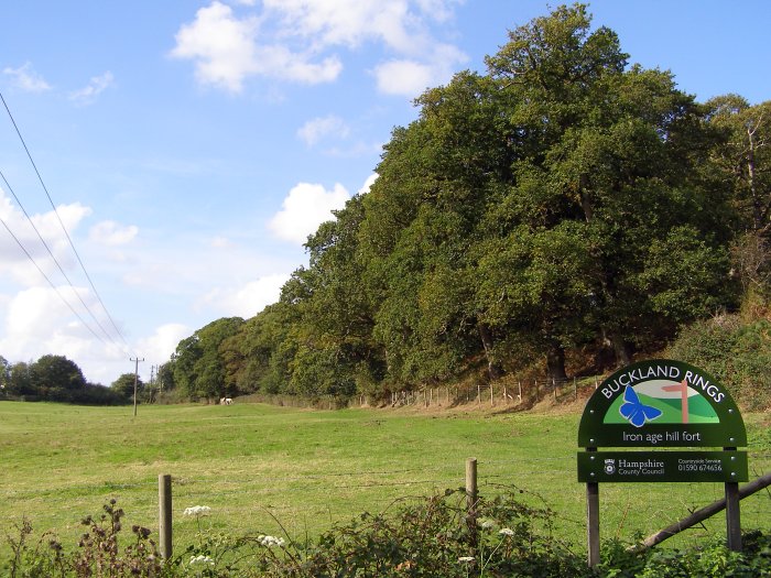
Buckland Rings
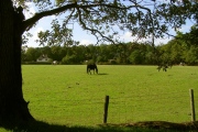
Buckland Rings submitted by JimChampion : A late summer/early autumn view along the southern edge of the earthworks: the triple banks are quite densely wooded with beech and oak. There are permissive paths through this field, and near the white horses there is a gate leading to a path up through the ramparts to the interior. (Vote or comment on this photo)
Buckland Rings, a Scheduled Ancient Monument on the outskirts of Lymington, has impressive earthworks comprising three banks or ramparts and two ditches enclosing a rectangular area of about 4.5 hectares. The ramparts and ditches are substantially complete except on the east side, where in the 18th century, a farmer levelled the banks to gain easier access to the interior. The only original entrance was on this side and traces of it are still visible to the trained eye.

Small scale excavations were carried out in the entrance area by Christopher Hawkes in the 1930's. Modern interpretation of his results and evidence from other excavated forts suggest that the Buckland Rings could have been constructed as early as 400 BC and the defences may have been rebuilt several times before abandonment, probably before the Roman Conquest in 43 AD. [source]

There is nothing "ring"-like about the earthworks, they are incredibly rectangular for a pre-Roman project. The missing part of the eastern defences is quite significant and permits a view across the Lymington River valley from the grassy rectangular interior.

Access The public have access to most of the site via permissive paths, the most obvious access points are to the south and east of the site with Hampshire County Council signs and kissing gates. There is no dedicated car park so you'll have to improvise: park discreetly and thoughtfully on a residential side-street and take a short walk. There are two private properties occupying the eastern edge of the site.

Note: Video Talk: Will Buckland Rings Reveal its secrets? Josie Hagan, Bournemouth University, and various other New Forest related talks, from the New Forest Knowledge Conference 2017
You may be viewing yesterday's version of this page. To see the most up to date information please register for a free account.
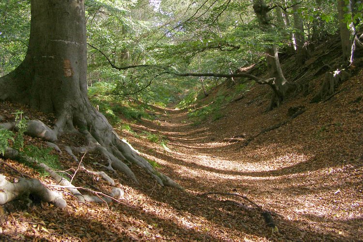
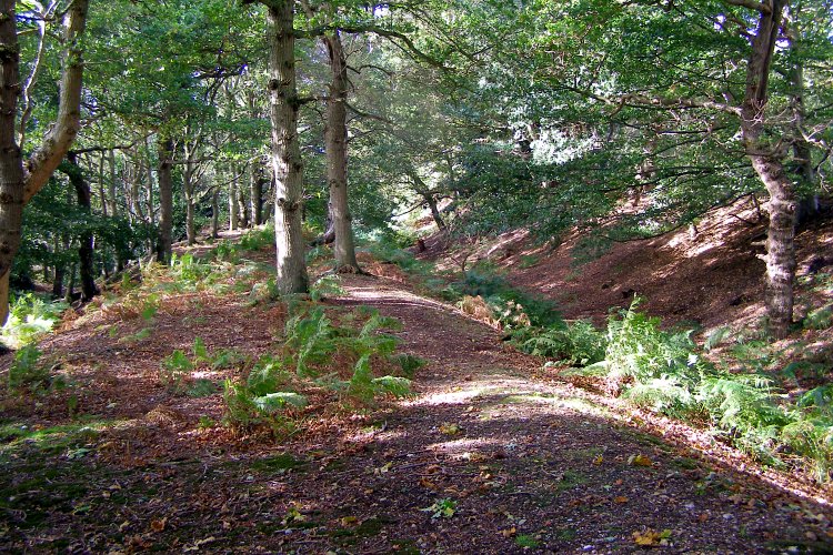
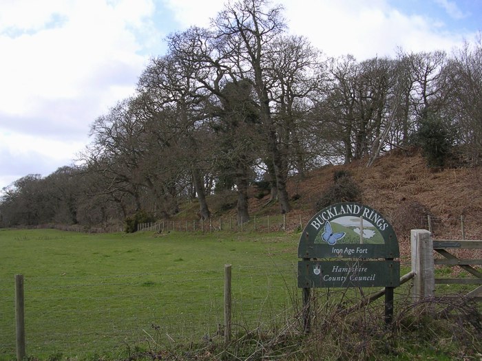
Buckland Rings
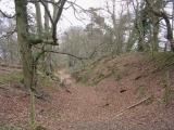
Buckland Rings submitted by JimChampion : The northern side of Buckland Rings, looking along the ditch between the inner rampart (right) and middle rampart (left). The outer rampart to the west and northwest of the camp no longer survives. The curved shadows of the tree trunks show how gently rounded the ditch is after 2000 years of infilling. (4 comments - Vote or comment on this photo)

Buckland Rings
Buckland Rings submitted by JimChampion : Standing on the middle rampart on the southern side of Buckland Rings, looking westwards. The earthworks support a large number of tall beech and oak trees, and at this time of year there is little growing at ground level. (Vote or comment on this photo)

Buckland Rings
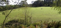
Buckland Rings submitted by JimChampion : A view along the southern edge of the earthworks: the triple banks are quite densely wooded with beech and oak. (2 comments - Vote or comment on this photo)

Buckland Rings
Buckland Rings submitted by dubnicos : View of the Lymington River, which runs in the valley overlooked by Buckland Rings, looking North from Bridge Road. The hillfort lies about a half mile ahead and to the left. (Vote or comment on this photo)

Buckland Rings
Buckland Rings submitted by dubnicos : View outwards towards the Lymington River Valley from the inner rampart on the east side. The view is a little out of character for an Iron Age hillfort, what with the power station and all - it takes something of an eye to try and appreciate the lie of the land underneath it all. (Vote or comment on this photo)

Buckland Rings
Buckland Rings submitted by JimChampion : View west across the northern part of Buckland Rings' interior, from the inner rampart on the eastern side. The house on the left in the distance is one of two on Sway Road built within the camp's interior. Apparently the site was once considered for a housing development, but the land was bought by Hampshire County Council in 1989 and it is now part of a Conservation Area.

Buckland Rings
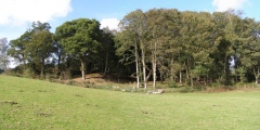
Buckland Rings submitted by JimChampion : Composite photo of the northern half of the interior of Buckland Rings. The trees on the left are growing on the north-facing rampart and those on in the centre-right are on the remains of the east-facing rampart. The gap to the right is where the banks and ditches were levelled in the 18th century by a farmer keen to improve access to his land in the interior. Now horses graze the interior and th...

Buckland Rings
Buckland Rings submitted by JimChampion : Earthworks on the eastern side of Buckland Rings, with the inner rampart on the left and the middle rampart on the right. The fire in the foreground was presumably lit the night before, by whoever left the lager-related litter. There wasn't much chance of the fire spreading, but I damped it down anyway in the traditional manner.

Buckland Rings
Buckland Rings submitted by JimChampion : A composite photo of the view south from the remaining inner rampart on the eastern side of Buckland Rings. The ramparts once stretched across the field to the trees opposite, but they were levelled by an 18th century farmer in order to improve access to his land in the interior of the camp. Some slight terracing can still be seen in the slope, indicating where the triple banks once stood.

Buckland Rings
Buckland Rings submitted by JimChampion : Composite photo of the remaining earthworks on the eastern side of Buckland Rings. The beech and oak trees are growing on the triple ramparts that face towards the Lymington River valley. The grassy slope on the left was created in the 18th century when a farmer levelled the banks to make access to the interior easier.

Buckland Rings
Buckland Rings submitted by JimChampion : Looking east along the innermost northern ditch of the earthworks. This is a fairly typical view of the banks at Buckland: perhaps an aerial view would be more impressive?!

Do not use the above information on other web sites or publications without permission of the contributor.
Click here to see more info for this site

Nearby sites

Click here to view sites on an interactive OS map

Key: Red: member's photo, Blue: 3rd party photo, Yellow: other image, Green: no photo - please go there and take one, Grey: site destroyed

Download sites to:
KML (Google Earth)
GPX (GPS waypoints)
CSV (Garmin/Navman)
CSV (Excel)

To unlock full downloads you need to sign up as a Contributory Member. Otherwise downloads are limited to 50 sites.


Turn off the page maps and other distractions

Nearby sites listing. In the following links * = Image available
 2.6km NW 311° Shirley Holms* Round Barrow(s) (SZ295985)
 3.7km NE 46° Laurences Barrow* Round Barrow(s) (SZ34139937)
 3.7km NNW 330° Setley Plain disc barrows* Round Barrow(s) (SU29620002)
 4.1km NE 38° Beaulieu Heath (West)* Round Barrow(s) (SU3400)
 4.8km NW 309° Longslade View tumulus* Round Barrow(s) (SZ278998)
 5.4km NNE 23° Pudding Barrow* Round Barrow(s) (SU336018)
 7.7km NNW 334° Ober Heath* Round Barrow(s) (SU281037)
 8.6km SE 143° Bouldnor Underwater Settlement and Wooden Structure* Ancient Trackway (SZ367900)
 8.8km NW 317° Ferny Knap tumuli* Round Barrow(s) (SU255032)
 9.9km NE 38° Culverley Farm Bowl Barrow Round Barrow(s) (SU37530461)
 9.9km NW 307° Clay Hill tumuli* Round Barrow(s) (SU235027)
 10.5km E 80° Exbury Promontory Fort / Cliff Castle (SZ419987)
 10.7km NNE 25° Yew Tree Heath* Round Barrow(s) (SU3589506556)
 11.0km S 181° Headon Warren* Round Barrow(s) (SZ314858)
 11.1km S 180° Heatherdown* Round Barrow(s) (SZ31508570)
 11.3km ENE 57° Beaulieu Heath (East)* Round Barrow(s) (SU4103)
 11.4km N 353° New Forest Museum* Museum (SU30020813)
 11.4km S 170° Long Mortuary Enclosure, 800mtr West of Freshwater Bay House* Barrow Cemetery (SZ3362785568)
 11.5km S 177° Highdown barrows* Round Barrow(s) (SZ32168535)
 11.5km S 175° Tennyson Monument Enclosure* Misc. Earthwork (SZ32498533)
 11.5km S 175° Tennyson Down Field System* Ancient Village or Settlement (SZ32508532)
 11.6km N 11° Matley Heath* Round Barrow(s) (SU336082)
 11.6km NE 37° Dibden Bottom* Barrow Cemetery (SU385061)
 11.7km SSE 162° Afton Down* Barrow Cemetery (SZ352857)
 11.9km S 184° West High Down* Round Barrow(s) (SZ30678495)
View more nearby sites and additional images

<< Kes Tor Cairn

Højene (Godsted) >>

Please add your thoughts on this site

New Book: Heavenly Art - Rock Art in Israel

New Book: Heavenly Art - Rock Art in Israel

Sponsors

Auto-Translation (Google)

Translate from English into:

"Buckland Rings" | Login/Create an Account | 10 News and Comments
  
Go back to top of page    Comments are owned by the poster. We aren't responsible for their content.
Video Talk: Will Buckland Rings Reveal its secrets? Josie Hagan, Bournemouth Uni by Andy B on Wednesday, 31 July 2019
(User Info | Send a Message)
Will Buckland Rings Reveal its secrets? Josie Hagan, Bournemouth University
Filmed at the New Forest Knowledge Conference 2017

Josie writes: I am a student placement from Bournemouth University spending a year working with the New Forest National Park Authority. After working in a variety of roles and helping staff I commenced my final project, which involved a Geophysical Survey of Buckland Rings.

The Geophysical Survey of Buckland Rings was to investigate if there was any evidence of settlement within the Hillfort, which had previously been excavated in the 1930’s by Hawkes and surveyed in the 1990’s by the Royal Commission, but was still relatively unknown.

The survey lasted a total of six days, and with the help from Bournemouth University students and New Forest Volunteers a total of 4 hectares was covered. The results from the survey uncovered potential internal round houses, linear features and the trenches from Hawkes excavation within the Hillfort, and also some Medieval field systems just to the east of the site, which were previously unknown.

To set these findings in the wider landscape, Buckland Rings is in very close proximity to Ampress, which lies just to the east. While Ampress has been built over and is now part of a waterworks, some radiocarbon dates have been obtained from the site, which suggest the site may have been Saxon or Danish. This evidence in conjunction with the findings of Medieval settlement around Buckland Rings could indicate to both sites being multi-phase sites, with long periods of settlement.

The next step in finding out more from Buckland Rings and its place in the wider landscape would be to have a small community excavation, which will hopefully take place this year.

Watch the talk here:
https://youtu.be/KQp49VNSLDs

Lots more on various New Forest subjects here:
https://dougsarchaeology.wordpress.com/2019/07/31/new-forest-knowledge-conference-2017/
With thanks to Doug Rocks-Macqueen for the videos
[ Reply to This ]
    Video Talk: HLF Funding for heritage projects by Andy B on Wednesday, 31 July 2019
    (User Info | Send a Message)
    Another one of wider interest: HLF Funding for heritage projects
    Judith Carruthers, Development Officer, Heritage Lottery Fund
    Find out what type of heritage projects HLF fund and how to apply. Grants start at £3000 and cover the whole spectrum of heritage from community archaeology projects, restoring natural heritage sites through to developing exciting new heritage centres.

    This talk covers what funding programmes are available, how projects are assessed and include some useful case studies. As Development Officer, Judith offers advice on HLF applications prior to their submission, particularly in South East HLF priority development areas.
    https://youtu.be/iS0X-bIrvC0
    [ Reply to This ]

Prehistoric Cooking With Jacqui Wood by Andy B on Thursday, 08 May 2014
(User Info | Send a Message)
Emma from Come Step Back in Time writes: In summer 2012 I leapt at the chance to see Jacqui Wood demonstrating prehistoric cooking techniques at Buckland Rings Iron Age hillfort on the outskirts of Lymington, Hampshire. Jacqui Wood is a food historian, researcher and Experimental Archaeologist The event was organised by St. Barbe Museum and was part of a programme of events and activities associated with a year-long project exploring the history of food and farming in and around Lymington.

Buckland Rings was once open countryside but is now covered with trees. During the Iron Age the inhabitants would have lived in roundhouses and cooked on a central hearth. According to historian Dr Joanna Close-Brooks, who is an expert on the history of Buckland Rings:

The houses were built of timber with thatched roofs and walls made of stakes and wattle covered with daub, or of planks. Inside there was usually a hearth over which food was cooked in a cauldron hanging from a beam, and sometimes a clay oven was constructed for baking bread. The houses were from 20 to 30 feet (6-9 metres) in diameter, with plenty of room to accommodate a large family…..Iron Age people were farmers, keeping cows, sheep, pigs and some horses and raising crops on fields near their settlements. The cattle yielded milk for drinking and making into butter and cheese; skin and sinew for leather and thongs; horn and bone for making into tools and ornament and, of course, meat to eat. Sheep provided the same (like cows they can be milked), but were probably more important for their wool which was woven into cloth, sometimes chequered or patterned in some other design.

The people living in the settlement during the Iron Age would have eaten a fairly simple diet consisting of meat, fish, bread, butter and cheese. The main cooking implements around the central hearth would have been a cauldron and a fire-dog. The fire-dog had a lower bar which supported the wooden logs in the hearth and an upper bar used for supporting the meat on the spits. The cauldron was suspended from an iron tripod and simple unglazed pottery vessels would have been used to cook with.

Jacqui, assisted by her son, cooked us from scratch a delicious smoked fish stew, sweet bean cakes, oat and barley bread which was accompanied by home-made butter.

More at:
http://comestepbackintime.wordpress.com/2012/09/23/prehistoric-cooking-with-jacqui-wood/
[ Reply to This ]
    Re: Prehistoric Cooking With Jacqui Wood by Runemage on Thursday, 08 May 2014
    (User Info | Send a Message)
    Yum! that bread baked around the stones would have been an edible soup-bowl. People would have also used their more traditional forage foods alongside the new techniques, e.g. cooking nettle tops in the spring makes a tasty green vegetable side dish even today, or adding a few large spoonfuls to soup in the last 10 minutes or so adds taste and nutrients. Collecting birch sap one spring is something I keep meaning to try after seeing it on Ray Mears.
    [ Reply to This ]

Re: Buckland Rings by coldrum on Tuesday, 30 March 2010
(User Info | Send a Message)
Street View


View Larger Map
[ Reply to This ]

Re: Buckland Rings by samthearchaeologist on Thursday, 23 March 2006
(User Info | Send a Message)
I live under 1/2 a mile away from Buckland Rings, and recently I was given the opportunity to have a group of fellow archaeologists to survey my field, which lies on a tangent from Buckland Rings. This survey has shown that something is shown underneath my field, and we dug a couple of small test pits, which brought up artefacts dating from the Iron Age through the Roman and right the way up to the late Anglo Saxon early Medieval period.
I am currently working on cleaning up the finds, and I will soon take pictures of them and post them on here.
[ Reply to This ]

Re: Buckland Rings by Anonymous on Thursday, 01 September 2005
Buckland Rings is the terminal point of a Roman Road starting from Cadnam on RR422 (Winchester - Lake Farm) which suggests that it was occupied at the time Legio Secunda Augusta passed through the area, taking the Isle of Wight as they went.
[ Reply to This ]

Re: Buckland Rings by JimChampion on Sunday, 13 March 2005
(User Info | Send a Message)
The Buckland Rings site lies within the Buckland conservation area, and full details (including a large-scale map) are given on this New Forest District Council webpage.
The most relevant paragraph reads:

Buckland Rings is a multivallate hill fort dating from the Iron Age period – 4th century BC to 1st century AD – early historians thought it was Roman. It has well preserved triple banks and double ditches but it may have started out with a single bank and ditch system. This type of site is rare in lowland areas and as such is the best preserved and most important in the Hampshire/Dorset basin. The east side which contained the entrance was partly ploughed up in the mid 18th century and in the present century two houses were built inside the west end near where the outer bank has been lost along Sway Road.
[ Reply to This ]

Re: Buckland Rings by JimChampion on Saturday, 12 March 2005
(User Info | Send a Message)
This perfectly adequate description is taken from the Hampshire County Council website:

Buckland Rings, which is a Scheduled Ancient Monument, has impressive earthworks comprising three banks or ramparts and two ditches enclosing a rectangular area of about 4.5 hectares.

The ramparts and ditches are substantially complete except on the east side, where in the 18th century, a farmer levelled the banks to gain easier access to the interior. The only original entrance was on this side and traces of it are still visible to the trained eye.

Small scale excavations were carried out in the entrance area by Christopher Hawkes in the 1930's. Modern interpretation of his results and evidence from other excavated forts suggest that the Buckland Rings could have been constructed as early as 400 BC and the defences may have been rebuilt several times before abandonment, probably before the Roman Conquest in 43 AD.


There is nothing "ring"-like about the earthworks, they are incredibly rectangular for a pre-Roman project. The missing part of the eastern defences is quite significant and permits a view across the Lymington River valley from the grassy rectangular interior.

Access The public have access to most of the site via permissive paths, the most
obvious access points are to the south and east of the site with Hampshire County Council signs and kissing gates. There is no dedicated car park so you'll have to improvise: park on a residential side-street and take a short walk. There are two private properties occupying the eastern edge of the site.

Also of interest: "Just about a half kilometer to the east lies Ampress, a smaller fort on the west bank of Lymington River at its confluence with Passford Water. The smaller fort has, in more recent times, been partly disturbed by industrial building and very little is known about it."
[ Reply to This ]

Your Name: Anonymous [ Register Now ]
Subject:


Add your comment or contribution to this page. Spam or offensive posts are deleted immediately, don't even bother

<<< What is five plus one as a number? (Please type the answer to this question in the little box on the left)
You can also embed videos and other things. For Youtube please copy and paste the 'embed code'.
For Google Street View please include Street View in the text.
Create a web link like this: <a href="https://www.megalithic.co.uk">This is a link</a>  

Allowed HTML is:
<p> <b> <i> <a> <img> <em> <br> <strong> <blockquote> <tt> <li> <ol> <ul> <object> <param> <embed> <iframe>

We would like to know more about this location. Please feel free to add a brief description and any relevant information in your own language.
Wir möchten mehr über diese Stätte erfahren. Bitte zögern Sie nicht, eine kurze Beschreibung und relevante Informationen in Deutsch hinzuzufügen.
Nous aimerions en savoir encore un peu sur les lieux. S'il vous plaît n'hesitez pas à ajouter une courte description et tous les renseignements pertinents dans votre propre langue.
Quisieramos informarnos un poco más de las lugares. No dude en añadir una breve descripción y otros datos relevantes en su propio idioma.