

<< Text Pages >> Akerreta Túmulo 2 - Round Barrow(s) in Spain in Navarra
Submitted by AlexHunger on Monday, 22 September 2008 Page Views: 978
Neolithic and Bronze AgeSite Name: Akerreta Túmulo 2 Alternative Name: Azporro 2Country: Spain Region: Navarra Type: Round Barrow(s)
Nearest Town: Baztan Nearest Village: Sunbilla
Latitude: 43.118444N Longitude: 1.553437W
Condition:
| 5 | Perfect |
| 4 | Almost Perfect |
| 3 | Reasonable but with some damage |
| 2 | Ruined but still recognisable as an ancient site |
| 1 | Pretty much destroyed, possibly visible as crop marks |
| 0 | No data. |
| -1 | Completely destroyed |
| 5 | Superb |
| 4 | Good |
| 3 | Ordinary |
| 2 | Not Good |
| 1 | Awful |
| 0 | No data. |
| 5 | Can be driven to, probably with disabled access |
| 4 | Short walk on a footpath |
| 3 | Requiring a bit more of a walk |
| 2 | A long walk |
| 1 | In the middle of nowhere, a nightmare to find |
| 0 | No data. |
| 5 | co-ordinates taken by GPS or official recorded co-ordinates |
| 4 | co-ordinates scaled from a detailed map |
| 3 | co-ordinates scaled from a bad map |
| 2 | co-ordinates of the nearest village |
| 1 | co-ordinates of the nearest town |
| 0 | no data |
Be the first person to rate this site - see the 'Contribute!' box in the right hand menu.
Internal Links:
External Links:
Round Barrow(s) in Community of Abartan - Saio
Have you visited this site? Please add a comment below.
You may be viewing yesterday's version of this page. To see the most up to date information please register for a free account.
Do not use the above information on other web sites or publications without permission of the contributor.
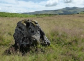
Nearby Images from Flickr
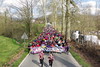
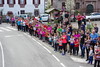
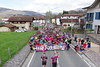
The above images may not be of the site on this page, but were taken nearby. They are loaded from Flickr so please click on them for image credits.
Click here to see more info for this site
Nearby sites
Click here to view sites on an interactive map of the areaKey: Red: member's photo, Blue: 3rd party photo, Yellow: other image, Green: no photo - please go there and take one, Grey: site destroyed
Download sites to:
KML (Google Earth)
GPX (GPS waypoints)
CSV (Garmin/Navman)
CSV (Excel)
To unlock full downloads you need to sign up as a Contributory Member. Otherwise downloads are limited to 50 sites.
Turn off the page maps and other distractions
Nearby sites listing. In the following links * = Image available
34m SE 142° Akerreta Túmulo 1 Round Barrow(s)
396m WSW 246° Munuxeta Fondo Cabaña 1+2 Ancient Village or Settlement
688m SW 214° Arborte Túmulo Round Barrow(s)
821m SW 231° Oronbor Túmulo Round Barrow(s)
1.3km S 172° Sorota Fondo Cabaña Ancient Village or Settlement
1.4km S 173° Sorota Dolmen* Burial Chamber or Dolmen
1.9km E 84° Agerretxeberriko Borda Túmulo Round Barrow(s)
2.0km E 83° Ezkaldo Túmulo 2 Round Barrow(s)
2.0km E 81° Indarteko Borda Campos Tumular Barrow Cemetery
2.1km S 186° Soate Dolmen* Burial Chamber or Dolmen
2.1km E 83° Etxebarrengo Borda Campos Tumular Barrow Cemetery
2.4km E 97° Mendigaña Campo Tumular* Barrow Cemetery
2.5km E 94° Andalorreko Borda Campo Tumular Barrow Cemetery
2.6km SSW 196° Abartan Izkoa Cromlechs 1-9* Stone Circle
2.6km W 259° Munoa Túmulo Round Barrow(s)
2.7km SE 127° Irazabal Dolmen Burial Chamber or Dolmen
2.7km WSW 258° Harriurdineta Munoa Túmulo Round Barrow(s)
2.7km S 191° Urdintz Menhir* Standing Stone (Menhir)
2.9km SSW 193° Elorregiko Lepoa Cromlech Stone Circle
3.0km SSW 193° Elorregiko Lepoa Túmulo Round Barrow(s)
3.0km E 95° Ezkaldo Túmulo 1 Round Barrow(s)
3.3km SW 227° Bidegurutzeta Dolmen Burial Chamber or Dolmen
3.8km E 94° Urkitze Dolmen 2 Burial Chamber or Dolmen
3.8km SSW 194° Abartango Zelaia Cromlech Stone Circle
3.8km E 92° Urkitze Dolmen 1 Burial Chamber or Dolmen
View more nearby sites and additional images


 We would like to know more about this location. Please feel free to add a brief description and any relevant information in your own language.
 Wir möchten mehr über diese Stätte erfahren. Bitte zögern Sie nicht, eine kurze Beschreibung und relevante Informationen in Deutsch hinzuzufügen.
 Nous aimerions en savoir encore un peu sur les lieux. S'il vous plaît n'hesitez pas à ajouter une courte description et tous les renseignements pertinents dans votre propre langue.
 Quisieramos informarnos un poco más de las lugares. No dude en añadir una breve descripción y otros datos relevantes en su propio idioma.