


<< Text Pages >> The Grey Stone (Sockburn) - Marker Stone in England in County Durham
Submitted by coldrum on Tuesday, 11 August 2009 Page Views: 4971
Multi-periodSite Name: The Grey Stone (Sockburn)Country: England
NOTE: This site is 2.582 km away from the location you searched for.
County: County Durham Type: Marker Stone
Map Ref: NZ34660708
Latitude: 54.457928N Longitude: 1.466877W
Condition:
| 5 | Perfect |
| 4 | Almost Perfect |
| 3 | Reasonable but with some damage |
| 2 | Ruined but still recognisable as an ancient site |
| 1 | Pretty much destroyed, possibly visible as crop marks |
| 0 | No data. |
| -1 | Completely destroyed |
| 5 | Superb |
| 4 | Good |
| 3 | Ordinary |
| 2 | Not Good |
| 1 | Awful |
| 0 | No data. |
| 5 | Can be driven to, probably with disabled access |
| 4 | Short walk on a footpath |
| 3 | Requiring a bit more of a walk |
| 2 | A long walk |
| 1 | In the middle of nowhere, a nightmare to find |
| 0 | No data. |
| 5 | co-ordinates taken by GPS or official recorded co-ordinates |
| 4 | co-ordinates scaled from a detailed map |
| 3 | co-ordinates scaled from a bad map |
| 2 | co-ordinates of the nearest village |
| 1 | co-ordinates of the nearest town |
| 0 | no data |
Be the first person to rate this site - see the 'Contribute!' box in the right hand menu.
Internal Links:
External Links:
Marker Stone in County Durham
Stone associated with a Dragon legend.
Sir John Conyers is supposed to have killed a Dragon near a boulder stone called the Grey Stone.
Pastscape site no. 25528
You may be viewing yesterday's version of this page. To see the most up to date information please register for a free account.
Do not use the above information on other web sites or publications without permission of the contributor.
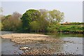
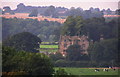
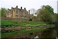
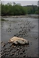
Nearby Images from Geograph Britain and Ireland:
©2011(licence)
©2006(licence)
©2011(licence)
©2011(licence)
©2011(licence)
The above images may not be of the site on this page, they are loaded from Geograph.
Please Submit an Image of this site or go out and take one for us!
Click here to see more info for this site
Nearby sites
Key: Red: member's photo, Blue: 3rd party photo, Yellow: other image, Green: no photo - please go there and take one, Grey: site destroyed
Download sites to:
KML (Google Earth)
GPX (GPS waypoints)
CSV (Garmin/Navman)
CSV (Excel)
To unlock full downloads you need to sign up as a Contributory Member. Otherwise downloads are limited to 50 sites.
Turn off the page maps and other distractions
Nearby sites listing. In the following links * = Image available
320m E 85° Conyer's Chapel Crosses* Ancient Cross (NZ34980711)
4.2km N 360° Low Dinsdale Cross* Ancient Cross (NZ34621126)
6.4km WNW 296° St Peter's Church (Croft-on-Tees)* Ancient Cross (NZ2887909849)
7.7km SSE 154° Sentry Circle* Modern Stone Circle etc (NZ3807100141)
8.8km NW 319° South park Stone* Natural Stone / Erratic / Other Natural Feature (NZ28851371)
8.9km ENE 72° St Martin's Church (Kirklevington)* Early Christian Sculptured Stone (NZ4317309860)
9.2km NW 323° St Cuthbert's Church (Darlington)* Ancient Cross (NZ2910814448)
9.6km NNW 337° Haughton le Skerne Ancient Cross* Ancient Cross (NZ30801588)
9.7km E 88° All Saints (Crathorne)* Ancient Cross (NZ4433007559)
9.7km NW 325° The Bulmer Stone* Natural Stone / Erratic / Other Natural Feature (NZ29021496)
9.8km N 357° Sadberge Village Erratic* Natural Stone / Erratic / Other Natural Feature (NZ34151688)
10.3km NE 56° Round Hill (Ingleby Barwick)* Artificial Mound (NZ43171293)
11.0km SSE 166° St Thomas (Brompton)* Ancient Cross (SE37379636)
11.4km NNE 19° Larberry Pastures settlement Ancient Village or Settlement (NZ38321790)
11.7km W 267° Five Hills round barrow* Round Barrow(s) (NZ2293006325)
12.0km NE 44° Preston Park Museum (Stockton on Tees)* Museum (NZ4297515796)
12.1km NE 49° Quarry Farm settlement Ancient Village or Settlement (NZ437151)
12.3km SW 234° Scorton Cursus Cursus (SE2480499698)
12.5km E 92° All Saints (Rudby-in-Cleveland)* Early Christian Sculptured Stone (NZ4718306666)
12.6km ESE 123° All Saints (Ingleby Arncliffe)* Ancient Cross (NZ45270027)
12.7km WSW 241° Scorton Cursus Cursus (NZ235009)
13.0km S 171° All Saints (Northallerton)* Ancient Cross (SE36729420)
13.4km SE 132° St John's Well (Osmotherley)* Holy Well or Sacred Spring (SE447981)
13.5km SE 131° St John's Well (Northallerton) Holy Well or Sacred Spring (SE449983)
14.0km N 9° Castle Hill (Bishopton)* Misc. Earthwork (NZ3667020898)
View more nearby sites and additional images


 We would like to know more about this location. Please feel free to add a brief description and any relevant information in your own language.
 Wir möchten mehr über diese Stätte erfahren. Bitte zögern Sie nicht, eine kurze Beschreibung und relevante Informationen in Deutsch hinzuzufügen.
 Nous aimerions en savoir encore un peu sur les lieux. S'il vous plaît n'hesitez pas à ajouter une courte description et tous les renseignements pertinents dans votre propre langue.
 Quisieramos informarnos un poco más de las lugares. No dude en añadir una breve descripción y otros datos relevantes en su propio idioma.