<< Text Pages >> St Mary's Well (Wallingwells) - Holy Well or Sacred Spring in England in Nottinghamshire
Submitted by Anne T on Monday, 08 January 2018 Page Views: 1511
Springs and Holy WellsSite Name: St Mary''s Well (Wallingwells)Country: England
NOTE: This site is 5.571 km away from the location you searched for.
County: Nottinghamshire Type: Holy Well or Sacred Spring
Nearest Town: Worksop Nearest Village: Wallingwells
Map Ref: SK572840
Latitude: 53.349805N Longitude: 1.142191W
Condition:
| 5 | Perfect |
| 4 | Almost Perfect |
| 3 | Reasonable but with some damage |
| 2 | Ruined but still recognisable as an ancient site |
| 1 | Pretty much destroyed, possibly visible as crop marks |
| 0 | No data. |
| -1 | Completely destroyed |
| 5 | Superb |
| 4 | Good |
| 3 | Ordinary |
| 2 | Not Good |
| 1 | Awful |
| 0 | No data. |
| 5 | Can be driven to, probably with disabled access |
| 4 | Short walk on a footpath |
| 3 | Requiring a bit more of a walk |
| 2 | A long walk |
| 1 | In the middle of nowhere, a nightmare to find |
| 0 | No data. |
| 5 | co-ordinates taken by GPS or official recorded co-ordinates |
| 4 | co-ordinates scaled from a detailed map |
| 3 | co-ordinates scaled from a bad map |
| 2 | co-ordinates of the nearest village |
| 1 | co-ordinates of the nearest town |
| 0 | no data |
Be the first person to rate this site - see the 'Contribute!' box in the right hand menu.
Internal Links:
External Links:
Holy Well or Sacred Spring in Nottinghamshire
The Northern Antiquarian (TNA) features a page for this holy well, originally to be found in Wallingwells Benedictine Priory - see their entry for St. Mary’s Well, Wallingwells, Nottinghamshire, which includes an old photo of the well, recent photographs showing it now overgrown and a brief archaeology & history.
TNA says: "St. Mary’s Well is the most ruined. The archway appears to have fallen or been knocked down but the channel or basin the spring flows into still exists. Observation underneath a flattened stone covering the channel show that the spring flows from a pipe further up and under a series of neat brick arches. It is clear that the well structure was never accessible as it abutts onto the Lake, but was designed to be seen from the other side of the Lake. This view now is difficult due to the considerable plant growth obscuring the sites. It is good to see that the well still exists and hopefully the garden could be restored."
Note: Have you visited this site? Do you have any photographs, information or illustrations to contribute?
You may be viewing yesterday's version of this page. To see the most up to date information please register for a free account.
Do not use the above information on other web sites or publications without permission of the contributor.
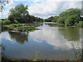
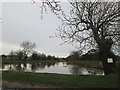
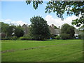
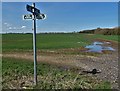
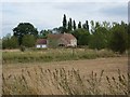
Nearby Images from Geograph Britain and Ireland:
©2012(licence)
©2016(licence)
©2012(licence)
©2018(licence)
©2010(licence)
The above images may not be of the site on this page, they are loaded from Geograph.
Please Submit an Image of this site or go out and take one for us!
Click here to see more info for this site
Nearby sites
Key: Red: member's photo, Blue: 3rd party photo, Yellow: other image, Green: no photo - please go there and take one, Grey: site destroyed
Download sites to:
KML (Google Earth)
GPX (GPS waypoints)
CSV (Garmin/Navman)
CSV (Excel)
To unlock full downloads you need to sign up as a Contributory Member. Otherwise downloads are limited to 50 sites.
Turn off the page maps and other distractions
Nearby sites listing. In the following links * = Image available
4.4km W 265° Dead Man's Cave/Anston Stones Wood* Cave or Rock Shelter (SK5276283530)
6.3km SW 224° Thorpe Common Shelter Cave or Rock Shelter (SK529794)
9.7km SW 217° Ash Tree Cave* Cave or Rock Shelter (SK5148576144)
10.3km SSW 201° Mother Grundy’s Parlour Cave or Rock Shelter (SK536743)
10.4km SSW 202° Creswell Crags* Cave or Rock Shelter (SK535743)
10.5km SSW 202° Robin Hood’s Cave* Cave or Rock Shelter (SK534742)
10.6km SSW 202° Ossiferous Fissure Cave or Rock Shelter (SK533741)
10.6km SSW 202° Pin Hole Cave Cave or Rock Shelter (SK533741)
10.7km SSW 203° Church Hole* Cave or Rock Shelter (SK532741)
10.7km SW 215° Markland Grips Hillfort* Hillfort (SK511752)
10.8km SW 215° Markland Grips Cave* Cave or Rock Shelter (SK510751)
13.4km SSW 208° Whaley Rock Shelter2 Cave or Rock Shelter (SK511721)
13.5km SSW 205° Whaley Rock Shelter1 Cave or Rock Shelter (SK515717)
14.0km SSE 160° Budby Barrow* Round Barrow(s) (SK62187087)
15.0km N 351° Edlington Woods* Cave or Rock Shelter (SK548988)
15.4km E 95° St John's Well (Welham) Holy Well or Sacred Spring (SK72558280)
15.5km SSW 201° Langwith Cave* Cave or Rock Shelter (SK518695)
15.9km S 171° Thynghowe* Artificial Mound (SK59936834)
16.0km NNW 339° St Peter's Minster (Conisbrough)* Sculptured Stone (SK512988)
16.0km NNW 339° St Francis's Well (Conisborough) Holy Well or Sacred Spring (SK51179881)
16.3km W 269° Birley Spa Holy Well or Sacred Spring (SK40908361)
16.4km SSW 203° Scarcliffe Shelter 4 Cave or Rock Shelter (SK509688)
16.7km NNW 341° Cadeby Henge Henge (SK515997)
16.9km SSW 204° Scarcliffe Shelter 3 Cave or Rock Shelter (SK504685)
16.9km SSW 204° Scarcliffe Shelter 2 Cave or Rock Shelter (SK504685)
View more nearby sites and additional images


 We would like to know more about this location. Please feel free to add a brief description and any relevant information in your own language.
 Wir möchten mehr über diese Stätte erfahren. Bitte zögern Sie nicht, eine kurze Beschreibung und relevante Informationen in Deutsch hinzuzufügen.
 Nous aimerions en savoir encore un peu sur les lieux. S'il vous plaît n'hesitez pas à ajouter une courte description et tous les renseignements pertinents dans votre propre langue.
 Quisieramos informarnos un poco más de las lugares. No dude en añadir una breve descripción y otros datos relevantes en su propio idioma.