<< Our Photo Pages >> Reading Cursus - Cursus in England in Berkshire
Submitted by EssexMan on Wednesday, 07 April 2010 Page Views: 4209
Neolithic and Bronze AgeSite Name: Reading CursusCountry: England County: Berkshire Type: Cursus
Nearest Town: Reading Nearest Village: Reading
Map Ref: SU70307005 Landranger Map Number: 175
Latitude: 51.425108N Longitude: 0.990281W
Condition:
| 5 | Perfect |
| 4 | Almost Perfect |
| 3 | Reasonable but with some damage |
| 2 | Ruined but still recognisable as an ancient site |
| 1 | Pretty much destroyed, possibly visible as crop marks |
| 0 | No data. |
| -1 | Completely destroyed |
| 5 | Superb |
| 4 | Good |
| 3 | Ordinary |
| 2 | Not Good |
| 1 | Awful |
| 0 | No data. |
| 5 | Can be driven to, probably with disabled access |
| 4 | Short walk on a footpath |
| 3 | Requiring a bit more of a walk |
| 2 | A long walk |
| 1 | In the middle of nowhere, a nightmare to find |
| 0 | No data. |
| 5 | co-ordinates taken by GPS or official recorded co-ordinates |
| 4 | co-ordinates scaled from a detailed map |
| 3 | co-ordinates scaled from a bad map |
| 2 | co-ordinates of the nearest village |
| 1 | co-ordinates of the nearest town |
| 0 | no data |
Internal Links:
External Links:
I have visited· I would like to visit
SolarMegalith visited on 9th Dec 2011 - their rating: Cond: 1 Amb: 4 Access: 4
")
Status: Possible
NMR No. SU 77 SW 203
Extent: 100mx50m
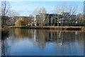
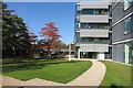
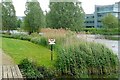
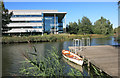
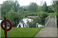
From SolarMegalith: Area of Reading Cursus is currently partly covered with Longwater Lake, which is part of Green Park in Reading. The area is well-maintained ad a very nice place to visit, but remains of the Neolithic monument are not distinguishable anymore. In the nearby remains of a Bronze Age settlement were discovered.
You may be viewing yesterday's version of this page. To see the most up to date information please register for a free account.
")
")
Do not use the above information on other web sites or publications without permission of the contributor.
Nearby Images from Geograph Britain and Ireland:
©2021(licence)
©2015(licence)
©2009(licence)
©2015(licence)
©2008(licence)
The above images may not be of the site on this page, they are loaded from Geograph.
Please Submit an Image of this site or go out and take one for us!
Click here to see more info for this site
Nearby sites
Key: Red: member's photo, Blue: 3rd party photo, Yellow: other image, Green: no photo - please go there and take one, Grey: site destroyed
Download sites to:
KML (Google Earth)
GPX (GPS waypoints)
CSV (Garmin/Navman)
CSV (Excel)
To unlock full downloads you need to sign up as a Contributory Member. Otherwise downloads are limited to 50 sites.
Turn off the page maps and other distractions
Nearby sites listing. In the following links * = Image available
1.4km NW 312° Anslow's Cottages Trackway Ancient Trackway (SU6923470984)
3.7km NNE 21° Reading Museum* Museum (SU716735)
3.9km ENE 69° Whiteknights Stones* Modern Stone Circle etc (SU739715)
5.0km N 11° St. Anne's Well (Caversham)* Holy Well or Sacred Spring (SU712750)
5.2km W 270° Burghfield Cursus Cursus (SU65137000)
7.5km WSW 244° Ufton Nervet Bell Barrow* Round Barrow(s) (SU6356266625)
7.7km W 273° Englefield Cursus (SU626703)
7.7km SW 231° Holden's Firs* Barrow Cemetery (SU64366506)
7.8km W 279° Englefield Cursus (SU626712)
8.3km W 264° Ufton Nervet Cursus Cursus (SU620691)
8.4km WSW 243° Raven Hill* Promontory Fort / Cliff Castle (SU62876615)
8.5km W 267° Ufton Nervet Cursus Cursus (SU618695)
8.5km NE 47° Sonning Cursus Cursus (SU765759)
8.7km NE 48° Sonning Cursus Cursus (SU767759)
10.1km SW 221° Calleva Atrebatum* Ancient Village or Settlement (SU638623)
10.3km SW 228° The Frith (Hampshire)* Hillfort (SU62686308)
10.3km NW 325° Bozedown Camp* Hillfort (SU6419578403)
10.4km WNW 285° St. Andrew's Well* Holy Well or Sacred Spring (SU602726)
10.4km ESE 122° Warren Lodge Barrows* Round Barrow(s) (SU7925664643)
10.9km SW 230° Aldermaston Enclosure* Misc. Earthwork (SU6197062917)
11.1km N 351° Wyfold Castle* Hillfort (SU68328099)
11.1km N 351° Castle Grove Camp Hillfort (SU6832580996)
11.2km SSE 149° Cudbury Clump Barrow* Round Barrow(s) (SU76216058)
11.9km SE 141° Eversley Church Sarsen Stone* Natural Stone / Erratic / Other Natural Feature (SU7791060924)
12.1km SSW 196° Bullsdown Camp* Hillfort (SU67085838)
View more nearby sites and additional images


 We would like to know more about this location. Please feel free to add a brief description and any relevant information in your own language.
 Wir möchten mehr über diese Stätte erfahren. Bitte zögern Sie nicht, eine kurze Beschreibung und relevante Informationen in Deutsch hinzuzufügen.
 Nous aimerions en savoir encore un peu sur les lieux. S'il vous plaît n'hesitez pas à ajouter une courte description et tous les renseignements pertinents dans votre propre langue.
 Quisieramos informarnos un poco más de las lugares. No dude en añadir una breve descripción y otros datos relevantes en su propio idioma.