<< Our Photo Pages >> St Ann's Well (Castle Howard) - Holy Well or Sacred Spring in England in Yorkshire (North)
Submitted by HOLYWELL on Wednesday, 26 March 2008 Page Views: 5059
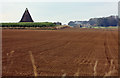
Springs and Holy WellsSite Name: St Ann's Well (Castle Howard)Country: England
NOTE: This site is 4.397 km away from the location you searched for.
County: Yorkshire (North) Type: Holy Well or Sacred Spring
Nearest Village: Castle Howard
Map Ref: SE71786918
Latitude: 54.113495N Longitude: 0.903468W
Condition:
| 5 | Perfect |
| 4 | Almost Perfect |
| 3 | Reasonable but with some damage |
| 2 | Ruined but still recognisable as an ancient site |
| 1 | Pretty much destroyed, possibly visible as crop marks |
| 0 | No data. |
| -1 | Completely destroyed |
| 5 | Superb |
| 4 | Good |
| 3 | Ordinary |
| 2 | Not Good |
| 1 | Awful |
| 0 | No data. |
| 5 | Can be driven to, probably with disabled access |
| 4 | Short walk on a footpath |
| 3 | Requiring a bit more of a walk |
| 2 | A long walk |
| 1 | In the middle of nowhere, a nightmare to find |
| 0 | No data. |
| 5 | co-ordinates taken by GPS or official recorded co-ordinates |
| 4 | co-ordinates scaled from a detailed map |
| 3 | co-ordinates scaled from a bad map |
| 2 | co-ordinates of the nearest village |
| 1 | co-ordinates of the nearest town |
| 0 | no data |
Internal Links:
External Links:
I have visited· I would like to visit
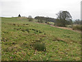
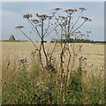
Jaredhardwick visited on 31st Aug 2020 - their rating: Cond: 3 Amb: 3 Access: 4 Found the well at the edge of the field (with bulls). The map pin was spot on! The condition of the site is a bit saddening. The spring is there, but is no longer flowing from the original stone chamber enclosure, which holds stagnant water, and has a dislodged capstone. Wether by erosion, cattle damage, or human intervention, the spring comes out from the ground about 2 meters away, and now seems to have a terra-cotta pipe keeping the hole open. There’s a lot of mud and cow poo all around it, although the water is still running nice and clear. It seems at some point in the past that someone has tried to lay a couple of pipes on the ground to try and direct the flow of water back into the enclosure, but now it just runs past the enclosure and down the hill.
 (PID:215397)")
Considering this is on the Castle Howard estate it is remarkably little endorned and has not been housed in a more folly like structure as we find on other similar estates.
You may be viewing yesterday's version of this page. To see the most up to date information please register for a free account.
 (PID:215398)")
Do not use the above information on other web sites or publications without permission of the contributor.
Nearby Images from Geograph Britain and Ireland:
©2012(licence)
©2013(licence)
©2023(licence)
©2017(licence)
©2008(licence)
The above images may not be of the site on this page, they are loaded from Geograph.
Please Submit an Image of this site or go out and take one for us!
Click here to see more info for this site
Nearby sites
Key: Red: member's photo, Blue: 3rd party photo, Yellow: other image, Green: no photo - please go there and take one, Grey: site destroyed
Download sites to:
KML (Google Earth)
GPX (GPS waypoints)
CSV (Garmin/Navman)
CSV (Excel)
To unlock full downloads you need to sign up as a Contributory Member. Otherwise downloads are limited to 50 sites.
Turn off the page maps and other distractions
Nearby sites listing. In the following links * = Image available
3.0km NE 51° Holy Well, Hildenley* Holy Well or Sacred Spring (SE741711)
6.5km E 99° Whitegrounds Barrow Cairn (SE78256824)
7.1km ESE 113° Hedon Howe Long Barrow (SE7843166510)
8.3km NW 323° All Saints (Hovingham)* Ancient Cross (SE6665575705)
9.6km WNW 287° City Of Troy* Turf Maze (SE6252871886)
10.7km NW 326° Stonegrave Minster* Ancient Cross (SE6561077885)
11.2km NNW 333° All Saints and St James (Nunnington) Ancient Cross (SE6657079070)
11.3km SE 132° Acklam Wold Cemetery* Barrow Cemetery (SE8027061693)
12.4km SE 133° Hanging Grimstone Barrow Cemetery (SE810608)
12.6km WNW 294° Gilling Long Cairn* Chambered Cairn (SE6017074185)
13.1km ESE 116° Wharram Percy Barrows Barrow Cemetery (SE837636)
13.7km NW 316° St Oswald (Oswaldkirk)* Ancient Cross (SE62107892)
13.8km SE 137° Kirby Underdale Cursus Cursus (SE81355922)
15.1km N 356° St Michael and All Angels (Great Edstone)* Early Christian Sculptured Stone (SE704842)
15.7km SSW 199° Holtby Timber Circle (SE668543)
15.8km S 180° Catton Cursus (SE721534)
16.0km SE 140° Callis Wold Barrow Cemetery* Barrow Cemetery (SE8217857003)
16.2km S 182° Catton Cursus (SE716530)
16.2km E 99° Duggleby Cursus Cursus (SE879669)
16.3km ESE 112° Fairy Stones* Natural Stone / Erratic / Other Natural Feature (SE8700363317)
16.4km E 99° Duggleby Howe* Round Barrow(s) (SE88046688)
16.9km N 4° Sinnington Round Barrow* Round Barrow(s) (SE7255686032)
16.9km NNW 347° Kirkdale Hyena Cave* Cave or Rock Shelter (SE678856)
17.1km ESE 110° High Street Barrow (Towthorpe) Cairn (SE88006373)
17.1km NNW 347° Kirkdale Sundial* Early Christian Sculptured Stone (SE6768885776)
View more nearby sites and additional images


 We would like to know more about this location. Please feel free to add a brief description and any relevant information in your own language.
 Wir möchten mehr über diese Stätte erfahren. Bitte zögern Sie nicht, eine kurze Beschreibung und relevante Informationen in Deutsch hinzuzufügen.
 Nous aimerions en savoir encore un peu sur les lieux. S'il vous plaît n'hesitez pas à ajouter une courte description et tous les renseignements pertinents dans votre propre langue.
 Quisieramos informarnos un poco más de las lugares. No dude en añadir una breve descripción y otros datos relevantes en su propio idioma.