<< Our Photo Pages >> St. Helen's Well (North Cave) - Holy Well or Sacred Spring in England in Yorkshire (East)
Submitted by HOLYWELL on Thursday, 27 August 2009 Page Views: 7639
Springs and Holy WellsSite Name: St. Helen's Well (North Cave) Alternative Name: Quaker WellCountry: England
NOTE: This site is 1.599 km away from the location you searched for.
County: Yorkshire (East) Type: Holy Well or Sacred Spring
Nearest Town: Hull Nearest Village: North Cave
Map Ref: SE894326
Latitude: 53.782060N Longitude: 0.644706W
Condition:
| 5 | Perfect |
| 4 | Almost Perfect |
| 3 | Reasonable but with some damage |
| 2 | Ruined but still recognisable as an ancient site |
| 1 | Pretty much destroyed, possibly visible as crop marks |
| 0 | No data. |
| -1 | Completely destroyed |
| 5 | Superb |
| 4 | Good |
| 3 | Ordinary |
| 2 | Not Good |
| 1 | Awful |
| 0 | No data. |
| 5 | Can be driven to, probably with disabled access |
| 4 | Short walk on a footpath |
| 3 | Requiring a bit more of a walk |
| 2 | A long walk |
| 1 | In the middle of nowhere, a nightmare to find |
| 0 | No data. |
| 5 | co-ordinates taken by GPS or official recorded co-ordinates |
| 4 | co-ordinates scaled from a detailed map |
| 3 | co-ordinates scaled from a bad map |
| 2 | co-ordinates of the nearest village |
| 1 | co-ordinates of the nearest town |
| 0 | no data |
Internal Links:
External Links:
 (PID:49778)")
This is one of a considerable number of wells dedicated to St. Helen in Yorkshire. This site is a delightful find tucked behind the Main Street of the village. It is reached by a little path through two gates which appears to be someone's private access but I have been reliably informed can be used. The spring arises in a stone lined chamber set at the base of a small mound reached by steps. Little is recorded of its history or properties other than it was apparently used by the Quakers who were very important in the village. Apparently local people would sweep spiders into the well when preparing for fairs which seems an odd thing to do!
You may be viewing yesterday's version of this page. To see the most up to date information please register for a free account.
 (PID:49777)")
Do not use the above information on other web sites or publications without permission of the contributor.
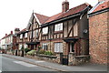
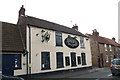
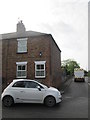
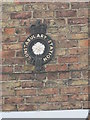
Nearby Images from Geograph Britain and Ireland:
©2012(licence)
©2012(licence)
©2019(licence)
©2019(licence)
©2015(licence)
The above images may not be of the site on this page, they are loaded from Geograph.
Please Submit an Image of this site or go out and take one for us!
Click here to see more info for this site
Nearby sites
Key: Red: member's photo, Blue: 3rd party photo, Yellow: other image, Green: no photo - please go there and take one, Grey: site destroyed
Download sites to:
KML (Google Earth)
GPX (GPS waypoints)
CSV (Garmin/Navman)
CSV (Excel)
To unlock full downloads you need to sign up as a Contributory Member. Otherwise downloads are limited to 50 sites.
Turn off the page maps and other distractions
Nearby sites listing. In the following links * = Image available
2.8km SE 127° St Helen's Well (South Cave)* Holy Well or Sacred Spring (SE91693096)
4.4km ENE 66° St Austin's Stone (High Hunsley)* Natural Stone / Erratic / Other Natural Feature (SE9336034443)
7.8km ENE 67° Ling Howe Long Barrow Long Barrow (SE96503580)
7.8km ENE 59° Ella Hill* Round Barrow(s) (SE9606036730)
8.2km NE 50° Littlewood Lodge Round Barrow(s) (SE95563801)
9.4km NNE 24° Arras Barrow Cemetery* Barrow Cemetery (SE930413)
9.8km N 359° St Helen's Well (Goodmanham)* Holy Well or Sacred Spring (SE890424)
9.9km ENE 64° Middle Howe Round Barrow(s) (SE98283713)
10.4km N 357° Lady Well (Goodmanham)* Holy Well or Sacred Spring (SE887430)
10.9km S 188° Julian's Bower* Turf Maze (SE880218)
11.1km S 189° Countess Close* Ancient Village or Settlement (SE879216)
12.1km S 191° Kell Well (Walcot)* Holy Well or Sacred Spring (SE873207)
13.0km N 350° All Saints (Londesborough)* Ancient Cross (SE86864538)
13.4km NW 306° Lady Well (Seaton Ross) Holy Well or Sacred Spring (SE784403)
15.2km WSW 254° Ringstone Wood (Howden) Stone Circle (SE748282)
15.6km SSE 162° Holy Well (Winterton) Holy Well or Sacred Spring (SE944178)
15.8km ENE 66° Beverley Minster Early Christian Sculptured Stone (TA03773925)
15.9km NNW 344° St James Church (Nunburnholme)* Ancient Cross (SE84774779)
18.0km NNW 343° Kilnwick Percy Hill - Barrow* Barrow Cemetery (SE8365149674)
18.4km S 178° Dragonby* Natural Stone / Erratic / Other Natural Feature (SE905142)
19.0km NNW 345° Newcote Round Barrow* Barrow Cemetery (SE84225085)
19.6km NNE 33° Cleves Top (High Bradley) Rock Art (SE99934916)
20.1km N 355° Dearsden Hill Hillfort (SE872526)
20.5km S 181° Crosby Stone Natural Stone / Erratic / Other Natural Feature (SE893121)
20.7km W 259° St. Helen's Well (Barmby) Holy Well or Sacred Spring (SE691284)
View more nearby sites and additional images


 We would like to know more about this location. Please feel free to add a brief description and any relevant information in your own language.
 Wir möchten mehr über diese Stätte erfahren. Bitte zögern Sie nicht, eine kurze Beschreibung und relevante Informationen in Deutsch hinzuzufügen.
 Nous aimerions en savoir encore un peu sur les lieux. S'il vous plaît n'hesitez pas à ajouter une courte description et tous les renseignements pertinents dans votre propre langue.
 Quisieramos informarnos un poco más de las lugares. No dude en añadir una breve descripción y otros datos relevantes en su propio idioma.