<< Our Photo Pages >> La Piatra Dolmen - Burial Chamber or Dolmen in Spain in Aragón
Submitted by AlexHunger on Saturday, 02 August 2008 Page Views: 3723
Neolithic and Bronze AgeSite Name: La Piatra Dolmen Alternative Name: Dolmen of Ibirque, Dolmen de Belsué, Dolmen de la PiatraCountry: Spain
NOTE: This site is 30.513 km away from the location you searched for.
Region: Aragón Type: Burial Chamber or Dolmen
Nearest Town: Huesca Nearest Village: Belsué
Latitude: 42.280269N Longitude: 0.385604W
Condition:
| 5 | Perfect |
| 4 | Almost Perfect |
| 3 | Reasonable but with some damage |
| 2 | Ruined but still recognisable as an ancient site |
| 1 | Pretty much destroyed, possibly visible as crop marks |
| 0 | No data. |
| -1 | Completely destroyed |
| 5 | Superb |
| 4 | Good |
| 3 | Ordinary |
| 2 | Not Good |
| 1 | Awful |
| 0 | No data. |
| 5 | Can be driven to, probably with disabled access |
| 4 | Short walk on a footpath |
| 3 | Requiring a bit more of a walk |
| 2 | A long walk |
| 1 | In the middle of nowhere, a nightmare to find |
| 0 | No data. |
| 5 | co-ordinates taken by GPS or official recorded co-ordinates |
| 4 | co-ordinates scaled from a detailed map |
| 3 | co-ordinates scaled from a bad map |
| 2 | co-ordinates of the nearest village |
| 1 | co-ordinates of the nearest town |
| 0 | no data |
Internal Links:
External Links:
")
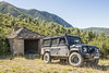
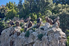
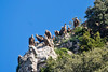
Dolmen with angled capstone due to broken upright on the side of a hill.
You may be viewing yesterday's version of this page. To see the most up to date information please register for a free account.
")
Do not use the above information on other web sites or publications without permission of the contributor.
Nearby Images from Flickr


The above images may not be of the site on this page, but were taken nearby. They are loaded from Flickr so please click on them for image credits.
Click here to see more info for this site
Nearby sites
Click here to view sites on an interactive map of the areaKey: Red: member's photo, Blue: 3rd party photo, Yellow: other image, Green: no photo - please go there and take one, Grey: site destroyed
Download sites to:
KML (Google Earth)
GPX (GPS waypoints)
CSV (Garmin/Navman)
CSV (Excel)
To unlock full downloads you need to sign up as a Contributory Member. Otherwise downloads are limited to 50 sites.
Turn off the page maps and other distractions
Nearby sites listing. In the following links * = Image available
8.9km ENE 77° Palomar Dolmen Burial Chamber or Dolmen
14.3km NE 54° Ibirque Dolmen* Burial Chamber or Dolmen
15.0km ESE 109° Articasales Dolmen* Burial Chamber or Dolmen
15.2km ESE 111° Piedrafita Dolmen* Burial Chamber or Dolmen
20.3km ESE 107° Cueva de Chaves Cave or Rock Shelter
24.6km E 83° Losa Mora Dolmen* Burial Chamber or Dolmen
34.0km ESE 106° Abrigo de Quizans Rock Art
34.3km ESE 104° Chimiachas* Cave or Rock Shelter
35.9km E 85° La Capilleta Dolmen* Burial Chamber or Dolmen
36.7km E 89° Caseta de las Balanzas Dolmen* Burial Chamber or Dolmen
36.9km E 87° Pueyoril Dolmen* Burial Chamber or Dolmen
41.5km SE 138° Almerge Castro or Chafurdão
42.5km N 7° Dolmen de Santa Elena* Burial Chamber or Dolmen
45.4km NNW 345° Cueva De Tres Peñas Dolmen Burial Chamber or Dolmen
45.7km N 351° Espata Chromlech Stone Circle
46.4km N 3° Ibón De Piedrafita Túmulo* Round Barrow(s)
46.6km NNW 346° Letranz Dolmen* Burial Chamber or Dolmen
46.6km NNW 345° Cueva De Las Güixas* Cave or Rock Shelter
46.6km NNW 345° Caseta De Las Güixas Dolmen* Burial Chamber or Dolmen
47.2km N 5° Las Lastras Chromlech* Stone Circle
47.3km NNE 12° Ibón De Sabocos Dolmen Burial Chamber or Dolmen
47.7km N 359° O Goluso Dolmen* Burial Chamber or Dolmen
48.5km N 358° Plan De Blasco Chromlech Stone Circle
48.6km N 356° Arbenuso Chromlech Stone Circle
48.6km N 2° La Paúl Túmulo Round Barrow(s)
View more nearby sites and additional images


 We would like to know more about this location. Please feel free to add a brief description and any relevant information in your own language.
 Wir möchten mehr über diese Stätte erfahren. Bitte zögern Sie nicht, eine kurze Beschreibung und relevante Informationen in Deutsch hinzuzufügen.
 Nous aimerions en savoir encore un peu sur les lieux. S'il vous plaît n'hesitez pas à ajouter une courte description et tous les renseignements pertinents dans votre propre langue.
 Quisieramos informarnos un poco más de las lugares. No dude en añadir una breve descripción y otros datos relevantes en su propio idioma.