 with our Megalithic Portal iPhone app")

<< Our Photo Pages >> Rackham Hill Earthwork and Tumuli - Round Barrow(s) in England in West Sussex
Submitted by Spiderdrone on Wednesday, 23 July 2008 Page Views: 6436
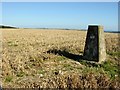
Iron Age and Later PrehistorySite Name: Rackham Hill Earthwork and Tumuli Alternative Name: An unenclosed Iron Age urnfield and associated remains on Rackham Hill, 900m SSE of Rackham FarmCountry: England County: West Sussex Type: Round Barrow(s)
Nearest Town: Storrington
Map Ref: TQ0529712589
Latitude: 50.903184N Longitude: 0.503887W
Condition:
| 5 | Perfect |
| 4 | Almost Perfect |
| 3 | Reasonable but with some damage |
| 2 | Ruined but still recognisable as an ancient site |
| 1 | Pretty much destroyed, possibly visible as crop marks |
| 0 | No data. |
| -1 | Completely destroyed |
| 5 | Superb |
| 4 | Good |
| 3 | Ordinary |
| 2 | Not Good |
| 1 | Awful |
| 0 | No data. |
| 5 | Can be driven to, probably with disabled access |
| 4 | Short walk on a footpath |
| 3 | Requiring a bit more of a walk |
| 2 | A long walk |
| 1 | In the middle of nowhere, a nightmare to find |
| 0 | No data. |
| 5 | co-ordinates taken by GPS or official recorded co-ordinates |
| 4 | co-ordinates scaled from a detailed map |
| 3 | co-ordinates scaled from a bad map |
| 2 | co-ordinates of the nearest village |
| 1 | co-ordinates of the nearest town |
| 0 | no data |
Internal Links:
External Links:
I have visited· I would like to visit
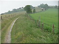
Spiderdrone visited on 2nd Jun 2022 - their rating: Cond: -1 Amb: 4 Access: 4 Parking in the nearby Parham Post road (Kithurst Hill) and a short walk along the SDW but nothing to see, which is unfortunate however there are plenty of fantastic views.
There are several other locations within the same spot however, these too are gone however one remains which is not on the website but nothing much to see.
")
Records suggest that the mound, the edge of which has been partly disturbed by modern ploughing, is surrounded by a now infilled construction ditch up to c.1.5m wide. The grave mound was investigated in 1929, when a centrally placed cremation burial and associated fragments of an Iron Age cinerary urn were discovered. The second grave mound lies c.46m to the north east and has a circular mound c.9m in diameter and up to c.0.3m high, surrounded by an infilled construction ditch c.1m wide. Further, associated unmarked burials are likely to survive in the areas between and around the grave mounds. The associated enclosure, interpreted as a contemporary ritual monument, lies between the grave mounds and survives as a roughly east-west aligned, raised sub-rectangular platform measuring c.12m by c.10m. Part excavation in 1929 revealed that the central area is paved with large flint nodules. The platform is enclosed by a low bank up to c.0.5m high and c.6m wide, surrounded by a `v'-shaped ditch. The ditch has become infilled due to the encroachment of modern ploughing onto the southern periphery of the enclosure, but will survive as a buried feature up to c.4m wide.
Source: Historic England
Page originally by Coldrum
You may be viewing yesterday's version of this page. To see the most up to date information please register for a free account.
Do not use the above information on other web sites or publications without permission of the contributor.
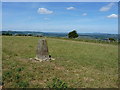
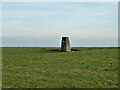
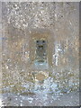
Nearby Images from Geograph Britain and Ireland:
©2015(licence)
©2024(licence)
©2015(licence)
©2005(licence)
©2011(licence)
The above images may not be of the site on this page, they are loaded from Geograph.
Please Submit an Image of this site or go out and take one for us!
Click here to see more info for this site
Nearby sites
Key: Red: member's photo, Blue: 3rd party photo, Yellow: other image, Green: no photo - please go there and take one, Grey: site destroyed
Download sites to:
KML (Google Earth)
GPX (GPS waypoints)
CSV (Garmin/Navman)
CSV (Excel)
To unlock full downloads you need to sign up as a Contributory Member. Otherwise downloads are limited to 50 sites.
Turn off the page maps and other distractions
Nearby sites listing. In the following links * = Image available
341m WSW 241° Rackham Banks* Ancient Village or Settlement (TQ05001242)
885m WSW 245° Amberley Mount Field System Misc. Earthwork (TQ045122)
905m E 97° Springhead Hill Cross Dyke Misc. Earthwork (TQ062125)
1.0km W 260° Amberley Mount Tumuli Barrow Cemetery (TQ043124)
1.4km E 99° Springhead Hill Tumuli Barrow Cemetery (TQ067124)
1.5km W 268° Highdown Tumulus Round Barrow(s) (TQ038125)
2.6km E 92° Kithurst Hill Tumuli* Barrow Cemetery (TQ07871254)
2.7km SSE 163° Wepham Down Earthwork* Misc. Earthwork (TQ06141001)
3.1km SSE 156° Friday's Well Holy Well or Sacred Spring (TQ06620983)
3.2km E 89° Chantry Hill Cross Dyke* Misc. Earthwork (TQ0850512712)
3.2km S 176° Norfolk Clump Tumulus Round Barrow(s) (TQ056094)
3.2km SSE 159° Barpham Hill Cross Dyke Round Barrow(s) (TQ06550959)
3.5km ESE 101° Chantry Hill Tumuli* Barrow Cemetery (TQ08731197)
3.8km SE 144° Harrow Hill Tumulus Round Barrow(s) (TQ07610959)
3.8km SE 133° Harrow Hill enclosure* Ancient Village or Settlement (TQ08151000)
3.9km SE 133° Harrow Hill Flint Mines* Ancient Mine, Quarry or other Industry (TQ082100)
4.1km E 95° Sullington Hill Cross Dyke* Misc. Earthwork (TQ09451232)
4.2km ESE 117° Old Gray's Wood Bowl Barrow Round Barrow(s) (TQ09051078)
4.3km SSW 200° Burpham Camp Hillfort (TQ03920854)
4.3km SSW 200° Burpham Camp Hillfort (TQ03920854)
4.5km ESE 122° Harrow Hill Barrows Barrow Cemetery (TQ09141026)
4.6km SE 125° Cock Hill Barrow* Round Barrow(s) (TQ09101007)
4.6km SE 138° New Barn Down Barrows Barrow Cemetery (TQ08430926)
4.6km SE 129° Cock Hill Settlement Ancient Village or Settlement (TQ08920974)
4.6km SE 138° New Barn Down Ancient Village or Settlement (TQ08460922)
View more nearby sites and additional images


 We would like to know more about this location. Please feel free to add a brief description and any relevant information in your own language.
 Wir möchten mehr über diese Stätte erfahren. Bitte zögern Sie nicht, eine kurze Beschreibung und relevante Informationen in Deutsch hinzuzufügen.
 Nous aimerions en savoir encore un peu sur les lieux. S'il vous plaît n'hesitez pas à ajouter une courte description et tous les renseignements pertinents dans votre propre langue.
 Quisieramos informarnos un poco más de las lugares. No dude en añadir una breve descripción y otros datos relevantes en su propio idioma.