<< Our Photo Pages >> St Faith's Well - Holy Well or Sacred Spring in England in Hertfordshire
Submitted by HOLYWELL on Friday, 04 February 2011 Page Views: 6599
Springs and Holy WellsSite Name: St Faith's WellCountry: England County: Hertfordshire Type: Holy Well or Sacred Spring
Nearest Village: Hexton
Map Ref: TL103303
Latitude: 51.960252N Longitude: 0.396139W
Condition:
| 5 | Perfect |
| 4 | Almost Perfect |
| 3 | Reasonable but with some damage |
| 2 | Ruined but still recognisable as an ancient site |
| 1 | Pretty much destroyed, possibly visible as crop marks |
| 0 | No data. |
| -1 | Completely destroyed |
| 5 | Superb |
| 4 | Good |
| 3 | Ordinary |
| 2 | Not Good |
| 1 | Awful |
| 0 | No data. |
| 5 | Can be driven to, probably with disabled access |
| 4 | Short walk on a footpath |
| 3 | Requiring a bit more of a walk |
| 2 | A long walk |
| 1 | In the middle of nowhere, a nightmare to find |
| 0 | No data. |
| 5 | co-ordinates taken by GPS or official recorded co-ordinates |
| 4 | co-ordinates scaled from a detailed map |
| 3 | co-ordinates scaled from a bad map |
| 2 | co-ordinates of the nearest village |
| 1 | co-ordinates of the nearest town |
| 0 | no data |
Internal Links:
External Links:
")
Francis Taverner the lord of the manor destroyed the site but gave the fullest report. In which he said: “There is a small persell of ground adjoining to the churchyard called St Ffaith's Wick....The greatest parte standing upon a bedde of springs, and undrained was very boggye, towards the churchyard. But the west side of the wick, being higher ground....neer adjoining unto which...the Craftye Priests had made a well about a yard deep and very cleere in the bottome, and curbed about. Now over this well, they built a house...in this house they placed an image or statue of St Ffaith and a cawsey they had made.... for people to passe, who resorted thither from four and neere to visit our lady and to perform their devotions.” The well would seem to be beneficial for foot complaints for pilgrims would be: “... revently kissing a fine colured stone placed on her toe’ which was believed to bestow cures.” Also the sick would throw something into the well“..which if swamme above they were accepted and there petition granted, but if it sinke, then rejected which the experienced Prieste had arts enove to cause to swymme or sinke according as himselfe was pleased with the partye, or rather with the offering made by the partye.”
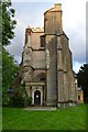
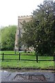
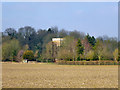
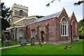
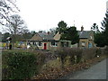
The approximate site can be seen to the side of the church, where a small picturesque pool of water is apparent. The well and church sit below Ravensburgh Castle hill fort and so probably had an ancient origin.
You may be viewing yesterday's version of this page. To see the most up to date information please register for a free account.
Do not use the above information on other web sites or publications without permission of the contributor.
Nearby Images from Geograph Britain and Ireland:
©2017(licence)
©2021(licence)
©2016(licence)
©2017(licence)
©2006(licence)
The above images may not be of the site on this page, they are loaded from Geograph.
Please Submit an Image of this site or go out and take one for us!
Click here to see more info for this site
Nearby sites
Key: Red: member's photo, Blue: 3rd party photo, Yellow: other image, Green: no photo - please go there and take one, Grey: site destroyed
Download sites to:
KML (Google Earth)
GPX (GPS waypoints)
CSV (Garmin/Navman)
CSV (Excel)
To unlock full downloads you need to sign up as a Contributory Member. Otherwise downloads are limited to 50 sites.
Turn off the page maps and other distractions
Nearby sites listing. In the following links * = Image available
894m SSW 208° Ravensburgh Castle* Hillfort (TL099295)
2.1km SE 140° Telegraph Hill (Lilley Hoo) Bowl Barrow Round Barrow(s) (TL117287)
2.3km ESE 103° Deacon Hill* Hillfort (TL12602982)
2.9km E 88° Tingley Field Plantation Round Barrow* Round Barrow(s) (TL1324030475)
3.1km ENE 78° Knocking Knoll* Long Barrow (TL133310)
3.5km SSW 200° Galley Hill (Streatley)* Round Barrow(s) (TL092270)
3.5km WSW 256° Sharpenhoe Burial Mound* Round Barrow(s)
3.8km W 273° Sharpenhoe Clappers* Hillfort (TL065304)
4.2km SSW 204° Dray's Ditches* Misc. Earthwork (TL08642641)
6.9km SW 217° Waulud's Bank* Henge (TL062247)
8.1km E 99° North Herts Museum* Museum (TL18342926)
9.3km W 263° Conger Hill* Hillfort (TL011289)
10.1km ENE 79° Wilbury Hill* Hillfort (TL202325)
11.3km NNW 336° Houghton Conquest Long Barrow (TL055405)
11.6km ESE 103° Priory Well (Hertfordshire)* Holy Well or Sacred Spring (TL217279)
11.8km NE 51° Etonbury Fort* Hillfort (TL1929637984)
13.2km SW 235° Maiden Bower Causewayed Enclosure Causewayed Enclosure (SP99662247)
13.3km SW 235° Maiden Bower* Hillfort (SP995225)
13.4km SW 227° Five Knolls* Barrow Cemetery (TL00632103)
13.4km ENE 75° Norton Henge Henge (TL232341)
14.2km ENE 74° Letchworth Cursus Cursus (TL239344)
14.8km NW 317° The Devil's stone (Bedfordshire)* Standing Stone (Menhir) (SP9989840865)
15.0km ESE 118° Six Hills* Round Barrow(s) (TL23742365)
15.3km E 85° Weston Hill Henge* Henge (TL256319)
16.6km ENE 76° Barrows under A505 Barrow Cemetery (TL264346)
View more nearby sites and additional images


 We would like to know more about this location. Please feel free to add a brief description and any relevant information in your own language.
 Wir möchten mehr über diese Stätte erfahren. Bitte zögern Sie nicht, eine kurze Beschreibung und relevante Informationen in Deutsch hinzuzufügen.
 Nous aimerions en savoir encore un peu sur les lieux. S'il vous plaît n'hesitez pas à ajouter une courte description et tous les renseignements pertinents dans votre propre langue.
 Quisieramos informarnos un poco más de las lugares. No dude en añadir una breve descripción y otros datos relevantes en su propio idioma.