<< Our Photo Pages >> Dray's Ditches - Misc. Earthwork in England in Bedfordshire
Submitted by coldrum on Wednesday, 01 September 2010 Page Views: 8531
Multi-periodSite Name: Dray's DitchesCountry: England
NOTE: This site is 6.734 km away from the location you searched for.
County: Bedfordshire Type: Misc. Earthwork
Map Ref: TL08642641
Latitude: 51.925617N Longitude: 0.421516W
Condition:
| 5 | Perfect |
| 4 | Almost Perfect |
| 3 | Reasonable but with some damage |
| 2 | Ruined but still recognisable as an ancient site |
| 1 | Pretty much destroyed, possibly visible as crop marks |
| 0 | No data. |
| -1 | Completely destroyed |
| 5 | Superb |
| 4 | Good |
| 3 | Ordinary |
| 2 | Not Good |
| 1 | Awful |
| 0 | No data. |
| 5 | Can be driven to, probably with disabled access |
| 4 | Short walk on a footpath |
| 3 | Requiring a bit more of a walk |
| 2 | A long walk |
| 1 | In the middle of nowhere, a nightmare to find |
| 0 | No data. |
| 5 | co-ordinates taken by GPS or official recorded co-ordinates |
| 4 | co-ordinates scaled from a detailed map |
| 3 | co-ordinates scaled from a bad map |
| 2 | co-ordinates of the nearest village |
| 1 | co-ordinates of the nearest town |
| 0 | no data |
Internal Links:
External Links:
I have visited· I would like to visit
Andy B has visited here
")
From Pastscape:
"Iron Age linear earthwork overlaying Bronze Age occupation."
More information here:
Pastscape
You may be viewing yesterday's version of this page. To see the most up to date information please register for a free account.
")
Do not use the above information on other web sites or publications without permission of the contributor.
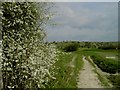
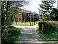
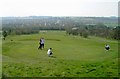
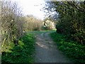
Nearby Images from Geograph Britain and Ireland:
©2009(licence)
©2007(licence)
©2007(licence)
©2007(licence)
©2007(licence)
The above images may not be of the site on this page, they are loaded from Geograph.
Please Submit an Image of this site or go out and take one for us!
Click here to see more info for this site
Nearby sites
Key: Red: member's photo, Blue: 3rd party photo, Yellow: other image, Green: no photo - please go there and take one, Grey: site destroyed
Download sites to:
KML (Google Earth)
GPX (GPS waypoints)
CSV (Garmin/Navman)
CSV (Excel)
To unlock full downloads you need to sign up as a Contributory Member. Otherwise downloads are limited to 50 sites.
Turn off the page maps and other distractions
Nearby sites listing. In the following links * = Image available
812m NE 45° Galley Hill (Streatley)* Round Barrow(s) (TL092270)
3.0km SW 236° Waulud's Bank* Henge (TL062247)
3.3km NNE 23° Ravensburgh Castle* Hillfort (TL099295)
3.4km NNW 331° Sharpenhoe Burial Mound* Round Barrow(s)
3.8km NE 54° Telegraph Hill (Lilley Hoo) Bowl Barrow Round Barrow(s) (TL117287)
4.2km NNE 24° St Faith's Well* Holy Well or Sacred Spring (TL103303)
4.5km NNW 333° Sharpenhoe Clappers* Hillfort (TL065304)
5.2km NE 50° Deacon Hill* Hillfort (TL12602982)
6.1km NE 50° Tingley Field Plantation Round Barrow* Round Barrow(s) (TL1324030475)
6.5km NE 47° Knocking Knoll* Long Barrow (TL133310)
7.9km WNW 290° Conger Hill* Hillfort (TL011289)
9.6km WSW 237° Five Knolls* Barrow Cemetery (TL00632103)
9.8km WSW 248° Maiden Bower Causewayed Enclosure Causewayed Enclosure (SP99662247)
9.9km WSW 248° Maiden Bower* Hillfort (SP995225)
10.1km ENE 75° North Herts Museum* Museum (TL18342926)
13.0km ENE 63° Wilbury Hill* Hillfort (TL202325)
13.1km E 85° Priory Well (Hertfordshire)* Holy Well or Sacred Spring (TL217279)
13.8km WSW 239° Edlesborough* Artificial Mound (SP970190)
14.4km NNW 349° Houghton Conquest Long Barrow (TL055405)
14.9km SW 233° Ivinghoe Beacon Barrow* Round Barrow(s) (SP96931709)
15.1km S 178° The Aubreys* Hillfort (TL095113)
15.3km ESE 102° Six Hills* Round Barrow(s) (TL23742365)
15.7km NE 44° Etonbury Fort* Hillfort (TL1929637984)
15.7km SW 229° Mead's Plantation Ancient Village or Settlement (SP97021576)
15.8km SW 234° Ivinghoe Beacon* Hillfort (SP960169)
View more nearby sites and additional images


 We would like to know more about this location. Please feel free to add a brief description and any relevant information in your own language.
 Wir möchten mehr über diese Stätte erfahren. Bitte zögern Sie nicht, eine kurze Beschreibung und relevante Informationen in Deutsch hinzuzufügen.
 Nous aimerions en savoir encore un peu sur les lieux. S'il vous plaît n'hesitez pas à ajouter une courte description et tous les renseignements pertinents dans votre propre langue.
 Quisieramos informarnos un poco más de las lugares. No dude en añadir una breve descripción y otros datos relevantes en su propio idioma.