<< Text Pages >> Grotte des Pigeons - Cave or Rock Shelter in Morocco
Submitted by KaiHofmann on Monday, 14 May 2012 Page Views: 6994
Natural PlacesSite Name: Grotte des PigeonsCountry: Morocco
NOTE: This site is 72.236 km away from the location you searched for.
Type: Cave or Rock Shelter
Nearest Town: Berkane Nearest Village: Taforalt
Latitude: 34.814536N Longitude: 2.404262W
Condition:
| 5 | Perfect |
| 4 | Almost Perfect |
| 3 | Reasonable but with some damage |
| 2 | Ruined but still recognisable as an ancient site |
| 1 | Pretty much destroyed, possibly visible as crop marks |
| 0 | No data. |
| -1 | Completely destroyed |
| 5 | Superb |
| 4 | Good |
| 3 | Ordinary |
| 2 | Not Good |
| 1 | Awful |
| 0 | No data. |
| 5 | Can be driven to, probably with disabled access |
| 4 | Short walk on a footpath |
| 3 | Requiring a bit more of a walk |
| 2 | A long walk |
| 1 | In the middle of nowhere, a nightmare to find |
| 0 | No data. |
| 5 | co-ordinates taken by GPS or official recorded co-ordinates |
| 4 | co-ordinates scaled from a detailed map |
| 3 | co-ordinates scaled from a bad map |
| 2 | co-ordinates of the nearest village |
| 1 | co-ordinates of the nearest town |
| 0 | no data |
Internal Links:
External Links:
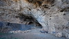
In this cave scientists found 180 palaeolitic skelletons and the earliest example (82.000 BCE) of art/jewellery: pierced seashells.
The cave belongs to the UNESCO world heritage.
You may be viewing yesterday's version of this page. To see the most up to date information please register for a free account.
Do not use the above information on other web sites or publications without permission of the contributor.
Nearby Images from Flickr
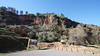
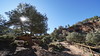
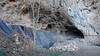
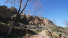
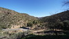
The above images may not be of the site on this page, but were taken nearby. They are loaded from Flickr so please click on them for image credits.
Click here to see more info for this site
Nearby sites
Click here to view sites on an interactive map of the areaKey: Red: member's photo, Blue: 3rd party photo, Yellow: other image, Green: no photo - please go there and take one, Grey: site destroyed
Download sites to:
KML (Google Earth)
GPX (GPS waypoints)
CSV (Garmin/Navman)
CSV (Excel)
To unlock full downloads you need to sign up as a Contributory Member. Otherwise downloads are limited to 50 sites.
Turn off the page maps and other distractions
Nearby sites listing. In the following links * = Image available
225.5km N 358° La Alcazaba Ancient Village or Settlement
239.5km N 358° Los Millares* Ancient Village or Settlement
243.7km NNW 332° Necrópolis Fenicio-Púnica Puente de Noy* Rock Cut Tomb
252.6km NNW 329° Caves of Nerja* Cave or Rock Shelter
276.3km NW 322° Dolmen Cerro de la Corona* Burial Chamber or Dolmen
277.0km NNW 332° Los Bermejales 7* Burial Chamber or Dolmen
277.4km NNW 331° Los Bermejales 4* Cist
277.4km NNW 331° Los Bermejales 5* Cist
277.9km NW 319° Cerro Del Villar* Ancient Village or Settlement
279.0km NNW 331° Los Bermejales 1* Burial Chamber or Dolmen
280.3km NNW 328° Dólmen de Llano de Zafarraya Burial Chamber or Dolmen
281.5km NW 325° Necrópolis de la Peña de Hierro Cist
282.6km NNW 338° Dólmen del Parque de las Ciencias* Modern Stone Circle etc
283.7km NNW 339° Abadia del Sacromonte* Cave or Rock Shelter
283.8km NNW 338° Museo Arqueológico y Etnológico de Granada* Museum
291.5km NW 322° Necrópolis de Las Chaperas Burial Chamber or Dolmen
292.3km NW 323° Dólmen del Tajillo del Moro* Burial Chamber or Dolmen
292.4km NW 323° Peñas de Cabrera* Rock Art
293.7km NNW 337° Zona Arqueológica de Medina Elvira Ancient Village or Settlement
294.9km NNW 344° Necrópolis Megalitica de Panoria* Burial Chamber or Dolmen
297.3km NNW 347° Fonelas Megalithic cemetery* Burial Chamber or Dolmen
297.8km N 349° Gorafe 142 Burial Chamber or Dolmen
297.8km N 349° Gorafe 143 Burial Chamber or Dolmen
297.9km N 349° Gorafe 141 Burial Chamber or Dolmen
297.9km N 349° Gorafe 140* Burial Chamber or Dolmen
View more nearby sites and additional images


 We would like to know more about this location. Please feel free to add a brief description and any relevant information in your own language.
 Wir möchten mehr über diese Stätte erfahren. Bitte zögern Sie nicht, eine kurze Beschreibung und relevante Informationen in Deutsch hinzuzufügen.
 Nous aimerions en savoir encore un peu sur les lieux. S'il vous plaît n'hesitez pas à ajouter une courte description et tous les renseignements pertinents dans votre propre langue.
 Quisieramos informarnos un poco más de las lugares. No dude en añadir una breve descripción y otros datos relevantes en su propio idioma.