<< Text Pages >> Clerk's Well (Farringdon Lane) - Holy Well or Sacred Spring in England in Greater London
Submitted by Anne T on Saturday, 05 January 2019 Page Views: 1606
Springs and Holy WellsSite Name: Clerk's Well (Farringdon Lane)Country: England County: Greater London Type: Holy Well or Sacred Spring
Nearest Town: Clerkenwell (EC1)
Map Ref: TQ3145282134
Latitude: 51.522832N Longitude: 0.106651W
Condition:
| 5 | Perfect |
| 4 | Almost Perfect |
| 3 | Reasonable but with some damage |
| 2 | Ruined but still recognisable as an ancient site |
| 1 | Pretty much destroyed, possibly visible as crop marks |
| 0 | No data. |
| -1 | Completely destroyed |
| 5 | Superb |
| 4 | Good |
| 3 | Ordinary |
| 2 | Not Good |
| 1 | Awful |
| 0 | No data. |
| 5 | Can be driven to, probably with disabled access |
| 4 | Short walk on a footpath |
| 3 | Requiring a bit more of a walk |
| 2 | A long walk |
| 1 | In the middle of nowhere, a nightmare to find |
| 0 | No data. |
| 5 | co-ordinates taken by GPS or official recorded co-ordinates |
| 4 | co-ordinates scaled from a detailed map |
| 3 | co-ordinates scaled from a bad map |
| 2 | co-ordinates of the nearest village |
| 1 | co-ordinates of the nearest town |
| 0 | no data |
Be the first person to rate this site - see the 'Contribute!' box in the right hand menu.
Internal Links:
External Links:
Holy Well or Sacred Spring in Greater London
The Journal of Antiquities features a page for this well - see their entry for Clerk’s Well, Farringdon Lane, Clerkenwell, London E.C.1. The Journal tells us: "it may have originally been a holy well, but was probably more a sacred well, where, in the distant past, miracle plays were performed by the parish clerks; further back into history it was perhaps associated with St Mary's nunnery …. adjoining the nunnery was St John's Priory, the headquarters of the medieval Knights Hospitallers".
The Journal adds the well was re-discovered in 1924 after having been lost for some time. A pump at the corner of Ray Street used to be connected to this chalybeate spring, which was first recorded in 1174. It is now located down some steps in the basement of no. 16 Well Court, a modern office block in Farringdon Lane, between Ray Street and Vine Street.
The Journal lists reference sources and related websites which provide more information. The well is also scheduled as Historic England List ID 1298055 and recorded as Pastscape Monument No. 404731.
You may be viewing yesterday's version of this page. To see the most up to date information please register for a free account.
Do not use the above information on other web sites or publications without permission of the contributor.
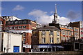
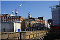
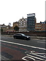
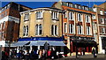
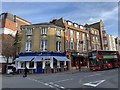
Nearby Images from Geograph Britain and Ireland:
©2019(licence)
©2016(licence)
©2018(licence)
©2019(licence)
©2019(licence)
The above images may not be of the site on this page, they are loaded from Geograph.
Please Submit an Image of this site or go out and take one for us!
Click here to see more info for this site
Nearby sites
Key: Red: member's photo, Blue: 3rd party photo, Yellow: other image, Green: no photo - please go there and take one, Grey: site destroyed
Download sites to:
KML (Google Earth)
GPX (GPS waypoints)
CSV (Garmin/Navman)
CSV (Excel)
To unlock full downloads you need to sign up as a Contributory Member. Otherwise downloads are limited to 50 sites.
Turn off the page maps and other distractions
Nearby sites listing. In the following links * = Image available
165m WNW 295° Skinner's Well (Finsbury) Holy Well or Sacred Spring (TQ313822)
460m SE 136° Cow Cross (Finsbury) Ancient Cross (TQ31788181)
905m SE 136° Museum of London* Museum (TQ321815)
935m S 179° Bridewell (Fleet Street) Holy Well or Sacred Spring (TQ315812)
1.2km SE 143° Broken Cross (Westminster) Ancient Cross (TQ322812)
1.5km SE 137° Mithras Temple (London)* Ancient Temple (TQ3252181031)
1.5km WSW 251° British Museum* Museum (TQ300816)
1.7km SE 137° London Stone* Standing Stone (Menhir) (TQ3267680903)
1.8km W 273° Petrie Museum of Egyptian Archaeology* Museum (TQ2962882172)
1.9km SSW 211° Cleopatra's Needle (London)* Standing Stone (Menhir) (TQ3054380516)
2.2km W 259° The One and The Many* Modern Stone Circle etc (TQ2926981650)
2.4km SE 128° All Hallows by the Tower* Museum (TQ3337380695)
2.5km SE 127° St Olave's Well* Holy Well or Sacred Spring (TQ335807)
3.6km S 170° Cuming Museum Museum (TQ322786)
4.2km SSW 199° Mesolithic structure near Vauxhall bridge* Timber Circle (TQ30217814)
5.1km SW 225° Tutankhamun: Treasures of the Golden Pharaoh exhibition, Saatchi Gallery* Museum (TQ279784)
5.4km N 6° Finsbury Park earthworks* Artificial Mound (TQ3186087537)
5.7km WSW 240° London Natural History Museum* Museum (TQ266792)
5.8km WSW 249° St Govor's Well* Holy Well or Sacred Spring (TQ2605079887)
6.0km NW 319° Hampstead Heath Barrow* Round Barrow(s) (TQ2738286518)
6.1km NW 311° Chalybeate Well* Holy Well or Sacred Spring (TQ2671986055)
7.7km NNE 19° St. Eloy's Well* Holy Well or Sacred Spring (TQ338895)
8.1km W 273° Kensal Green* Modern Stone Circle etc (TQ233824)
8.3km NNW 343° Mus Well (Muswell Hill) Holy Well or Sacred Spring (TQ28869001)
8.6km NNW 347° St. Dunstan's Well Holy Well or Sacred Spring (TQ293905)
View more nearby sites and additional images


 We would like to know more about this location. Please feel free to add a brief description and any relevant information in your own language.
 Wir möchten mehr über diese Stätte erfahren. Bitte zögern Sie nicht, eine kurze Beschreibung und relevante Informationen in Deutsch hinzuzufügen.
 Nous aimerions en savoir encore un peu sur les lieux. S'il vous plaît n'hesitez pas à ajouter une courte description et tous les renseignements pertinents dans votre propre langue.
 Quisieramos informarnos un poco más de las lugares. No dude en añadir una breve descripción y otros datos relevantes en su propio idioma.