


<< Text Pages >> Cow Cross (Finsbury) - Ancient Cross in England in Greater London
Submitted by Anne T on Thursday, 13 July 2017 Page Views: 2007
Early Medieval (Dark Age)Site Name: Cow Cross (Finsbury)Country: England County: Greater London Type: Ancient Cross
Nearest Town: London Nearest Village: Finsbury
Map Ref: TQ31788181
Latitude: 51.519844N Longitude: 0.102047W
Condition:
| 5 | Perfect |
| 4 | Almost Perfect |
| 3 | Reasonable but with some damage |
| 2 | Ruined but still recognisable as an ancient site |
| 1 | Pretty much destroyed, possibly visible as crop marks |
| 0 | No data. |
| -1 | Completely destroyed |
| 5 | Superb |
| 4 | Good |
| 3 | Ordinary |
| 2 | Not Good |
| 1 | Awful |
| 0 | No data. |
| 5 | Can be driven to, probably with disabled access |
| 4 | Short walk on a footpath |
| 3 | Requiring a bit more of a walk |
| 2 | A long walk |
| 1 | In the middle of nowhere, a nightmare to find |
| 0 | No data. |
| 5 | co-ordinates taken by GPS or official recorded co-ordinates |
| 4 | co-ordinates scaled from a detailed map |
| 3 | co-ordinates scaled from a bad map |
| 2 | co-ordinates of the nearest village |
| 1 | co-ordinates of the nearest town |
| 0 | no data |
Internal Links:
External Links:
Ancient Cross in Greater London
The Cow Cross used to be near the long lost Fag Well, and is marked on the 1896 OS maps on the junction of Charterhouse Street and Cow Cross Street. The Northern Antiquarian (TNA) features a page for this site - see their entry for Cow Cross, Finsbury, London, Middlesex. The TNA entry includes an image of the 1896 map and a brief archaeology and history of the site, which apparently took its name from the cattle market that took place here from the 12th century onwards.
There is also a brief entry on Pastscape Monument No. 404917 which records this as a "Medieval or later cross shown on Ordnance Survey maps of 1914."
Note: Do you have any historical documents that mention this cross or which include any images you can add?
You may be viewing yesterday's version of this page. To see the most up to date information please register for a free account.
Do not use the above information on other web sites or publications without permission of the contributor.
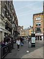
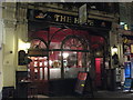
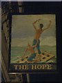
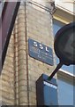
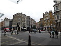
Nearby Images from Geograph Britain and Ireland:
©2015(licence)
©2010(licence)
©2010(licence)
©2019(licence)
©2020(licence)
The above images may not be of the site on this page, they are loaded from Geograph.
Please Submit an Image of this site or go out and take one for us!
Click here to see more info for this site
Nearby sites
Key: Red: member's photo, Blue: 3rd party photo, Yellow: other image, Green: no photo - please go there and take one, Grey: site destroyed
Download sites to:
KML (Google Earth)
GPX (GPS waypoints)
CSV (Garmin/Navman)
CSV (Excel)
To unlock full downloads you need to sign up as a Contributory Member. Otherwise downloads are limited to 50 sites.
Turn off the page maps and other distractions
Nearby sites listing. In the following links * = Image available
445m SE 136° Museum of London* Museum (TQ321815)
460m NW 316° Clerk's Well (Farringdon Lane) Holy Well or Sacred Spring (TQ3145282134)
617m NW 311° Skinner's Well (Finsbury) Holy Well or Sacred Spring (TQ313822)
671m SSW 206° Bridewell (Fleet Street) Holy Well or Sacred Spring (TQ315812)
740m SSE 147° Broken Cross (Westminster) Ancient Cross (TQ322812)
1.1km SE 138° Mithras Temple (London)* Ancient Temple (TQ3252181031)
1.3km SE 137° London Stone* Standing Stone (Menhir) (TQ3267680903)
1.8km W 265° British Museum* Museum (TQ300816)
1.8km SW 225° Cleopatra's Needle (London)* Standing Stone (Menhir) (TQ3054380516)
1.9km SE 127° All Hallows by the Tower* Museum (TQ3337380695)
2.0km SE 124° St Olave's Well* Holy Well or Sacred Spring (TQ335807)
2.2km W 281° Petrie Museum of Egyptian Archaeology* Museum (TQ2962882172)
2.5km W 268° The One and The Many* Modern Stone Circle etc (TQ2926981650)
3.2km S 174° Cuming Museum Museum (TQ322786)
4.0km SSW 205° Mesolithic structure near Vauxhall bridge* Timber Circle (TQ30217814)
5.2km SW 230° Tutankhamun: Treasures of the Golden Pharaoh exhibition, Saatchi Gallery* Museum (TQ279784)
5.7km N 2° Finsbury Park earthworks* Artificial Mound (TQ3186087537)
5.8km WSW 245° London Natural History Museum* Museum (TQ266792)
6.0km WSW 253° St Govor's Well* Holy Well or Sacred Spring (TQ2605079887)
6.4km NW 319° Hampstead Heath Barrow* Round Barrow(s) (TQ2738286518)
6.6km NW 312° Chalybeate Well* Holy Well or Sacred Spring (TQ2671986055)
7.9km NNE 16° St. Eloy's Well* Holy Well or Sacred Spring (TQ338895)
8.5km SE 125° Greenwich Park Barrows* Barrow Cemetery (TQ3883677128)
8.5km W 275° Kensal Green* Modern Stone Circle etc (TQ233824)
8.7km SE 141° Hilly Fields Stone Circle* Modern Stone Circle etc (TQ374752)
View more nearby sites and additional images


 We would like to know more about this location. Please feel free to add a brief description and any relevant information in your own language.
 Wir möchten mehr über diese Stätte erfahren. Bitte zögern Sie nicht, eine kurze Beschreibung und relevante Informationen in Deutsch hinzuzufügen.
 Nous aimerions en savoir encore un peu sur les lieux. S'il vous plaît n'hesitez pas à ajouter une courte description et tous les renseignements pertinents dans votre propre langue.
 Quisieramos informarnos un poco más de las lugares. No dude en añadir una breve descripción y otros datos relevantes en su propio idioma.