<< Text Pages >> Resolute Thule Houses - Ancient Village or Settlement in Canada
Submitted by bat400 on Monday, 30 April 2007 Page Views: 17368
Multi-periodSite Name: Resolute Thule HousesCountry: Canada
NOTE: This site is 412.293 km away from the location you searched for.
Type: Ancient Village or Settlement
Nearest Village: Resolute
Latitude: 74.697500N Longitude: 94.8322W
Condition:
| 5 | Perfect |
| 4 | Almost Perfect |
| 3 | Reasonable but with some damage |
| 2 | Ruined but still recognisable as an ancient site |
| 1 | Pretty much destroyed, possibly visible as crop marks |
| 0 | No data. |
| -1 | Completely destroyed |
| 5 | Superb |
| 4 | Good |
| 3 | Ordinary |
| 2 | Not Good |
| 1 | Awful |
| 0 | No data. |
| 5 | Can be driven to, probably with disabled access |
| 4 | Short walk on a footpath |
| 3 | Requiring a bit more of a walk |
| 2 | A long walk |
| 1 | In the middle of nowhere, a nightmare to find |
| 0 | No data. |
| 5 | co-ordinates taken by GPS or official recorded co-ordinates |
| 4 | co-ordinates scaled from a detailed map |
| 3 | co-ordinates scaled from a bad map |
| 2 | co-ordinates of the nearest village |
| 1 | co-ordinates of the nearest town |
| 0 | no data |
Be the first person to rate this site - see the 'Contribute!' box in the right hand menu.
Internal Links:
External Links:
Ancient Village or Settlement in Nunavut, Canada.
Several Thule house site lie just west of Resolute [Qausuittuq], Nunavut. These are unexcavated, but excavation and reconstruction are planned for the 2007 season. The location given is for the village of Resolute.
Thule homes were permanent seasonal dwellings, dug into the earth and lined with flat sided stones to make a floor. The homes would be roofed over, generally by large bones and layers of plants and earth for insulation. One entered the home by going down and then rising into the living area, situated above the entrance. This kept warm air from an oil lamp / hearth and the people themselves trapped inside the house.
The people of the Thule culture (1000 AD - 1200 AD) were direct predecessors to the modern arctic North Americans.
Note: See the article on the planned excavation of these two winter homes.
You may be viewing yesterday's version of this page. To see the most up to date information please register for a free account.
Do not use the above information on other web sites or publications without permission of the contributor.
Nearby Images from Flickr
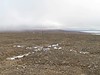
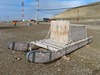

The above images may not be of the site on this page, but were taken nearby. They are loaded from Flickr so please click on them for image credits.
Click here to see more info for this site
Nearby sites
Click here to view sites on an interactive map of the areaKey: Red: member's photo, Blue: 3rd party photo, Yellow: other image, Green: no photo - please go there and take one, Grey: site destroyed
Download sites to:
KML (Google Earth)
GPX (GPS waypoints)
CSV (Garmin/Navman)
CSV (Excel)
To unlock full downloads you need to sign up as a Contributory Member. Otherwise downloads are limited to 50 sites.
Turn off the page maps and other distractions
Nearby sites listing. In the following links * = Image available
1578.6km E 90° Ilulissat Museum* Museum
1579.2km E 90° Sermermiut* Ancient Village or Settlement
1701.9km N 1° Termas Romanas Toledo* Museum
1712.3km SE 136° Qajartalik Petroglyphs Rock Art
1807.4km W 266° Bluefish Caves* Cave or Rock Shelter
1937.8km WNW 290° Birnirk National Historic Landmark* Artificial Mound
1982.0km ENE 60° Rendalen Hut Site* Ancient Village or Settlement
2063.3km SSW 209° Quarry of the Ancestors Ancient Mine, Quarry or other Industry
2195.6km ENE 67° Danmark Ø Hut Foundations* Ancient Village or Settlement
2200.1km W 265° Upward Sun River* Ancient Village or Settlement
2208.4km W 265° Swan Point Archaeological Site* Ancient Village or Settlement
2222.4km WSW 248° Yukon Beringia Interpretive Centre* Museum
2223.5km SSW 198° Lac La Ronge Rock Art Rock Art
2225.3km WNW 285° Feniak Lake* Rock Art
2314.7km W 264° Tangle Lakes Archaeological District* Ancient Village or Settlement
2317.4km WNW 282° Onion Portage Archaeological District* Ancient Village or Settlement
2355.3km S 190° Kapakoskasewakak Lake stones Stone Row / Alignment
2555.0km SSW 199° Wanuskewin Heritage Park* Museum
2570.7km WSW 239° Petroglyph Beach* Rock Art
2578.5km WSW 243° Hidden Falls Ancient Village or Settlement
2583.5km SW 232° 'Ksan Historical Village and Museum* Museum
2616.4km WSW 240° On-Your-Knees Cave* Cave or Rock Shelter
2625.2km SW 224° Beaverly Workshop Ancient Mine, Quarry or other Industry
2687.6km ENE 74° Flókatóftir Ancient Village or Settlement
2696.2km SW 214° Cataract Creek Petroglyphs* Rock Art
View more nearby sites and additional images


 We would like to know more about this location. Please feel free to add a brief description and any relevant information in your own language.
 Wir möchten mehr über diese Stätte erfahren. Bitte zögern Sie nicht, eine kurze Beschreibung und relevante Informationen in Deutsch hinzuzufügen.
 Nous aimerions en savoir encore un peu sur les lieux. S'il vous plaît n'hesitez pas à ajouter une courte description et tous les renseignements pertinents dans votre propre langue.
 Quisieramos informarnos un poco más de las lugares. No dude en añadir una breve descripción y otros datos relevantes en su propio idioma.