<< Our Photo Pages >> Umba ancient labyrinth - Turf Maze in Russia
Submitted by AlexAssa on Sunday, 08 November 2015 Page Views: 3781
Multi-periodSite Name: Umba ancient labyrinth Alternative Name: Stone Labyrinth UmbaCountry: Russia
NOTE: This site is 31.463 km away from the location you searched for.
Type: Turf Maze
Nearest Town: Murmansk Nearest Village: Umba
Latitude: 66.677829N Longitude: 34.344261E
Condition:
| 5 | Perfect |
| 4 | Almost Perfect |
| 3 | Reasonable but with some damage |
| 2 | Ruined but still recognisable as an ancient site |
| 1 | Pretty much destroyed, possibly visible as crop marks |
| 0 | No data. |
| -1 | Completely destroyed |
| 5 | Superb |
| 4 | Good |
| 3 | Ordinary |
| 2 | Not Good |
| 1 | Awful |
| 0 | No data. |
| 5 | Can be driven to, probably with disabled access |
| 4 | Short walk on a footpath |
| 3 | Requiring a bit more of a walk |
| 2 | A long walk |
| 1 | In the middle of nowhere, a nightmare to find |
| 0 | No data. |
| 5 | co-ordinates taken by GPS or official recorded co-ordinates |
| 4 | co-ordinates scaled from a detailed map |
| 3 | co-ordinates scaled from a bad map |
| 2 | co-ordinates of the nearest village |
| 1 | co-ordinates of the nearest town |
| 0 | no data |
Internal Links:
External Links:
")
"Some of labyrinths are located near other archaeological objects (primeval site, prehistoric burial places) where the quartz scrapers and drawing knifes, the shale arrowhead, the fragments of asbestine ceramics and the rare fragments of vessels decorated with an ornament have been found. The finding of these cultural artifacts attributes to the so-called "culture of Arctic Neolith (late Stone Age)", which approximately had dated back to the temporal interval of V-I millennium B.C. It allowed Gurina N.N. (1948; 1953), Mullo I.M. (1966) and others to compare age of the labyrinths known in the Kola region and located close to the primeval archeological sites just with the epoch of late Stone Age. Afterwards this age was extrapolated for all stone labyrinths available in the Kola region, and not just on those located near the primeval archeological sites. Due to works of the archeologists the age of the Kola labyrinths is already traditionally defined as the second millennium B.C., i.e. estimated as 3000-4000 years B.P."
Check it here.
You may be viewing yesterday's version of this page. To see the most up to date information please register for a free account.
Do not use the above information on other web sites or publications without permission of the contributor.
Nearby Images from Flickr
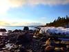
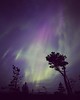
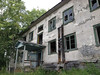
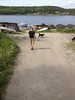
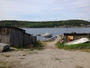
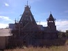
The above images may not be of the site on this page, but were taken nearby. They are loaded from Flickr so please click on them for image credits.
Click here to see more info for this site
Nearby sites
Click here to view sites on an interactive map of the areaKey: Red: member's photo, Blue: 3rd party photo, Yellow: other image, Green: no photo - please go there and take one, Grey: site destroyed
Download sites to:
KML (Google Earth)
GPX (GPS waypoints)
CSV (Garmin/Navman)
CSV (Excel)
To unlock full downloads you need to sign up as a Contributory Member. Otherwise downloads are limited to 50 sites.
Turn off the page maps and other distractions
Nearby sites listing. In the following links * = Image available
40.2km NNW 344° Lake Kanozero* Carving
49.0km SW 218° Seyd of Chupskaya Guba* Natural Stone / Erratic / Other Natural Feature
94.9km WNW 302° Kandalaksha* Turf Maze
119.3km SSE 168° Ostrov Bol'shoy Rob'yak* Standing Stones
189.7km SSE 154° Pyramid island Anzer* Artificial Mound
195.2km SSE 168° Oleshin Island* Turf Maze
197.7km SSW 208° Vottovaara Mountain* Natural Stone / Erratic / Other Natural Feature
199.0km SSE 162° Labyrinth Big Zayatsky Island* Turf Maze
244.7km S 177° Zalavruga* Rock Art
257.7km NNW 348° Crow Stone complex* Stone Circle
298.3km NNW 348° Seids Ura-Guba* Natural Stone / Erratic / Other Natural Feature
365.5km NNW 344° Dva Brata Natural Stone / Erratic / Other Natural Feature
388.1km NW 314° Ukonkivi Round Cairn
401.7km WSW 252° Kierikki Keskus Ancient Village or Settlement
415.7km WSW 253° Metelinkirkko, Huhinmaa Giant's Church Stone Fort or Dun
419.6km WSW 255° Hankapalo Giant's Church Stone Fort or Dun
420.1km WSW 252° Mäntyselkä Giant's Church Stone Fort or Dun
420.4km WSW 251° Rajakangas Giant's Church* Stone Fort or Dun
420.9km W 262° Jatulinlehto Giant's Church Stone Fort or Dun
421.5km WSW 246° Jättiläissaari Giant's Church Stone Fort or Dun
422.9km WSW 251° Laivakangas NE Giant's Church Stone Fort or Dun
429.2km WSW 249° Linnasaari Giant's Church Stone Fort or Dun
442.2km WSW 244° Hautakangas Giant's Church (Tyrnävä) Stone Fort or Dun
442.3km WSW 245° Metelinkangas Giant's Church Stone Fort or Dun
450.9km W 261° Ruutinpuisto Stonehenge* Modern Stone Circle etc
View more nearby sites and additional images


 We would like to know more about this location. Please feel free to add a brief description and any relevant information in your own language.
 Wir möchten mehr über diese Stätte erfahren. Bitte zögern Sie nicht, eine kurze Beschreibung und relevante Informationen in Deutsch hinzuzufügen.
 Nous aimerions en savoir encore un peu sur les lieux. S'il vous plaît n'hesitez pas à ajouter une courte description et tous les renseignements pertinents dans votre propre langue.
 Quisieramos informarnos un poco más de las lugares. No dude en añadir una breve descripción y otros datos relevantes en su propio idioma.