<< Our Photo Pages >> Tingstajalabacken - Round Barrow(s) in Sweden in Medelpad
Submitted by Ogneslav on Wednesday, 22 January 2014 Page Views: 2739
Neolithic and Bronze AgeSite Name: Tingstajalabacken Alternative Name: Njurunda 114:2Country: Sweden
NOTE: This site is 6.903 km away from the location you searched for.
Landskap: Medelpad Type: Round Barrow(s)
Nearest Town: Sundsvall Nearest Village: Kvissleby
Latitude: 62.289241N Longitude: 17.375528E
Condition:
| 5 | Perfect |
| 4 | Almost Perfect |
| 3 | Reasonable but with some damage |
| 2 | Ruined but still recognisable as an ancient site |
| 1 | Pretty much destroyed, possibly visible as crop marks |
| 0 | No data. |
| -1 | Completely destroyed |
| 5 | Superb |
| 4 | Good |
| 3 | Ordinary |
| 2 | Not Good |
| 1 | Awful |
| 0 | No data. |
| 5 | Can be driven to, probably with disabled access |
| 4 | Short walk on a footpath |
| 3 | Requiring a bit more of a walk |
| 2 | A long walk |
| 1 | In the middle of nowhere, a nightmare to find |
| 0 | No data. |
| 5 | co-ordinates taken by GPS or official recorded co-ordinates |
| 4 | co-ordinates scaled from a detailed map |
| 3 | co-ordinates scaled from a bad map |
| 2 | co-ordinates of the nearest village |
| 1 | co-ordinates of the nearest town |
| 0 | no data |
Internal Links:
External Links:
")
You may be viewing yesterday's version of this page. To see the most up to date information please register for a free account.
Do not use the above information on other web sites or publications without permission of the contributor.
davidmorgan has found this location on Google Street View:
Nearby Images from Flickr


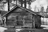
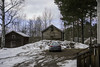
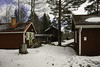

The above images may not be of the site on this page, but were taken nearby. They are loaded from Flickr so please click on them for image credits.
Click here to see more info for this site
Nearby sites
Click here to view sites on an interactive map of the areaKey: Red: member's photo, Blue: 3rd party photo, Yellow: other image, Green: no photo - please go there and take one, Grey: site destroyed
Download sites to:
KML (Google Earth)
GPX (GPS waypoints)
CSV (Garmin/Navman)
CSV (Excel)
To unlock full downloads you need to sign up as a Contributory Member. Otherwise downloads are limited to 50 sites.
Turn off the page maps and other distractions
Nearby sites listing. In the following links * = Image available
13.8km NNW 334° Högoms gravfält* Barrow Cemetery
20.6km WNW 293° Vattjom Gravfält* Barrow Cemetery
35.6km NNW 337° Naemforsen* Rock Art
60.7km SSW 197° Hög 50:1* Round Barrow(s)
60.7km SSW 197° Kungshögen* Round Barrow(s)
172.0km NW 307° Frösö Runestone* Carving
218.8km E 101° Merikarvia King's grave* Cairn
222.1km E 88° Susiluola* Cave or Rock Shelter
236.6km S 177° Vendeltidsmuseet* Museum
237.0km S 177° Vendlas hög* Round Barrow(s)
239.1km S 177° Ottarshögen* Round Barrow(s)
250.5km S 176° Runsten U 1034* Carving
250.6km S 176° Runsten U 1036* Carving
250.6km S 176° Runsten U 1035* Carving
251.4km SSE 147° Myran* Artificial Mound
251.6km SSE 147° Smidbacka* Artificial Mound
251.7km S 178° Runsten U 1050* Carving
251.7km S 178° Runsten U 1045* Carving
251.7km S 178° Runsten U 1046* Carving
251.7km S 178° Runsten U 1047* Carving
251.7km S 178° Runsten U 1048* Carving
253.2km S 177° Runsten U 1043* Carving
255.3km ENE 77° Hiivanaanen* Artificial Mound
255.3km ENE 77° Hiivanaasenkivi* Artificial Mound
256.0km ENE 69° Vahakyro* Barrow Cemetery
View more nearby sites and additional images


 We would like to know more about this location. Please feel free to add a brief description and any relevant information in your own language.
 Wir möchten mehr über diese Stätte erfahren. Bitte zögern Sie nicht, eine kurze Beschreibung und relevante Informationen in Deutsch hinzuzufügen.
 Nous aimerions en savoir encore un peu sur les lieux. S'il vous plaît n'hesitez pas à ajouter une courte description et tous les renseignements pertinents dans votre propre langue.
 Quisieramos informarnos un poco más de las lugares. No dude en añadir una breve descripción y otros datos relevantes en su propio idioma.