<< Our Photo Pages >> Myran - Artificial Mound in Finland
Submitted by ilsignorstano on Saturday, 05 November 2022 Page Views: 556
Multi-periodSite Name: MyranCountry: Finland Type: Artificial Mound
Nearest Town: Geta Nearest Village: Olofsnäs
Latitude: 60.365160N Longitude: 19.852310E
Condition:
| 5 | Perfect |
| 4 | Almost Perfect |
| 3 | Reasonable but with some damage |
| 2 | Ruined but still recognisable as an ancient site |
| 1 | Pretty much destroyed, possibly visible as crop marks |
| 0 | No data. |
| -1 | Completely destroyed |
| 5 | Superb |
| 4 | Good |
| 3 | Ordinary |
| 2 | Not Good |
| 1 | Awful |
| 0 | No data. |
| 5 | Can be driven to, probably with disabled access |
| 4 | Short walk on a footpath |
| 3 | Requiring a bit more of a walk |
| 2 | A long walk |
| 1 | In the middle of nowhere, a nightmare to find |
| 0 | No data. |
| 5 | co-ordinates taken by GPS or official recorded co-ordinates |
| 4 | co-ordinates scaled from a detailed map |
| 3 | co-ordinates scaled from a bad map |
| 2 | co-ordinates of the nearest village |
| 1 | co-ordinates of the nearest town |
| 0 | no data |
Internal Links:
External Links:
")
63 graves from Late Iron Age. Beautiful, well-kept burial ground with several interesting grave types.
You may be viewing yesterday's version of this page. To see the most up to date information please register for a free account.
")
")
")
")
Do not use the above information on other web sites or publications without permission of the contributor.
Nearby Images from Flickr

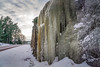
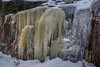
The above images may not be of the site on this page, but were taken nearby. They are loaded from Flickr so please click on them for image credits.
Click here to see more info for this site
Nearby sites
Click here to view sites on an interactive map of the areaKey: Red: member's photo, Blue: 3rd party photo, Yellow: other image, Green: no photo - please go there and take one, Grey: site destroyed
Download sites to:
KML (Google Earth)
GPX (GPS waypoints)
CSV (Garmin/Navman)
CSV (Excel)
To unlock full downloads you need to sign up as a Contributory Member. Otherwise downloads are limited to 50 sites.
Turn off the page maps and other distractions
Nearby sites listing. In the following links * = Image available
223m SSW 193° Smidbacka* Artificial Mound
12.9km S 172° Knösbackarna* Artificial Mound
14.2km SSW 208° Mellanåkersbacken* Artificial Mound
15.0km SE 132° Johannisberg (Kvarnbo)* Artificial Mound
15.2km SSW 203° Kvarnbacken* Artificial Mound
16.9km SSE 153° Flyhagen/Knösäkern* Artificial Mound
17.4km SE 128° Borgboda Hillfort* Hillfort
17.7km SSE 156° Björkens/Söderskog* Artificial Mound
21.7km SW 218° Knösgärdan Artificial Mound
115.5km ENE 60° Laitila* Barrow Cemetery
117.7km WSW 250° Runsten U 1012* Carving
125.0km ENE 77° Isotalo, Nousiainen* Cairn
125.4km WSW 238° Broborg Hillfort
125.8km WSW 254° Runsten U 1036* Carving
125.8km WSW 254° Runsten U 1034* Carving
125.8km WSW 254° Runsten U 1035* Carving
126.0km WSW 251° Runsten U 1033* Carving
126.2km W 261° Vendeltidsmuseet* Museum
126.2km W 261° Vendlas hög* Round Barrow(s)
127.3km WSW 250° Runsten U 1022* Carving
128.0km W 260° Ottarshögen* Round Barrow(s)
128.1km E 83° Altar Raisio* NOT SET
128.4km SW 230° Orkesta Runestones* Carving
128.7km WSW 253° Runsten U 1043* Carving
130.7km SW 226° Örsta hällristning* Rock Art
View more nearby sites and additional images


 We would like to know more about this location. Please feel free to add a brief description and any relevant information in your own language.
 Wir möchten mehr über diese Stätte erfahren. Bitte zögern Sie nicht, eine kurze Beschreibung und relevante Informationen in Deutsch hinzuzufügen.
 Nous aimerions en savoir encore un peu sur les lieux. S'il vous plaît n'hesitez pas à ajouter une courte description et tous les renseignements pertinents dans votre propre langue.
 Quisieramos informarnos un poco más de las lugares. No dude en añadir una breve descripción y otros datos relevantes en su propio idioma.