 with our Megalithic Portal iPhone app")


<< Text Pages >> Cairn O'Mey - Cairn in Scotland in Caithness
Submitted by SolarMegalith on Monday, 02 May 2011 Page Views: 4014
Neolithic and Bronze AgeSite Name: Cairn O'MeyCountry: Scotland
NOTE: This site is 0.938 km away from the location you searched for.
County: Caithness Type: Cairn
Nearest Village: Barrogill Mains
Map Ref: ND28657374
Latitude: 58.645632N Longitude: 3.231015W
Condition:
| 5 | Perfect |
| 4 | Almost Perfect |
| 3 | Reasonable but with some damage |
| 2 | Ruined but still recognisable as an ancient site |
| 1 | Pretty much destroyed, possibly visible as crop marks |
| 0 | No data. |
| -1 | Completely destroyed |
| 5 | Superb |
| 4 | Good |
| 3 | Ordinary |
| 2 | Not Good |
| 1 | Awful |
| 0 | No data. |
| 5 | Can be driven to, probably with disabled access |
| 4 | Short walk on a footpath |
| 3 | Requiring a bit more of a walk |
| 2 | A long walk |
| 1 | In the middle of nowhere, a nightmare to find |
| 0 | No data. |
| 5 | co-ordinates taken by GPS or official recorded co-ordinates |
| 4 | co-ordinates scaled from a detailed map |
| 3 | co-ordinates scaled from a bad map |
| 2 | co-ordinates of the nearest village |
| 1 | co-ordinates of the nearest town |
| 0 | no data |
Internal Links:
External Links:
Cairn in Caithness
Remains of a cairn, strongly reduced by ploughing, currently of 1 m height and 16 m diameter.
Read More at ScotlandsPlaces.
You may be viewing yesterday's version of this page. To see the most up to date information please register for a free account.
Do not use the above information on other web sites or publications without permission of the contributor.
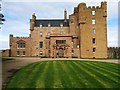
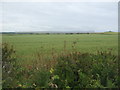
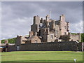
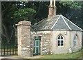
Nearby Images from Geograph Britain and Ireland:
©2017(licence)
©2016(licence)
©2006(licence)
©2023(licence)
©2016(licence)
The above images may not be of the site on this page, they are loaded from Geograph.
Please Submit an Image of this site or go out and take one for us!
Click here to see more info for this site
Nearby sites
Key: Red: member's photo, Blue: 3rd party photo, Yellow: other image, Green: no photo - please go there and take one, Grey: site destroyed
Download sites to:
KML (Google Earth)
GPX (GPS waypoints)
CSV (Garmin/Navman)
CSV (Excel)
To unlock full downloads you need to sign up as a Contributory Member. Otherwise downloads are limited to 50 sites.
Turn off the page maps and other distractions
Nearby sites listing. In the following links * = Image available
3.0km W 278° Scarfskerry Broch or Nuraghe (ND25647420)
3.4km W 271° Rattarburn Broch or Nuraghe (ND25257389)
3.7km W 268° Rattar East Chambered Cairn (ND2492073710)
4.6km SSW 209° Earl's Cairn* Chambered Cairn (ND26296973)
5.7km SE 131° Brabstermire Broch or Nuraghe (ND32856993)
5.9km ENE 63° Castle Mestag* Hillfort (ND33977633)
7.6km SSW 208° Ha' of Greenland Broch or Nuraghe (ND24906709)
7.6km SW 236° Links of Dunnet Broch or Nuraghe (ND222696)
9.3km ESE 114° Warth Hill* Stone Circle (ND37156979)
10.1km SW 230° Thurdistoft Broch or Nuraghe (ND20786731)
10.5km WSW 241° Castlehill Broch* Broch or Nuraghe (ND19366876)
10.8km ESE 123° Freswick Links* Broch or Nuraghe (ND37616761)
10.9km WSW 243° Craig of Hattel Class I Pictish Symbol Stone (ND18776901)
11.1km SSW 204° Ha' of Bowermadden* Broch or Nuraghe (ND23986369)
11.2km S 177° Hill of Works* Broch or Nuraghe (ND29036255)
11.3km SSW 196° Murza Broch or Nuraghe (ND25386290)
11.7km S 183° Gunn's Hillock* Broch or Nuraghe (ND27926201)
12.0km ESE 115° Skirza Head Broch or Nuraghe (ND39406844)
12.4km WSW 246° East Murkle Cairn (ND17216891)
12.8km SE 140° Caithness Broch Centre* Museum (ND367637)
12.9km SE 140° Watenan Class I Pictish Symbol Stone (ND36806370)
13.0km WSW 252° West Murkle Cairn (ND16206990)
13.3km SSW 205° Mains of Bowertower Broch or Nuraghe (ND22796179)
13.4km SSW 200° Halcro Manse* Broch or Nuraghe (ND23896119)
13.5km SE 141° Nybster Broch* Broch or Nuraghe (ND37026314)
View more nearby sites and additional images


 We would like to know more about this location. Please feel free to add a brief description and any relevant information in your own language.
 Wir möchten mehr über diese Stätte erfahren. Bitte zögern Sie nicht, eine kurze Beschreibung und relevante Informationen in Deutsch hinzuzufügen.
 Nous aimerions en savoir encore un peu sur les lieux. S'il vous plaît n'hesitez pas à ajouter une courte description et tous les renseignements pertinents dans votre propre langue.
 Quisieramos informarnos un poco más de las lugares. No dude en añadir una breve descripción y otros datos relevantes en su propio idioma.