


<< Our Photo Pages >> Tungadal - Souterrain (Fogou, Earth House) in Scotland in Isle of Skye
Submitted by TimPrevett on Wednesday, 07 September 2005 Page Views: 9157
Iron Age and Later PrehistorySite Name: TungadalCountry: Scotland County: Isle of Skye Type: Souterrain (Fogou, Earth House)
Nearest Village: Totardor
Map Ref: NG404401
Latitude: 57.377063N Longitude: 6.320391W
Condition:
| 5 | Perfect |
| 4 | Almost Perfect |
| 3 | Reasonable but with some damage |
| 2 | Ruined but still recognisable as an ancient site |
| 1 | Pretty much destroyed, possibly visible as crop marks |
| 0 | No data. |
| -1 | Completely destroyed |
| 5 | Superb |
| 4 | Good |
| 3 | Ordinary |
| 2 | Not Good |
| 1 | Awful |
| 0 | No data. |
| 5 | Can be driven to, probably with disabled access |
| 4 | Short walk on a footpath |
| 3 | Requiring a bit more of a walk |
| 2 | A long walk |
| 1 | In the middle of nowhere, a nightmare to find |
| 0 | No data. |
| 5 | co-ordinates taken by GPS or official recorded co-ordinates |
| 4 | co-ordinates scaled from a detailed map |
| 3 | co-ordinates scaled from a bad map |
| 2 | co-ordinates of the nearest village |
| 1 | co-ordinates of the nearest town |
| 0 | no data |
Internal Links:
External Links:
I have visited· I would like to visit
coin would like to visit
Andy B has visited here
")
Tungadale Souterrain is a seven metre long underground passage constructed in the bronze age. This one is very remote and very tricky to locate on a steep hillside in a forest.
You may be viewing yesterday's version of this page. To see the most up to date information please register for a free account.
")
Do not use the above information on other web sites or publications without permission of the contributor.
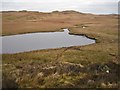
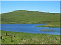
Nearby Images from Geograph Britain and Ireland:

©2006(licence)

©2012(licence)
©2012(licence)
©2008(licence)

©2011(licence)
The above images may not be of the site on this page, they are loaded from Geograph.
Please Submit an Image of this site or go out and take one for us!
Click here to see more info for this site
Nearby sites
Key: Red: member's photo, Blue: 3rd party photo, Yellow: other image, Green: no photo - please go there and take one, Grey: site destroyed
Download sites to:
KML (Google Earth)
GPX (GPS waypoints)
CSV (Garmin/Navman)
CSV (Excel)
To unlock full downloads you need to sign up as a Contributory Member. Otherwise downloads are limited to 50 sites.
Turn off the page maps and other distractions
Nearby sites listing. In the following links * = Image available
4.5km WSW 250° Dun Garsin* Broch or Nuraghe (NG361388)
5.3km WSW 245° Dun Diarmaid* Broch or Nuraghe (NG35453816)
5.4km SW 226° Dun Taimh* Stone Fort or Dun (NG363366)
5.9km WNW 291° Dun Arkaig* Broch or Nuraghe (NG350426)
6.5km WSW 257° Dun Mor (Struan)* Stone Fort or Dun (NG340390)
6.6km WSW 253° Dun Beag (Struan)* Broch or Nuraghe (NG3395438630)
7.1km WSW 246° Struanmore* Chambered Cairn (NG337376)
7.2km WSW 253° Ullinish Souterrain Souterrain (Fogou, Earth House) (NG334385)
8.1km SW 234° Dun Ardtreck* Broch or Nuraghe (NG335358)
8.1km SW 223° Crois Mic Jamain Standing Stones (NG345345)
8.2km N 3° Dun Sgalair* Stone Fort or Dun (NG41354826)
8.4km WSW 250° Ullinish Lodge* Chambered Cairn (NG323378)
8.5km N 6° St Columba's Chapel (Skeabost) Early Christian Sculptured Stone (NG41824850)
8.5km NE 38° Drumuie Standing Stone* Standing Stone (Menhir) (NG4606746524)
9.1km N 7° Tote, Skye* Class I Pictish Symbol Stone (NG421491)
9.2km NNE 28° Borve Stone Row* Stone Row / Alignment (NG452480)
9.4km NNE 32° Dun Borve (Skye)* Broch or Nuraghe (NG45914772)
9.6km S 185° Dun Merkadale* Stone Fort or Dun (NG38983061)
9.8km W 281° Dun Abhuinn Bhaile Mheadhonaich* Stone Fort or Dun (NG309425)
9.8km ENE 62° Dun Torvaig* Stone Fort or Dun (NG49374422)
9.9km NE 55° Dun Gerashader* Hillfort (NG489452)
10.7km W 278° Dun Feorlig* Broch or Nuraghe (NG299423)
10.7km N 8° Kensaleyre S Cairn* Cairn (NG42605059)
10.7km N 8° Kensaleyre N Cairn* Cairn (NG42555064)
10.8km N 8° Kensalyre Stone* Standing Stone (Menhir) (NG426507)
View more nearby sites and additional images


 We would like to know more about this location. Please feel free to add a brief description and any relevant information in your own language.
 Wir möchten mehr über diese Stätte erfahren. Bitte zögern Sie nicht, eine kurze Beschreibung und relevante Informationen in Deutsch hinzuzufügen.
 Nous aimerions en savoir encore un peu sur les lieux. S'il vous plaît n'hesitez pas à ajouter une courte description et tous les renseignements pertinents dans votre propre langue.
 Quisieramos informarnos un poco más de las lugares. No dude en añadir una breve descripción y otros datos relevantes en su propio idioma.