<< Our Photo Pages >> The Blue Stane (St Andrews) - Standing Stone (Menhir) in Scotland in Fife
Submitted by Anne T on Saturday, 29 April 2017 Page Views: 3360
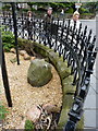
Neolithic and Bronze AgeSite Name: The Blue Stane (St Andrews) Alternative Name: Blue Stone (St Andrews)Country: Scotland
NOTE: This site is 0.391 km away from the location you searched for.
County: Fife Type: Standing Stone (Menhir)
Nearest Town: St Andrews
Map Ref: NO5055216707
Latitude: 56.340126N Longitude: 2.801466W
Condition:
| 5 | Perfect |
| 4 | Almost Perfect |
| 3 | Reasonable but with some damage |
| 2 | Ruined but still recognisable as an ancient site |
| 1 | Pretty much destroyed, possibly visible as crop marks |
| 0 | No data. |
| -1 | Completely destroyed |
| 5 | Superb |
| 4 | Good |
| 3 | Ordinary |
| 2 | Not Good |
| 1 | Awful |
| 0 | No data. |
| 5 | Can be driven to, probably with disabled access |
| 4 | Short walk on a footpath |
| 3 | Requiring a bit more of a walk |
| 2 | A long walk |
| 1 | In the middle of nowhere, a nightmare to find |
| 0 | No data. |
| 5 | co-ordinates taken by GPS or official recorded co-ordinates |
| 4 | co-ordinates scaled from a detailed map |
| 3 | co-ordinates scaled from a bad map |
| 2 | co-ordinates of the nearest village |
| 1 | co-ordinates of the nearest town |
| 0 | no data |
Internal Links:
External Links:
 (PID:173880)")
This standing stone is featured on The Northern Antiquarian (TNA); see their page for Blue Stane, St. Andrews, Fife. This entry includes directions on how to find the stone, together with a brief archaeology and history of the site and the folklore.
There are a number of entries on Canmore around this grid reference, but these relate to the nearby hotel, re-used foundation stones, pottery fragments, etc, but there is no mention of this stone.
TNA includes a photograph of this stone from several different angles, along with the blue plaque alongside which tells us "the Blue Stane is a relic of Pre-Christian Pictish St. Andrews when it had some now forgotten ritual significance. It is reputed to be have been the coronation stone of Kenneth MacAlpine, who united the Kingdom of Scots and the Picts in 843 AD."
You may be viewing yesterday's version of this page. To see the most up to date information please register for a free account.
 (PID:173881)")
Do not use the above information on other web sites or publications without permission of the contributor.
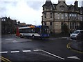
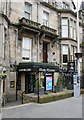
Nearby Images from Geograph Britain and Ireland:
©2010(licence)
©2012(licence)
©2019(licence)
©2019(licence)
©2008(licence)
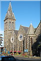
The above images may not be of the site on this page, they are loaded from Geograph.
Please Submit an Image of this site or go out and take one for us!
Click here to see more info for this site
Nearby sites
Key: Red: member's photo, Blue: 3rd party photo, Yellow: other image, Green: no photo - please go there and take one, Grey: site destroyed
Download sites to:
KML (Google Earth)
GPX (GPS waypoints)
CSV (Garmin/Navman)
CSV (Excel)
To unlock full downloads you need to sign up as a Contributory Member. Otherwise downloads are limited to 50 sites.
Turn off the page maps and other distractions
Nearby sites listing. In the following links * = Image available
852m E 97° Monk's Well, St Andrews* Holy Well or Sacred Spring (NO514166)
895m SW 217° St. Andrews Museum* Museum (NO5016)
5.8km SE 125° Boarhills* Standing Stone (Menhir) (NO5525413356)
5.8km SW 232° Drumcarrow Craig* Broch or Nuraghe (NO459132)
6.2km SSE 156° Dunino Stone Circle (NO530110)
6.7km SSE 149° Dunino Den* Stone Row / Alignment (NO540109)
6.8km SSE 149° Druid's Well (Dunino)* Holy Well or Sacred Spring (NO540108)
7.0km NW 314° Lady's Well (Leuchars) Holy Well or Sacred Spring (NO4557321645)
7.1km NW 311° St Bunyan's Well (Leuchars) Holy Well or Sacred Spring (NO4525221483)
11.7km SE 145° West Pitcorthie* Standing Stone (Menhir) (NO572071)
11.8km WSW 243° Spout Well* Holy Well or Sacred Spring (NO400114)
12.3km WNW 298° Kilmany Cursus Cursus (NO39742263)
12.8km S 183° Easter Pitcorthie* Standing Stone (Menhir) (NO497039)
13.2km WNW 286° Lochmaloney Farmm (Kilmany) Rock Art (NO37902049)
13.5km SW 225° Norrie's Law* Round Barrow(s) (NO409073)
13.7km SE 129° Sauchope* Class III Pictish Cross Slab (NO61040788)
13.7km SSE 151° Skeith Stone* Class II Pictish Symbol Stone (NO571046)
13.9km SE 128° Devil's Blue Stane* Standing Stone (Menhir) (NO614079)
14.2km SE 128° Briery Well* Holy Well or Sacred Spring (NO617078)
14.3km SE 139° Caiplie* Class I Pictish Symbol Stone (NO599058)
14.9km SSE 162° St Fillan's Well (Pittenweem)* Holy Well or Sacred Spring (NO550025)
15.6km SSW 211° Largo Pictish Stone* Class II Pictish Symbol Stone (NO42340347)
15.7km S 180° Ardross souterrain* Souterrain (Fogou, Earth House) (NO5037500950)
16.3km NNW 348° Balmossie Den (Broughty Ferry)* Holy Well or Sacred Spring (NO4721732714)
16.7km WSW 251° Walton Symbol Stone Class I Pictish Symbol Stone (NO34651135)
View more nearby sites and additional images


 We would like to know more about this location. Please feel free to add a brief description and any relevant information in your own language.
 Wir möchten mehr über diese Stätte erfahren. Bitte zögern Sie nicht, eine kurze Beschreibung und relevante Informationen in Deutsch hinzuzufügen.
 Nous aimerions en savoir encore un peu sur les lieux. S'il vous plaît n'hesitez pas à ajouter une courte description et tous les renseignements pertinents dans votre propre langue.
 Quisieramos informarnos un poco más de las lugares. No dude en añadir una breve descripción y otros datos relevantes en su propio idioma.