


<< Text Pages >> Cairnpark (Dollar) - Cairn in Scotland in Clackmannanshire
Submitted by Anne T on Wednesday, 10 May 2017 Page Views: 2496
Neolithic and Bronze AgeSite Name: Cairnpark (Dollar)Country: Scotland
NOTE: This site is 2.067 km away from the location you searched for.
County: Clackmannanshire Type: Cairn
Nearest Town: Dunfermline Nearest Village: Dollar
Map Ref: NS96189802
Latitude: 56.163500N Longitude: 3.673332W
Condition:
| 5 | Perfect |
| 4 | Almost Perfect |
| 3 | Reasonable but with some damage |
| 2 | Ruined but still recognisable as an ancient site |
| 1 | Pretty much destroyed, possibly visible as crop marks |
| 0 | No data. |
| -1 | Completely destroyed |
| 5 | Superb |
| 4 | Good |
| 3 | Ordinary |
| 2 | Not Good |
| 1 | Awful |
| 0 | No data. |
| 5 | Can be driven to, probably with disabled access |
| 4 | Short walk on a footpath |
| 3 | Requiring a bit more of a walk |
| 2 | A long walk |
| 1 | In the middle of nowhere, a nightmare to find |
| 0 | No data. |
| 5 | co-ordinates taken by GPS or official recorded co-ordinates |
| 4 | co-ordinates scaled from a detailed map |
| 3 | co-ordinates scaled from a bad map |
| 2 | co-ordinates of the nearest village |
| 1 | co-ordinates of the nearest town |
| 0 | no data |
Internal Links:
External Links:
Cairn in Clackmannanshire
The cairn, now built over, is important enough to have its own entry on Canmore - see Canmore ID 48240. In 1937, it was recorded that "there was once an immense cairn of stones about 30' high in Cairnpark Street, Dollar. Urns were found at the bottom of it, but that is all that is known."
The Northern Antiquarian (TNA) also list this site - see their page for Cairnpark, Dollar, Clackmannanshire, which gives an brief archaeology and history. They clarify that the cairn was destroyed more than 200 years ago in 1806, and that "This was nothing less than a great pyramid (well, it was not quite so big as the famous one of Egypt, but still it was a great pile) which had evidently been erected to commemorate some great battle, or the death of some celebrated warrior; and it certainly is very much to be regretted that it should have been removed. This was an immense cairn of stones, some thirty feet high, and as many square at the base; and the park in which it stood took its name from it—Cairnpark."
Note: Do you have any more information or historical documents/drawings relating to this cairn that you can add?
You may be viewing yesterday's version of this page. To see the most up to date information please register for a free account.
Do not use the above information on other web sites or publications without permission of the contributor.
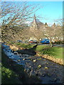
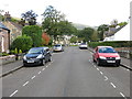
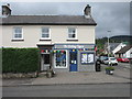
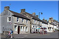
Nearby Images from Geograph Britain and Ireland:
©2006(licence)
©2017(licence)
©2019(licence)
©2014(licence)
©2016(licence)
The above images may not be of the site on this page, they are loaded from Geograph.
Please Submit an Image of this site or go out and take one for us!
Click here to see more info for this site
Nearby sites
Key: Red: member's photo, Blue: 3rd party photo, Yellow: other image, Green: no photo - please go there and take one, Grey: site destroyed
Download sites to:
KML (Google Earth)
GPX (GPS waypoints)
CSV (Garmin/Navman)
CSV (Excel)
To unlock full downloads you need to sign up as a Contributory Member. Otherwise downloads are limited to 50 sites.
Turn off the page maps and other distractions
Nearby sites listing. In the following links * = Image available
776m NNE 26° Moir's Well (Dollar) Holy Well or Sacred Spring (NS9653598711)
1.1km NNE 19° Wizard's Stone (Dollar)* Natural Stone / Erratic / Other Natural Feature (NS96569904)
1.2km NNE 32° Deil's Cradle (Dollar)* Natural Stone / Erratic / Other Natural Feature (NS96869906)
1.3km N 356° Castle Campbell (Dollar) Rock Art (NS96139928)
2.2km N 356° Butter Well (Dollar) Holy Well or Sacred Spring (NN96100018)
2.3km WNW 297° White Stane of Tam Baird (Dollar) Natural Stone / Erratic / Other Natural Feature (NS9413599110)
2.9km NE 44° Castleton (Dollar)* Standing Stone (Menhir) (NN9828400060)
3.2km SW 226° Balhearty Standing Stone (Menhir) (NS9378295816)
3.5km NNE 13° Maiden's Well (Glendevon) Holy Well or Sacred Spring (NN97030139)
3.7km WSW 254° Cunninghar* Stone Circle (NS9256097080)
3.8km W 261° Tillicoultry House Carving (Tillicoultry) Rock Art (NS92409752)
3.9km N 10° Garchel Burn (Glendevon) Ancient Village or Settlement (NN96960182)
4.2km WNW 286° Eliston West (Tilicoultry) Cairn (NS92209924)
5.1km W 263° Lady's Well (Tillicoultry) Holy Well or Sacred Spring (NS91119749)
5.9km SW 217° Grassmainston Well (Clackmannan) Holy Well or Sacred Spring (NS9247893403)
7.2km N 352° Four Stanes (Glendevon) Stone Circle (NN9529405196)
7.3km SSW 213° Hawk Hill Stone Circle (NS920920)
7.3km ENE 75° Bull Stone (Crook of Devon)* Standing Stone (Menhir) (NT0332699712)
7.4km W 262° St Serf's Well (Alva) Holy Well or Sacred Spring (NS88819723)
7.6km W 268° Ladies Well (Alva) Holy Well or Sacred Spring (NS88579788)
7.7km W 265° Dwarf's Tomb (Alva) Burial Chamber or Dolmen (NS88489754)
7.8km SW 224° Hawk Hill (Alloa) Stone Circle (NS906926)
7.9km E 83° Carleith (Crook of Devon)* Cairn (NT04029878)
7.9km SW 218° Mercat Cross (Clackmannan)* Ancient Cross (NS9111091889)
7.9km SW 218° Stone of Mannan* Standing Stone (Menhir) (NS91119188)
View more nearby sites and additional images


 We would like to know more about this location. Please feel free to add a brief description and any relevant information in your own language.
 Wir möchten mehr über diese Stätte erfahren. Bitte zögern Sie nicht, eine kurze Beschreibung und relevante Informationen in Deutsch hinzuzufügen.
 Nous aimerions en savoir encore un peu sur les lieux. S'il vous plaît n'hesitez pas à ajouter une courte description et tous les renseignements pertinents dans votre propre langue.
 Quisieramos informarnos un poco más de las lugares. No dude en añadir una breve descripción y otros datos relevantes en su propio idioma.